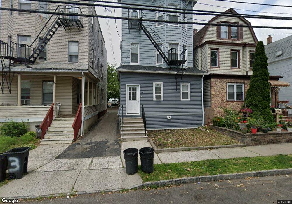
68 James St Unit 2 Bloomfield, NJ 07003
Estimated Value: $660,500 - $780,000
1
Bed
1
Bath
2,720
Sq Ft
$273/Sq Ft
Est. Value
About This Home
This home is located at 68 James St Unit 2, Bloomfield, NJ 07003 and is currently estimated at $742,625, approximately $273 per square foot. 68 James St Unit 2 is a home located in Essex County with nearby schools including Franklin School, Bloomfield Middle School, and Bloomfield High School.
Ownership History
Date
Name
Owned For
Owner Type
Purchase Details
Closed on
Oct 6, 2004
Sold by
The Morresi Group Llc
Bought by
Sanderson Mark and Sanderson Judith
Current Estimated Value
Home Financials for this Owner
Home Financials are based on the most recent Mortgage that was taken out on this home.
Original Mortgage
$288,000
Outstanding Balance
$142,919
Interest Rate
5.8%
Estimated Equity
$599,706
Purchase Details
Closed on
Mar 18, 2003
Sold by
Young Ching Haim
Bought by
Morresi Group Llc
Purchase Details
Closed on
Mar 30, 1992
Sold by
Kong Yan Kang and Kong Ching,Haim
Bought by
Kong Yan Kang
Create a Home Valuation Report for This Property
The Home Valuation Report is an in-depth analysis detailing your home's value as well as a comparison with similar homes in the area
Home Values in the Area
Average Home Value in this Area
Purchase History
| Date | Buyer | Sale Price | Title Company |
|---|---|---|---|
| Sanderson Mark | $360,000 | -- | |
| Morresi Group Llc | $250,000 | -- | |
| Kong Yan Kang | -- | -- |
Source: Public Records
Mortgage History
| Date | Status | Borrower | Loan Amount |
|---|---|---|---|
| Open | Sanderson Mark | $288,000 |
Source: Public Records
Tax History Compared to Growth
Tax History
| Year | Tax Paid | Tax Assessment Tax Assessment Total Assessment is a certain percentage of the fair market value that is determined by local assessors to be the total taxable value of land and additions on the property. | Land | Improvement |
|---|---|---|---|---|
| 2025 | $15,644 | $478,700 | $96,900 | $381,800 |
| 2024 | $15,644 | $478,700 | $96,900 | $381,800 |
| 2022 | $15,328 | $478,700 | $96,900 | $381,800 |
| 2021 | $15,046 | $478,700 | $96,900 | $381,800 |
| 2020 | $14,816 | $478,700 | $96,900 | $381,800 |
| 2019 | $10,932 | $274,600 | $106,000 | $168,600 |
| 2018 | $10,885 | $274,600 | $106,000 | $168,600 |
| 2017 | $10,720 | $274,600 | $106,000 | $168,600 |
| 2016 | $10,600 | $274,600 | $106,000 | $168,600 |
| 2015 | $10,503 | $274,600 | $106,000 | $168,600 |
| 2014 | $10,311 | $274,600 | $106,000 | $168,600 |
Source: Public Records
Map
Nearby Homes
- 50 James St Unit 3
- 31 Spring St
- 27 Gillespie Rd
- 366 Hoover Ave Unit 119
- 328 Hoover Ave
- 328-330 Hoover Ave
- 10 Almira St Unit 14
- 10 14almira St
- 322 Hoover Ave Unit 73
- 298 Hoover Ave Unit 28
- 267 Hoover Ave
- 40 Brighton Ave
- 48 Broughton Ave
- 48 Broughton Ave Unit 2
- 40 Mill St Unit 7
- 28 Forest Dr
- 39 Forest Dr
- 33 Oak St
- 170 Pake St
- 36 Clarendon Place
- 68 James St
- 66 James St
- 72 James St
- 74 James St
- 64 James St
- 11 N Spring St
- 9 Lois Place Unit 3
- 9 Lois Place Unit 2
- 9 Lois Place Unit 11
- 9 Lois Place Unit a
- 13 N Spring St
- 62 James St
- 15 N Spring St
- 60 James St Unit 2
- 60 James St
- 75 James St
- 81 James St
- 81 James St Unit 2
- 81 James St Unit 1
- 79 James St