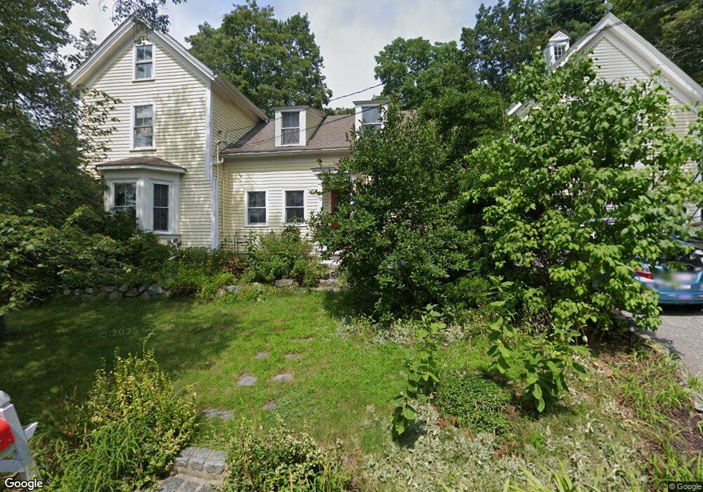
68 King Philip Rd Sudbury, MA 01776
Estimated Value: $1,074,000 - $1,333,000
4
Beds
3
Baths
3,048
Sq Ft
$395/Sq Ft
Est. Value
About This Home
This home is located at 68 King Philip Rd, Sudbury, MA 01776 and is currently estimated at $1,203,986, approximately $395 per square foot. 68 King Philip Rd is a home located in Middlesex County with nearby schools including Israel Loring Elementary School, Ephraim Curtis Middle School, and Lincoln-Sudbury Regional High School.
Ownership History
Date
Name
Owned For
Owner Type
Purchase Details
Closed on
Jan 19, 1999
Sold by
Skog Ester L and Skog William L
Bought by
Carboni Susan M
Current Estimated Value
Home Financials for this Owner
Home Financials are based on the most recent Mortgage that was taken out on this home.
Original Mortgage
$225,000
Outstanding Balance
$49,587
Interest Rate
6.7%
Mortgage Type
Purchase Money Mortgage
Estimated Equity
$1,154,399
Create a Home Valuation Report for This Property
The Home Valuation Report is an in-depth analysis detailing your home's value as well as a comparison with similar homes in the area
Home Values in the Area
Average Home Value in this Area
Purchase History
| Date | Buyer | Sale Price | Title Company |
|---|---|---|---|
| Carboni Susan M | $185,000 | -- |
Source: Public Records
Mortgage History
| Date | Status | Borrower | Loan Amount |
|---|---|---|---|
| Open | Carboni Susan M | $35,000 | |
| Open | Carboni Susan M | $225,000 |
Source: Public Records
Tax History Compared to Growth
Tax History
| Year | Tax Paid | Tax Assessment Tax Assessment Total Assessment is a certain percentage of the fair market value that is determined by local assessors to be the total taxable value of land and additions on the property. | Land | Improvement |
|---|---|---|---|---|
| 2025 | $13,341 | $911,300 | $398,800 | $512,500 |
| 2024 | $12,871 | $881,000 | $387,200 | $493,800 |
| 2023 | $11,663 | $739,600 | $358,500 | $381,100 |
| 2022 | $10,747 | $595,400 | $329,000 | $266,400 |
| 2021 | $11,353 | $602,900 | $329,000 | $273,900 |
| 2020 | $11,124 | $602,900 | $329,000 | $273,900 |
| 2019 | $10,798 | $602,900 | $329,000 | $273,900 |
| 2018 | $10,756 | $599,900 | $350,800 | $249,100 |
| 2017 | $10,032 | $565,500 | $333,700 | $231,800 |
| 2016 | $9,795 | $550,300 | $321,000 | $229,300 |
| 2015 | $9,383 | $533,100 | $308,700 | $224,400 |
| 2014 | $9,358 | $519,000 | $299,600 | $219,400 |
Source: Public Records
Map
Nearby Homes
- 23 Massasoit Ave
- 36 Concord Rd
- 1011 Boston Post Rd
- 94 Goodmans Hill Rd
- 216 Landham Rd
- 24 Woodland Rd
- 128 Nobscot Rd
- 270 Old Lancaster Rd
- 89 Bridle Path
- 84 Hopestill Brown Rd
- 7 Adams Rd
- 0 Wagonwheel Rd
- 6 Old County Rd Unit 16
- 63 Landham Rd
- 30 Nobscot Rd Unit 14
- 0 Robbins Rd
- 91 Eaton Rd W
- 32 Eaton Rd W
- 12 Hickory Rd
- 19 Nob Hill Dr
- 330 Boston Post Rd
- 62 King Philip Rd
- 344 Boston Post Rd Unit Rear Unit
- 344 Boston Post Rd
- 344 Boston Post Rd Unit Front
- 61 King Philip Rd
- 346 Boston Post Rd
- 330 Boston Post Road (Route 20)
- 345 Boston Post Rd Unit B
- 345 Boston Post Rd Unit D down
- 345 Boston Post Rd Unit D up
- 345 Boston Post Rd Unit C- Rear
- 345 Boston Post Rd Unit A
- 345 Boston Post Rd Unit 345A
- 345 Boston Post Rd Unit C- Rear
- 345 Boston Post Rd Unit Suite 3
- 345 Boston Post Rd Unit C-front
- 345 Boston Post Rd Unit C-1
- 345 Boston Post Rd Unit A
- 345 Boston Post Rd Unit I & J