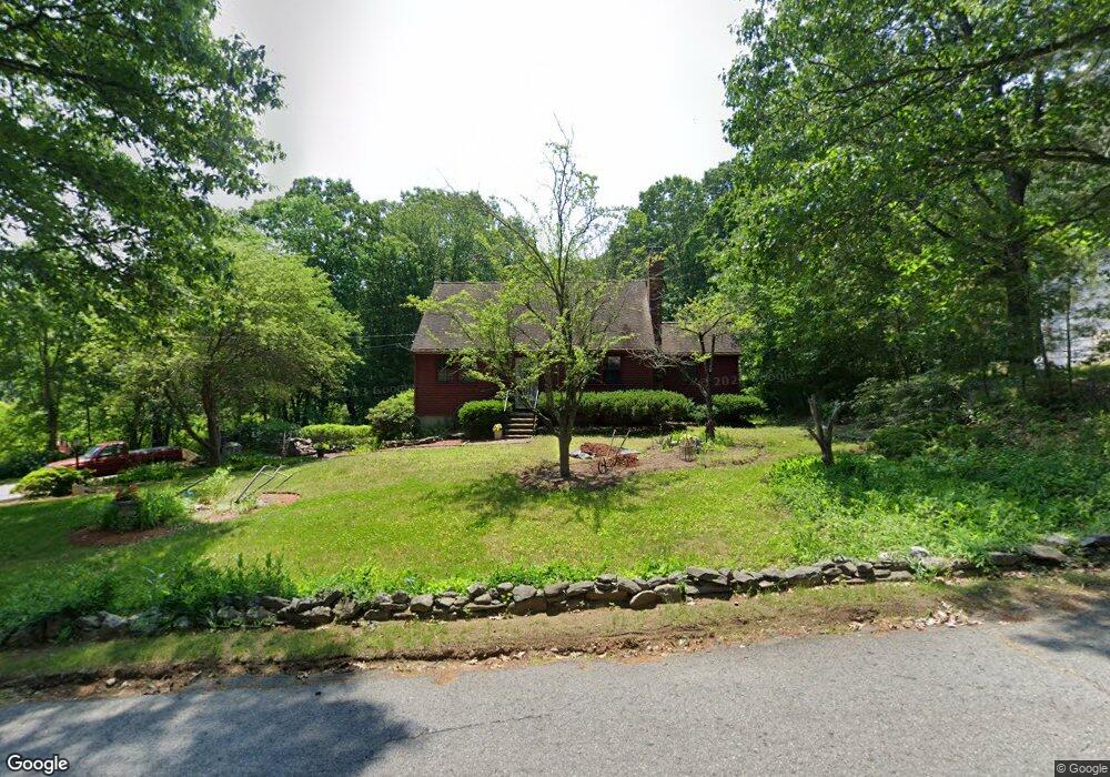
68 King St Leicester, MA 01524
Estimated Value: $434,000 - $459,000
3
Beds
2
Baths
1,596
Sq Ft
$279/Sq Ft
Est. Value
About This Home
This home is located at 68 King St, Leicester, MA 01524 and is currently estimated at $446,015, approximately $279 per square foot. 68 King St is a home located in Worcester County with nearby schools including Leicester Integrated Preschool, Leicester Memorial Elementary School, and Leicester Middle School.
Ownership History
Date
Name
Owned For
Owner Type
Purchase Details
Closed on
Aug 15, 2000
Sold by
Guinee Jeffrey S and Guinee Tracy J
Bought by
Stephens James P and Mandella Celeste
Current Estimated Value
Purchase Details
Closed on
Jan 11, 1999
Sold by
Worc Community Hsg
Bought by
Perez Jose and Perez Ramona
Purchase Details
Closed on
Dec 30, 1997
Sold by
Kuszpa Philip A and Kuszpa Ellen M
Bought by
Stuart Robert R
Purchase Details
Closed on
Apr 15, 1997
Sold by
Kuszpa Philip A and Kuszpa Ellen M
Bought by
Guinee Jeffrey S and Guinee Tracy J
Create a Home Valuation Report for This Property
The Home Valuation Report is an in-depth analysis detailing your home's value as well as a comparison with similar homes in the area
Home Values in the Area
Average Home Value in this Area
Purchase History
| Date | Buyer | Sale Price | Title Company |
|---|---|---|---|
| Stephens James P | $171,500 | -- | |
| Stephens James P | $171,500 | -- | |
| Perez Jose | $152,000 | -- | |
| Perez Jose | $152,000 | -- | |
| Stuart Robert R | $45,000 | -- | |
| Stuart Robert R | $45,000 | -- | |
| Guinee Jeffrey S | $130,000 | -- | |
| Guinee Jeffrey S | $130,000 | -- |
Source: Public Records
Mortgage History
| Date | Status | Borrower | Loan Amount |
|---|---|---|---|
| Open | Guinee Jeffrey S | $10,000 | |
| Open | Guinee Jeffrey S | $137,200 |
Source: Public Records
Tax History Compared to Growth
Tax History
| Year | Tax Paid | Tax Assessment Tax Assessment Total Assessment is a certain percentage of the fair market value that is determined by local assessors to be the total taxable value of land and additions on the property. | Land | Improvement |
|---|---|---|---|---|
| 2025 | $46 | $392,800 | $75,500 | $317,300 |
| 2024 | $4,390 | $349,800 | $65,300 | $284,500 |
| 2023 | $4,146 | $322,400 | $65,300 | $257,100 |
| 2022 | $4,001 | $286,000 | $62,400 | $223,600 |
| 2021 | $4,288 | $283,400 | $62,400 | $221,000 |
| 2020 | $3,854 | $258,500 | $59,400 | $199,100 |
| 2019 | $3,639 | $241,300 | $53,300 | $188,000 |
| 2018 | $3,490 | $216,900 | $53,300 | $163,600 |
| 2017 | $3,358 | $216,900 | $53,300 | $163,600 |
| 2016 | $3,129 | $210,000 | $66,400 | $143,600 |
| 2015 | $3,053 | $210,000 | $66,400 | $143,600 |
Source: Public Records
Map
Nearby Homes
- 75 Huntoon Memorial Hwy Unit 1-2
- 10 Edward St
- 164 Peter Salem Rd
- 3 Edward St Unit 3
- 2 Victor Ave
- 473 Pleasant St
- 6 Brickyard Rd
- 381 Pleasant St
- 285 Henshaw St
- 19 Laurelwood Ave
- 2 Crestwood Rd
- 748-A Stafford St
- 3 Flagg Dr
- 102 River St
- 664 Stafford St
- 2 Wendy Place
- 6 Ryans Way Unit 6
- 502 Pine St
- 19 Virginia Dr Unit 19
- 620 Henshaw St