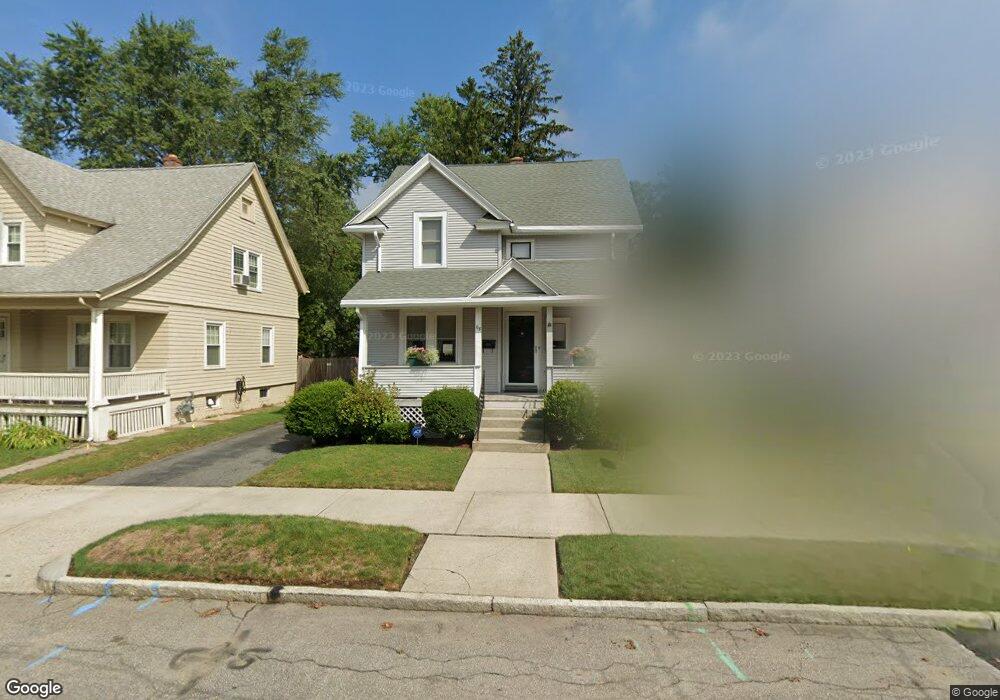
68 Larkspur St Springfield, MA 01108
Forest Park NeighborhoodEstimated Value: $227,000 - $283,000
3
Beds
1
Bath
1,348
Sq Ft
$186/Sq Ft
Est. Value
About This Home
This home is located at 68 Larkspur St, Springfield, MA 01108 and is currently estimated at $250,736, approximately $186 per square foot. 68 Larkspur St is a home located in Hampden County with nearby schools including Washington Elementary School, M Marcus Kiley Middle, and High School Of Commerce.
Ownership History
Date
Name
Owned For
Owner Type
Purchase Details
Closed on
Nov 13, 2018
Sold by
Merrill Margaret E
Bought by
Merrill Margaret E and Hopper Megan A
Current Estimated Value
Purchase Details
Closed on
Mar 15, 2005
Sold by
Beglane John T
Bought by
Merrill Margaret E
Home Financials for this Owner
Home Financials are based on the most recent Mortgage that was taken out on this home.
Original Mortgage
$64,000
Interest Rate
5.64%
Mortgage Type
Purchase Money Mortgage
Create a Home Valuation Report for This Property
The Home Valuation Report is an in-depth analysis detailing your home's value as well as a comparison with similar homes in the area
Home Values in the Area
Average Home Value in this Area
Purchase History
| Date | Buyer | Sale Price | Title Company |
|---|---|---|---|
| Merrill Margaret E | -- | -- | |
| Merrill Margaret E | $111,900 | -- |
Source: Public Records
Mortgage History
| Date | Status | Borrower | Loan Amount |
|---|---|---|---|
| Previous Owner | Merrill Margaret E | $64,000 |
Source: Public Records
Tax History
| Year | Tax Paid | Tax Assessment Tax Assessment Total Assessment is a certain percentage of the fair market value that is determined by local assessors to be the total taxable value of land and additions on the property. | Land | Improvement |
|---|---|---|---|---|
| 2025 | $3,851 | $245,600 | $36,200 | $209,400 |
| 2024 | $3,469 | $216,000 | $36,200 | $179,800 |
| 2023 | $3,500 | $205,300 | $34,500 | $170,800 |
| 2022 | $3,006 | $159,700 | $34,500 | $125,200 |
| 2021 | $2,871 | $151,900 | $31,400 | $120,500 |
| 2020 | $2,621 | $134,200 | $31,400 | $102,800 |
| 2019 | $2,490 | $126,500 | $31,400 | $95,100 |
| 2018 | $2,582 | $131,200 | $31,400 | $99,800 |
| 2017 | $2,503 | $127,300 | $31,400 | $95,900 |
| 2016 | $2,271 | $115,500 | $31,400 | $84,100 |
| 2015 | $2,162 | $109,900 | $31,400 | $78,500 |
Source: Public Records
Map
Nearby Homes
- 77 Dorset St
- 46 Eckington St
- 161 Dorset St
- 914-916 Belmont Ave
- 34 Castle St
- 854-856 Sumner Ave
- 59 Daviston St
- 33-35 Ruskin St
- 57 Lyndale St
- 144 Washington St
- 38 Manchester Terrace
- 13 Bither St
- 70-72 E Alvord St
- 35 Carlton St
- 26 Dwight Rd
- 29 Eddywood St
- 147 Belvidere St
- 1088 Sumner Ave
- 134-136 Woodlawn St
- 52 Orlando St
- 72 Larkspur St
- 62 Larkspur St
- 91 Eckington St
- 58 Larkspur St
- 70 Brunswick St
- 64 Brunswick St
- 3 Greenbrier St
- 54 Larkspur St
- 75 Morningside Park
- 60 Brunswick St
- 85 Eckington St
- 9 Greenbrier St
- 55 Larkspur St
- 54 Brunswick St
- 50 Larkspur St
- 50 Larkspur St Unit 1
- 71 Morningside Park
- 51 Larkspur St
- 79 Eckington St
- 84 Brunswick St Unit 86
Your Personal Tour Guide
Ask me questions while you tour the home.