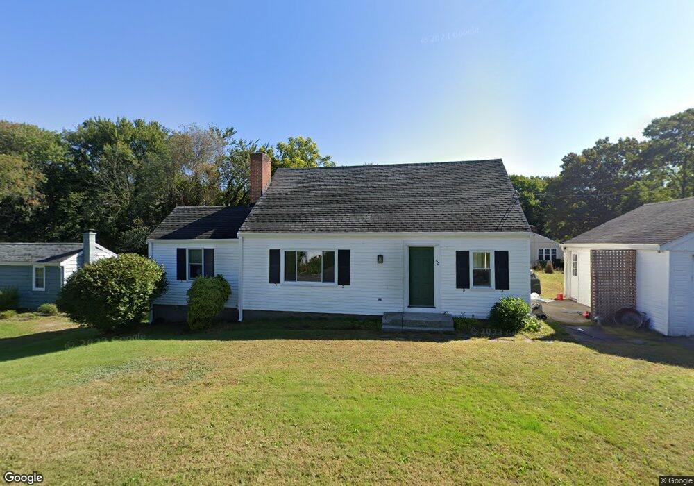
68 Maple Dell Ln Holliston, MA 01746
Estimated Value: $611,000 - $676,000
3
Beds
2
Baths
1,539
Sq Ft
$419/Sq Ft
Est. Value
About This Home
This home is located at 68 Maple Dell Ln, Holliston, MA 01746 and is currently estimated at $644,209, approximately $418 per square foot. 68 Maple Dell Ln is a home located in Middlesex County with nearby schools including Placentino Elementary School, Miller Elementary School, and Robert H. Adams Middle School.
Ownership History
Date
Name
Owned For
Owner Type
Purchase Details
Closed on
Jul 28, 2021
Sold by
Loscocco Rita M
Bought by
Hughes Mark and Michaud Sarah
Current Estimated Value
Home Financials for this Owner
Home Financials are based on the most recent Mortgage that was taken out on this home.
Original Mortgage
$355,000
Outstanding Balance
$326,399
Interest Rate
2.93%
Mortgage Type
Purchase Money Mortgage
Estimated Equity
$265,200
Purchase Details
Closed on
Jan 31, 1994
Sold by
Evans James J
Bought by
Loscocco Rita M
Home Financials for this Owner
Home Financials are based on the most recent Mortgage that was taken out on this home.
Original Mortgage
$110,000
Interest Rate
7.11%
Mortgage Type
Purchase Money Mortgage
Purchase Details
Closed on
Apr 14, 1987
Sold by
Middleton Wayne C
Bought by
Evans James J
Create a Home Valuation Report for This Property
The Home Valuation Report is an in-depth analysis detailing your home's value as well as a comparison with similar homes in the area
Home Values in the Area
Average Home Value in this Area
Purchase History
| Date | Buyer | Sale Price | Title Company |
|---|---|---|---|
| Hughes Mark | $455,000 | None Available | |
| Loscocco Rita M | $160,000 | -- | |
| Evans James J | $163,400 | -- |
Source: Public Records
Mortgage History
| Date | Status | Borrower | Loan Amount |
|---|---|---|---|
| Open | Hughes Mark | $355,000 | |
| Previous Owner | Evans James J | $110,000 | |
| Previous Owner | Evans James J | $147,000 |
Source: Public Records
Tax History Compared to Growth
Tax History
| Year | Tax Paid | Tax Assessment Tax Assessment Total Assessment is a certain percentage of the fair market value that is determined by local assessors to be the total taxable value of land and additions on the property. | Land | Improvement |
|---|---|---|---|---|
| 2025 | $7,759 | $529,600 | $232,000 | $297,600 |
| 2024 | $6,998 | $464,700 | $232,000 | $232,700 |
| 2023 | $7,047 | $457,600 | $232,000 | $225,600 |
| 2022 | $7,265 | $418,000 | $232,000 | $186,000 |
| 2021 | $6,389 | $357,900 | $221,200 | $136,700 |
| 2020 | $6,045 | $320,700 | $196,900 | $123,800 |
| 2019 | $6,020 | $319,700 | $191,200 | $128,500 |
| 2018 | $5,969 | $319,700 | $191,200 | $128,500 |
| 2017 | $6,043 | $326,300 | $195,100 | $131,200 |
| 2016 | $5,614 | $298,800 | $167,600 | $131,200 |
| 2015 | $5,054 | $260,800 | $134,000 | $126,800 |
Source: Public Records
Map
Nearby Homes
- 156 Mitchell Rd
- 485 Central St
- 58 Front St
- 14 Sawyer Cir
- 85 Water St
- 1366 Washington St
- 148 Union St
- 154 Union St
- 655 Central St
- 880 Washington St
- 52 Jasper Hill Rd
- 328 Washington St
- 27 Richardson Dr Unit 27
- 30 Powderhorn Ln
- 121 Bullard St
- 123 Goulding St
- 1 Jameson Dr Unit 1
- 0 Hill St
- 20 Jameson Dr Unit 20
- 15 Fiske Pond Rd
- 68 Maple Dell Ln
- 58 Maple Dell Ln
- 67 Maple Dell Ln
- 59 Maple Dell Ln
- 74 Maple Dell Ln
- 74 Maple Dell Ln
- 50 Maple Dell Ln
- 51 Maple Dell Ln
- 43 Maple Dell Ln
- 40 Maple Dell Ln
- 84 Maple Dell Ln
- 37 Maple Dell Ln
- 29 Maple Dell Ln
- 43 Maple Del Ln
- 141 Mitchell Rd
- 21 Maple Dell Ln
- 155 Mitchell Rd
- 145 Mitchell Rd
- 319 Central St
- 135 Mitchell Rd