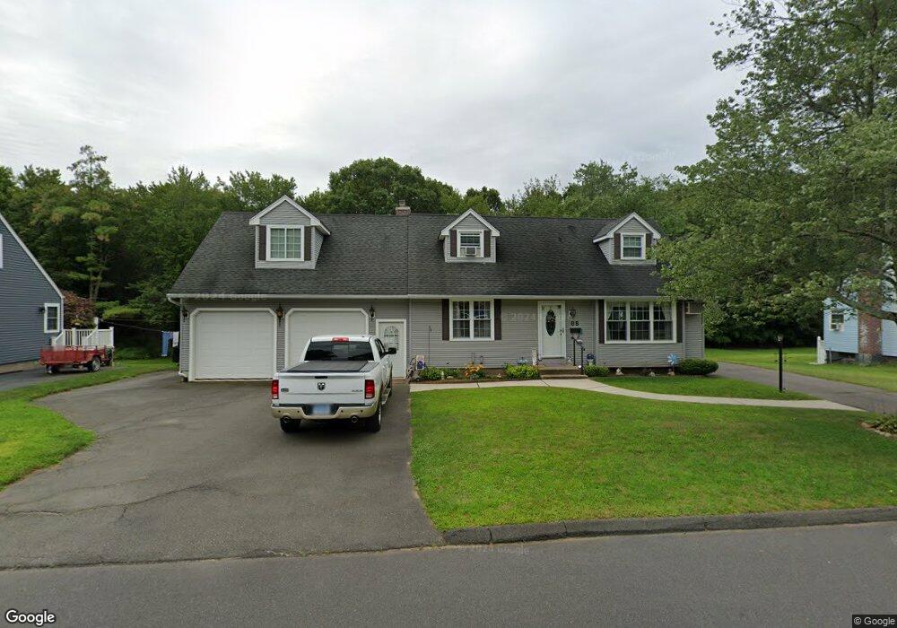
68 Milton Rd Bristol, CT 06010
Forestville NeighborhoodEstimated Value: $323,000 - $363,000
3
Beds
2
Baths
1,555
Sq Ft
$225/Sq Ft
Est. Value
About This Home
This home is located at 68 Milton Rd, Bristol, CT 06010 and is currently estimated at $349,635, approximately $224 per square foot. 68 Milton Rd is a home located in Hartford County with nearby schools including Northeast Middle School, Bristol Eastern High School, and St Matthew School.
Ownership History
Date
Name
Owned For
Owner Type
Purchase Details
Closed on
Apr 15, 1997
Sold by
Monsan Barbara A
Bought by
Ouellette Marcel R and Ouellette Barbara
Current Estimated Value
Home Financials for this Owner
Home Financials are based on the most recent Mortgage that was taken out on this home.
Original Mortgage
$82,400
Interest Rate
7.55%
Mortgage Type
Unknown
Create a Home Valuation Report for This Property
The Home Valuation Report is an in-depth analysis detailing your home's value as well as a comparison with similar homes in the area
Home Values in the Area
Average Home Value in this Area
Purchase History
| Date | Buyer | Sale Price | Title Company |
|---|---|---|---|
| Ouellette Marcel R | $86,800 | -- |
Source: Public Records
Mortgage History
| Date | Status | Borrower | Loan Amount |
|---|---|---|---|
| Open | Ouellette Marcel R | $135,000 | |
| Closed | Ouellette Marcel R | $25,000 | |
| Closed | Ouellette Marcel R | $84,500 | |
| Closed | Ouellette Marcel R | $82,400 |
Source: Public Records
Tax History
| Year | Tax Paid | Tax Assessment Tax Assessment Total Assessment is a certain percentage of the fair market value that is determined by local assessors to be the total taxable value of land and additions on the property. | Land | Improvement |
|---|---|---|---|---|
| 2025 | $6,031 | $178,710 | $39,690 | $139,020 |
| 2024 | $5,692 | $178,710 | $39,690 | $139,020 |
| 2023 | $5,424 | $178,710 | $39,690 | $139,020 |
| 2022 | $4,864 | $126,840 | $32,200 | $94,640 |
| 2021 | $4,864 | $126,840 | $32,200 | $94,640 |
| 2020 | $4,864 | $126,840 | $32,200 | $94,640 |
| 2019 | $4,826 | $126,840 | $32,200 | $94,640 |
| 2018 | $4,678 | $126,840 | $32,200 | $94,640 |
| 2017 | $4,560 | $126,560 | $40,040 | $86,520 |
| 2016 | $4,560 | $126,560 | $40,040 | $86,520 |
| 2015 | $4,380 | $126,560 | $40,040 | $86,520 |
| 2014 | $4,380 | $126,560 | $40,040 | $86,520 |
Source: Public Records
Map
Nearby Homes
- 201 Westwoods Terrace
- 179 Mark St
- 160 Fair St
- 262 Westwoods Terrace
- 206 Burton St
- 169 Morningside Dr E
- 0 Overlook Dr Unit Lot 3 24092446
- 0 Overlook Dr Unit Lot 4 24092448
- 79 Beths Ave Unit 100
- 55 Beths Ave Unit 77
- 20 Westchester Dr
- 81 Lancaster Rd
- 92 Garfield Rd
- 29 Bingham St
- 19 Bingham St
- 941 Farmington Ave
- 135 E Main St
- 158 E Main St
- 196 Frederick St
- 0 Oakwood Cir
Your Personal Tour Guide
Ask me questions while you tour the home.