Estimated Value: $467,000 - $547,515
4
Beds
2
Baths
1,552
Sq Ft
$333/Sq Ft
Est. Value
About This Home
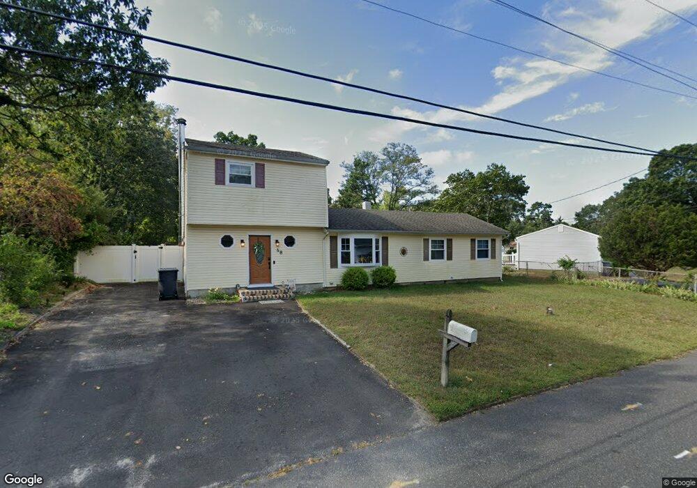
This home is located at 68 Neil Ave, Brick, NJ 08724 and is currently estimated at $517,379, approximately $333 per square foot. 68 Neil Ave is a home located in Ocean County with nearby schools including Lanes Mill Elementary School, Veterans Memorial Middle School, and Brick Township Memorial High School.
Ownership History
Date
Name
Owned For
Owner Type
Purchase Details
Closed on
Aug 29, 2003
Sold by
Fastnacht Paula
Bought by
Keith Serafin and Serafin Susan
Current Estimated Value
Home Financials for this Owner
Home Financials are based on the most recent Mortgage that was taken out on this home.
Original Mortgage
$183,000
Outstanding Balance
$84,777
Interest Rate
6.22%
Estimated Equity
$432,602
Create a Home Valuation Report for This Property
The Home Valuation Report is an in-depth analysis detailing your home's value as well as a comparison with similar homes in the area
Home Values in the Area
Average Home Value in this Area
Purchase History
| Date | Buyer | Sale Price | Title Company |
|---|---|---|---|
| Keith Serafin | $229,000 | -- |
Source: Public Records
Mortgage History
| Date | Status | Borrower | Loan Amount |
|---|---|---|---|
| Open | Keith Serafin | $183,000 |
Source: Public Records
Tax History Compared to Growth
Tax History
| Year | Tax Paid | Tax Assessment Tax Assessment Total Assessment is a certain percentage of the fair market value that is determined by local assessors to be the total taxable value of land and additions on the property. | Land | Improvement |
|---|---|---|---|---|
| 2025 | $6,239 | $238,600 | $131,600 | $107,000 |
| 2024 | $5,932 | $238,600 | $131,600 | $107,000 |
| 2023 | $5,853 | $238,600 | $131,600 | $107,000 |
| 2022 | $5,853 | $238,600 | $131,600 | $107,000 |
| 2021 | $5,544 | $238,600 | $131,600 | $107,000 |
| 2020 | $5,655 | $238,600 | $131,600 | $107,000 |
| 2019 | $5,545 | $238,600 | $131,600 | $107,000 |
| 2018 | $5,419 | $238,600 | $131,600 | $107,000 |
| 2017 | $5,273 | $238,600 | $131,600 | $107,000 |
| 2016 | $5,235 | $238,600 | $131,600 | $107,000 |
| 2015 | $5,097 | $238,600 | $131,600 | $107,000 |
| 2014 | $5,046 | $238,600 | $131,600 | $107,000 |
Source: Public Records
Map
Nearby Homes
- 70 Neil Ave
- 15 Skipper Ln
- 10 Lark Ln
- 11 Sanford Rd
- 47 Kitty Ct
- 58 Belinda Ct
- 129 Camille Ct Unit 35B
- 1759 Burrsville Rd
- 802 Sandra Place
- 1728 Burrsville Rd
- 6 Hardy Ct
- 1722 Burrsville Rd
- 50 Burton Dr
- 1255 County Line Rd E
- 47 Cherrywood Cir Unit 147
- 1412 Forest Ave
- 41 Alan Terrace
- 213 Blake Cir
- 1248 Isadora Ct
- 51 Alan Terrace