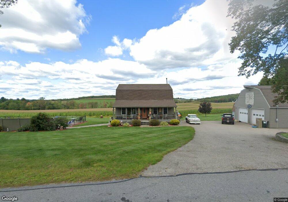
68 Northwest Rd Spencer, MA 01562
Estimated Value: $473,706 - $593,000
3
Beds
2
Baths
1,872
Sq Ft
$297/Sq Ft
Est. Value
About This Home
This home is located at 68 Northwest Rd, Spencer, MA 01562 and is currently estimated at $555,177, approximately $296 per square foot. 68 Northwest Rd is a home located in Worcester County with nearby schools including David Prouty High School.
Ownership History
Date
Name
Owned For
Owner Type
Purchase Details
Closed on
Aug 30, 2006
Sold by
Fritze Brett E
Bought by
Fritze Brett E and Fritze Kimberly A
Current Estimated Value
Create a Home Valuation Report for This Property
The Home Valuation Report is an in-depth analysis detailing your home's value as well as a comparison with similar homes in the area
Home Values in the Area
Average Home Value in this Area
Purchase History
| Date | Buyer | Sale Price | Title Company |
|---|---|---|---|
| Fritze Brett E | -- | -- |
Source: Public Records
Tax History Compared to Growth
Tax History
| Year | Tax Paid | Tax Assessment Tax Assessment Total Assessment is a certain percentage of the fair market value that is determined by local assessors to be the total taxable value of land and additions on the property. | Land | Improvement |
|---|---|---|---|---|
| 2025 | $52 | $445,900 | $56,000 | $389,900 |
| 2024 | $5,074 | $443,500 | $56,000 | $387,500 |
| 2023 | $4,775 | $395,900 | $56,000 | $339,900 |
| 2022 | $4,627 | $351,600 | $50,700 | $300,900 |
| 2021 | $4,212 | $300,000 | $50,700 | $249,300 |
| 2020 | $3,973 | $281,400 | $50,700 | $230,700 |
| 2019 | $3,745 | $270,200 | $45,900 | $224,300 |
| 2018 | $3,554 | $264,800 | $53,100 | $211,700 |
| 2017 | $3,540 | $253,200 | $50,700 | $202,500 |
| 2016 | $3,400 | $237,900 | $50,700 | $187,200 |
| 2015 | $3,293 | $240,900 | $56,100 | $184,800 |
| 2014 | $3,168 | $240,900 | $56,100 | $184,800 |
Source: Public Records
Map
Nearby Homes
- 111 Northwest Rd
- 15 Northwest Rd
- 50-52 & N Spencer
- 18 B N Spencer Rd
- 61 Hillsville and Spencer Rd
- 13 Washburn Terrace
- 6 Eagleton St
- 4 Eagleton St
- 72 Wire Village Rd
- 30 Grant St
- 16 Old Farm Rd
- 196 N Spencer Rd
- 8 Wilson St
- 108 Paxton Rd
- 52 Grove St
- 130 Paxton Rd
- 140 Paxton Rd
- 6 Sullivan St
- 13 Grove St
- 12 Crown St
- 66 Northwest Rd
- 63 Northwest Rd
- 69 Northwest Rd
- 74 Northwest Rd
- 0 N Brookfield Rd
- 77 Northwest Rd
- 79 Northwest Rd
- 1 Kittredge Rd
- 82 Northwest Rd
- 45 Northwest Rd
- 3 Kittredge Rd
- 48 Northwest Rd
- 2 Kittredge Rd
- 5 Kittredge Rd
- 7 Kittredge Rd
- 46 Northwest Rd
- 83 Northwest Rd
- 9 Kittredge Rd
- 8 Kittredge Rd
- 42 Northwest Rd