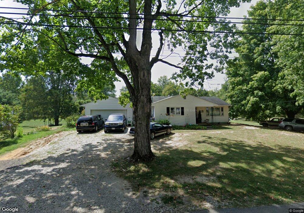
68 Oberly Rd Carroll, OH 43112
Estimated Value: $276,345 - $326,000
3
Beds
2
Baths
1,536
Sq Ft
$195/Sq Ft
Est. Value
About This Home
This home is located at 68 Oberly Rd, Carroll, OH 43112 and is currently estimated at $299,836, approximately $195 per square foot. 68 Oberly Rd is a home located in Fairfield County with nearby schools including Bloom Carroll Primary School, Bloom Carroll Intermediate School, and Bloom-Carroll Middle School.
Ownership History
Date
Name
Owned For
Owner Type
Purchase Details
Closed on
Sep 1, 2004
Sold by
Dimichele Anthony and Dimichele Jacqueline
Bought by
Gogolin Richard T and Gogolin Vernola K
Current Estimated Value
Home Financials for this Owner
Home Financials are based on the most recent Mortgage that was taken out on this home.
Original Mortgage
$157,429
Outstanding Balance
$76,708
Interest Rate
6.17%
Mortgage Type
FHA
Estimated Equity
$223,128
Purchase Details
Closed on
Jul 13, 2001
Sold by
Norris Eloise M
Bought by
Dimichele Anthony
Home Financials for this Owner
Home Financials are based on the most recent Mortgage that was taken out on this home.
Original Mortgage
$90,000
Interest Rate
7.27%
Mortgage Type
New Conventional
Create a Home Valuation Report for This Property
The Home Valuation Report is an in-depth analysis detailing your home's value as well as a comparison with similar homes in the area
Purchase History
| Date | Buyer | Sale Price | Title Company |
|---|---|---|---|
| Gogolin Richard T | $159,900 | Title First Agency Inc | |
| Dimichele Anthony | $134,900 | -- |
Source: Public Records
Mortgage History
| Date | Status | Borrower | Loan Amount |
|---|---|---|---|
| Open | Gogolin Richard T | $157,429 | |
| Closed | Dimichele Anthony | $90,000 |
Source: Public Records
Tax History
| Year | Tax Paid | Tax Assessment Tax Assessment Total Assessment is a certain percentage of the fair market value that is determined by local assessors to be the total taxable value of land and additions on the property. | Land | Improvement |
|---|---|---|---|---|
| 2025 | $5,820 | $105,120 | $45,500 | $59,620 |
| 2024 | $5,820 | $73,020 | $25,200 | $47,820 |
| 2023 | $3,169 | $73,020 | $25,200 | $47,820 |
| 2022 | $3,192 | $73,020 | $25,200 | $47,820 |
| 2021 | $2,365 | $53,130 | $21,000 | $32,130 |
| 2020 | $2,393 | $53,130 | $21,000 | $32,130 |
| 2019 | $2,403 | $53,130 | $21,000 | $32,130 |
| 2018 | $1,818 | $39,450 | $16,800 | $22,650 |
| 2017 | $1,705 | $41,370 | $16,800 | $24,570 |
| 2016 | $1,653 | $41,370 | $16,800 | $24,570 |
| 2015 | $1,584 | $38,610 | $16,800 | $21,810 |
| 2014 | $1,513 | $38,610 | $16,800 | $21,810 |
| 2013 | $1,513 | $38,610 | $16,800 | $21,810 |
Source: Public Records
Map
Nearby Homes
- 52 W Canal St
- 61 Highland St
- 5699 Feldon Ct NW
- 2155 Carroll-Southern Rd NW
- 3510 Kauffman Rd NW
- 4645 Meadow Grove Dr NW
- 6103 Pickerington Rd
- 8322 Benson Rd
- 5560 Amanda Northern Rd NW
- 5840 Amanda Northern Rd NW
- 2270 Ginder Rd NW
- 7894 Windsor Ave NW
- 7195 Alspach Rd NW
- 1925 Wilshire Ln NW
- 6775 Busey Rd
- 7815 Jefferson Dr NW
- 4315 Brook Rd NW
- 5870 Brook Rd NW
- 1809 W Glenhurst Dr NW
- 3355 Old Columbus Rd NW
Your Personal Tour Guide
Ask me questions while you tour the home.