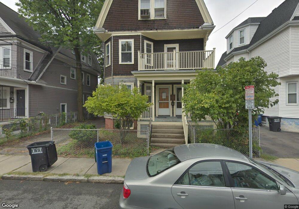
68 Pearson Ave Somerville, MA 02144
Ball Square NeighborhoodEstimated Value: $1,669,000
8
Beds
3
Baths
2,400
Sq Ft
$695/Sq Ft
Est. Value
About This Home
This home is located at 68 Pearson Ave, Somerville, MA 02144 and is currently priced at $1,669,000, approximately $695 per square foot. 68 Pearson Ave is a home located in Middlesex County with nearby schools including Somerville High School and St. Clement Elementary School.
Create a Home Valuation Report for This Property
The Home Valuation Report is an in-depth analysis detailing your home's value as well as a comparison with similar homes in the area
Home Values in the Area
Average Home Value in this Area
Tax History
We collect this data history from publicly available records. To have your information removed, we recommend requesting removal directly through your county’s website.
| Year | Tax Paid | Tax Assessment Tax Assessment Total Assessment is a certain percentage of the fair market value that is determined by local assessors to be the total taxable value of land and additions on the property. | Land | Improvement |
|---|---|---|---|---|
| 2023 | $14,945 | $1,445,400 | $662,100 | $783,300 |
| 2022 | $14,714 | $1,445,400 | $662,100 | $783,300 |
| 2021 | $14,729 | $1,445,400 | $662,100 | $783,300 |
| 2020 | $14,584 | $1,445,400 | $662,100 | $783,300 |
| 2019 | $10,919 | $1,014,800 | $602,800 | $412,000 |
| 2018 | $9,961 | $880,700 | $548,000 | $332,700 |
| 2017 | $9,796 | $839,400 | $516,900 | $322,500 |
| 2016 | $9,602 | $766,300 | $461,700 | $304,600 |
| 2015 | $9,121 | $723,300 | $426,400 | $296,900 |
Source: Public Records
Map
Nearby Homes
- 45 Pearson Ave
- 63 Prichard Ave
- 38 Prichard Ave
- 29 Prichard Ave Unit 3
- 29 Prichard Ave Unit 1
- 121 Highland Rd Unit 1
- 97 Boston Ave
- 15 Clyde St Unit E
- 15 Clyde St Unit D
- 292 Cedar St
- 12 Foskett St Unit 1
- 12 Foskett St Unit 2
- 12 Foskett St Unit 3
- 595 Broadway Unit 302
- 595 Broadway Unit 303
- 143 Cedar St Unit 6
- 10 Roberts St Unit 12
- 63 Albion St
- 156 Albion St Unit R
- 12 Charles e Ryan Rd
- 66 Pearson Ave Unit 2
- 66 Pearson Ave
- 66 Pearson Ave Unit 1
- 68 Pearson Ave Unit 1
- 68 Pearson Ave Unit 2
- 68 Pearson Ave Unit 3
- 73 Highland Rd Unit 1
- 73 Highland Rd
- 74 Pearson Ave Unit 1
- 74 Pearson Ave Unit 2
- 60 Pearson Ave
- 58 Pearson Ave
- 58 Pearson Ave Unit 58
- 60 Pearson Ave Unit 1
- 58 Pearson Ave Unit 2
- 77 Highland Rd
- 69 Highland Rd
- 83 Highland Rd
- 67 Pearson Ave
- 67 Pearson Ave Unit 1
Your Personal Tour Guide
Ask me questions while you tour the home.