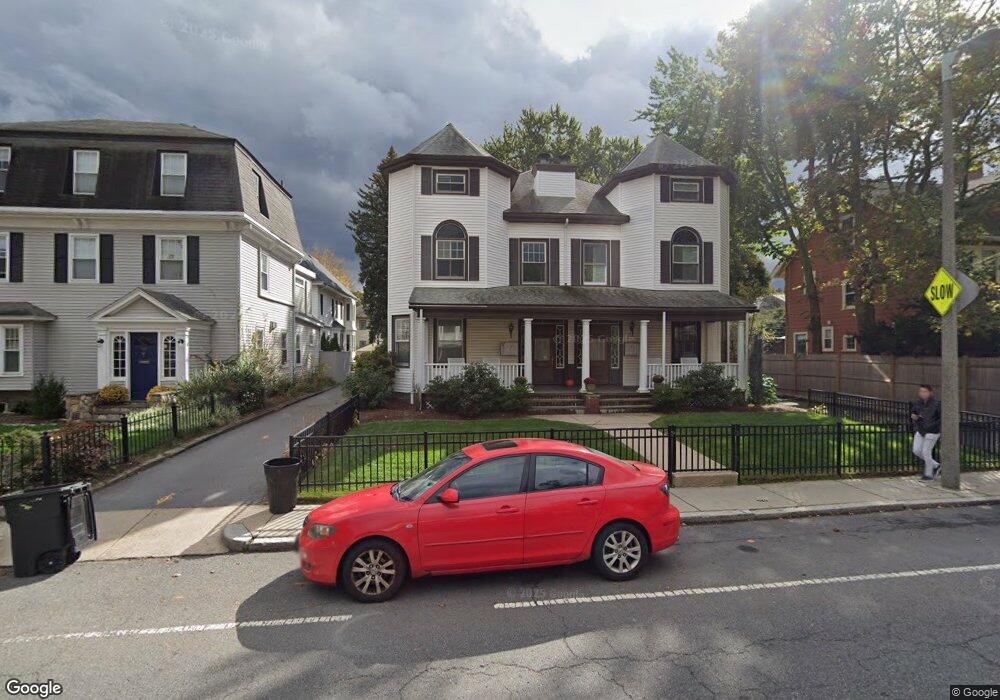
68 Perkins St Unit 70 Jamaica Plain, MA 02130
Jamaica Plain NeighborhoodEstimated Value: $516,000 - $676,000
1
Bed
1
Bath
1,128
Sq Ft
$546/Sq Ft
Est. Value
About This Home
This home is located at 68 Perkins St Unit 70, Jamaica Plain, MA 02130 and is currently estimated at $616,070, approximately $546 per square foot. 68 Perkins St Unit 70 is a home located in Suffolk County with nearby schools including Roxbury Preparatory Charter School and Nativity Preparatory School.
Ownership History
Date
Name
Owned For
Owner Type
Purchase Details
Closed on
Sep 7, 1993
Sold by
Shafrin Jane L
Bought by
Nolan Elizabeth M
Current Estimated Value
Purchase Details
Closed on
Apr 20, 1989
Sold by
Zeghibe Douglas
Bought by
Shafrin J L
Home Financials for this Owner
Home Financials are based on the most recent Mortgage that was taken out on this home.
Original Mortgage
$132,400
Interest Rate
10.79%
Mortgage Type
Purchase Money Mortgage
Create a Home Valuation Report for This Property
The Home Valuation Report is an in-depth analysis detailing your home's value as well as a comparison with similar homes in the area
Home Values in the Area
Average Home Value in this Area
Purchase History
| Date | Buyer | Sale Price | Title Company |
|---|---|---|---|
| Nolan Elizabeth M | $147,000 | -- | |
| Shafrin J L | $165,500 | -- |
Source: Public Records
Mortgage History
| Date | Status | Borrower | Loan Amount |
|---|---|---|---|
| Previous Owner | Shafrin J L | $132,400 |
Source: Public Records
Tax History Compared to Growth
Tax History
| Year | Tax Paid | Tax Assessment Tax Assessment Total Assessment is a certain percentage of the fair market value that is determined by local assessors to be the total taxable value of land and additions on the property. | Land | Improvement |
|---|---|---|---|---|
| 2025 | $6,611 | $570,900 | $0 | $570,900 |
| 2024 | $6,168 | $565,900 | $0 | $565,900 |
| 2023 | $5,783 | $538,500 | $0 | $538,500 |
| 2022 | $5,528 | $508,100 | $0 | $508,100 |
| 2021 | $5,316 | $498,200 | $0 | $498,200 |
| 2020 | $4,924 | $466,300 | $0 | $466,300 |
| 2019 | $4,550 | $431,700 | $0 | $431,700 |
| 2018 | $4,436 | $423,300 | $0 | $423,300 |
| 2017 | $4,312 | $407,200 | $0 | $407,200 |
| 2016 | $4,225 | $384,100 | $0 | $384,100 |
| 2015 | $4,019 | $331,900 | $0 | $331,900 |
| 2014 | $3,831 | $304,500 | $0 | $304,500 |
Source: Public Records
Map
Nearby Homes
- 68 Perkins St Unit 1
- 12 Zamora St
- 65-67 Halifax St
- 332 Jamaicaway Unit 406
- 343 S Huntington Ave Unit 7
- 111 Perkins St Unit 108
- 111 Perkins St Unit 282
- 111 Perkins St Unit 121
- 111 Perkins St Unit 152
- 90 Bynner St Unit 7
- 24 Evergreen St Unit 2
- 10 Bynner St
- 11 Spring Park Ave Unit B
- 10 Jamaicaway Ct Unit 25
- 10 Jamaicaway Ct Unit 24
- 11 Robinwood Ave
- 32 Forbes St
- 3 Kenney St Unit 2
- 70 Day St Unit 2
- 70 Day St
- 68 Perkins St Unit 70
- 68 Perkins St Unit 70
- 68 Perkins St Unit 70
- 70 Perkins St Unit 4
- 70 Perkins St Unit 2
- 68-70 Perkins St Unit 1
- 68-70 Perkins St Unit 4
- 66 Perkins St
- 74 Perkins St
- 66 Perkins St
- 76 Perkins St Unit 78
- 60 Perkins St
- 25 Halifax St
- 10 Ashcroft St Unit 12
- 17 Halifax St Unit 19
- 10-12 Ashcroft St Unit 2
- 23 Halifax St
- 21 Halifax St
- 21 Halifax St Unit 21
- 82 Perkins St