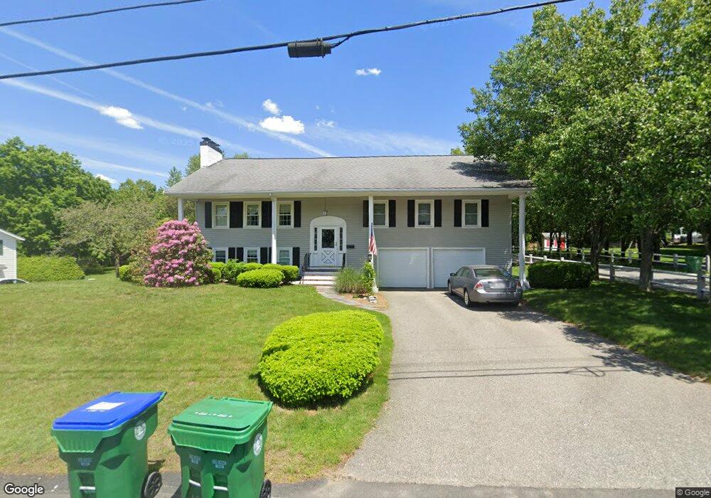
68 Phillips Brooks Rd Westwood, MA 02090
Estimated Value: $1,020,073 - $1,226,000
About This Home
This home is located at 68 Phillips Brooks Rd, Westwood, MA 02090 and is currently estimated at $1,126,518, approximately $804 per square foot. 68 Phillips Brooks Rd is a home located in Norfolk County with nearby schools including Westwood High School, Dedham Country Day School, and Beacon Scholastic Academy.
Ownership History
We collect this data history from publicly available records. To have your information removed, we recommend requesting removal directly through your county’s website.
Purchase Details
Home Financials for this Owner
Home Financials are based on the most recent Mortgage that was taken out on this home.Purchase Details
Home Financials for this Owner
Home Financials are based on the most recent Mortgage that was taken out on this home.Purchase Details
Home Financials for this Owner
Home Financials are based on the most recent Mortgage that was taken out on this home.Home Values in the Area
Average Home Value in this Area
Purchase History
We collect this data history from publicly available records. To have your information removed, we recommend requesting removal directly through your county’s website.
| Date | Buyer | Sale Price | Title Company |
|---|---|---|---|
| -- | -- | ||
| $530,000 | -- | ||
| $610,000 | -- |
Mortgage History
We collect this data history from publicly available records. To have your information removed, we recommend requesting removal directly through your county’s website.
| Date | Status | Borrower | Loan Amount |
|---|---|---|---|
| Open | $345,000 | ||
| Previous Owner | $400,000 | ||
| Previous Owner | $457,500 |
Tax History
We collect this data history from publicly available records. To have your information removed, we recommend requesting removal directly through your county’s website.
| Year | Tax Paid | Tax Assessment Tax Assessment Total Assessment is a certain percentage of the fair market value that is determined by local assessors to be the total taxable value of land and additions on the property. | Land | Improvement |
|---|---|---|---|---|
| 2025 | $11,645 | $909,800 | $517,600 | $392,200 |
| 2024 | $10,678 | $833,600 | $492,800 | $340,800 |
| 2023 | $9,670 | $676,200 | $410,800 | $265,400 |
| 2022 | $9,255 | $624,050 | $347,400 | $276,650 |
| 2021 | $9,096 | $615,450 | $330,800 | $284,650 |
| 2020 | $8,432 | $581,100 | $330,800 | $250,300 |
| 2019 | $8,282 | $565,300 | $315,000 | $250,300 |
| 2018 | $7,704 | $510,550 | $315,000 | $195,550 |
| 2017 | $7,717 | $529,650 | $315,000 | $214,650 |
| 2016 | $7,574 | $516,650 | $315,000 | $201,650 |
| 2015 | $7,824 | $513,400 | $315,000 | $198,400 |
Map
- 58 Weatherbee Dr
- 290 East St
- 12 Westwood Terrace
- 243 Weatherbee Dr
- 501 Canton St
- 33 Overlook Ave
- 13 Willard St
- 1139 East St
- 113 Ledgewood Rd
- 10 Peartree Dr
- 59 Beacon St Unit 59
- 202 Washington St
- 387 Washington St
- 138 Ellis Ave
- 19 Rose Ct Unit 19
- 407 Washington St Unit 2
- 1044 East St
- 76 Washington St
- 989 East St Unit 310
- 34 Preston St
- 62 Phillips Brooks Rd
- 78 Phillips Brooks Rd
- 10 Currier Farm Rd
- 92 Phillips Brooks Rd
- 54 Phillips Brooks Rd
- 69 Phillips Brooks Rd
- 61 Phillips Brooks Rd
- 79 Phillips Brooks Rd
- 102 Phillips Brooks Rd
- 53 Phillips Brooks Rd
- 50 Booth Dr
- 46 Phillips Brooks Rd
- 41 Booth Dr
- 85 Phillips Brooks Rd
- 47 Phillips Brooks Rd
- 91 Phillips Brooks Rd
- 60 Strasser Ave
- 68 Strasser Ave
- 108 Phillips Brooks Rd
- 105 Phillips Brooks Rd
Ask me questions while you tour the home.