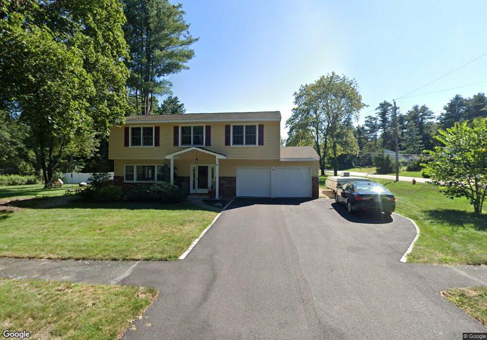
68 Ruth Ellen Rd Holliston, MA 01746
Estimated Value: $724,655 - $807,000
4
Beds
3
Baths
2,118
Sq Ft
$365/Sq Ft
Est. Value
About This Home
This home is located at 68 Ruth Ellen Rd, Holliston, MA 01746 and is currently estimated at $772,164, approximately $364 per square foot. 68 Ruth Ellen Rd is a home located in Middlesex County with nearby schools including Miller Elementary School, Robert H. Adams Middle School, and Holliston High School.
Ownership History
Date
Name
Owned For
Owner Type
Purchase Details
Closed on
Jan 31, 1997
Sold by
Hamilton Wilbert A and Hamilton Ruth N
Bought by
Meyers Maureen A and Meyers Richard C
Current Estimated Value
Home Financials for this Owner
Home Financials are based on the most recent Mortgage that was taken out on this home.
Original Mortgage
$178,200
Interest Rate
7.65%
Mortgage Type
Purchase Money Mortgage
Create a Home Valuation Report for This Property
The Home Valuation Report is an in-depth analysis detailing your home's value as well as a comparison with similar homes in the area
Home Values in the Area
Average Home Value in this Area
Purchase History
| Date | Buyer | Sale Price | Title Company |
|---|---|---|---|
| Meyers Maureen A | $198,000 | -- |
Source: Public Records
Mortgage History
| Date | Status | Borrower | Loan Amount |
|---|---|---|---|
| Open | Meyers Maureen A | $178,000 | |
| Closed | Meyers Maureen A | $178,200 | |
| Previous Owner | Meyers Maureen A | $75,000 |
Source: Public Records
Tax History Compared to Growth
Tax History
| Year | Tax Paid | Tax Assessment Tax Assessment Total Assessment is a certain percentage of the fair market value that is determined by local assessors to be the total taxable value of land and additions on the property. | Land | Improvement |
|---|---|---|---|---|
| 2025 | $8,884 | $606,400 | $261,400 | $345,000 |
| 2024 | $8,230 | $546,500 | $261,400 | $285,100 |
| 2023 | $8,228 | $534,300 | $261,400 | $272,900 |
| 2022 | $8,075 | $464,600 | $261,400 | $203,200 |
| 2021 | $7,908 | $443,000 | $239,800 | $203,200 |
| 2020 | $7,887 | $418,400 | $239,900 | $178,500 |
| 2019 | $7,359 | $390,800 | $208,600 | $182,200 |
| 2018 | $7,296 | $390,800 | $208,600 | $182,200 |
| 2017 | $7,143 | $385,700 | $200,700 | $185,000 |
| 2016 | $6,744 | $358,900 | $175,600 | $183,300 |
| 2015 | $6,508 | $335,800 | $157,800 | $178,000 |
Source: Public Records
Map
Nearby Homes
- 150 Westfield Dr
- 59 Turner Rd
- 152 Turner Rd Unit 43
- 152 Turner Rd Unit 14
- 147 Turner Rd Unit 80
- 32 Colonial Way
- 95 Brooksmont Dr Unit 26
- 133 Brooksmont Dr Unit 43
- 56 Roy Ave
- 8 Raymond Way
- 54 Westfield Dr
- 74 Meeting House Path
- 72 Meeting House Path
- 97 Meeting House Path Unit 97
- 277 Meeting House Path
- 131 Jennings Rd
- 157 Leland Farm Rd
- 195 High St
- 160 Winter St
- 63 Trailside Way Unit 63
- 85 Anne Marie Dr
- 62 Ruth Ellen Rd
- 90 Ann Marie Dr
- 86 Anne Marie Dr
- 96 Ann Marie Dr
- 81 Ann Marie Dr
- 82 Ann Marie Dr
- 82 Anne Marie Dr
- 111 Richard Rd
- 117 Richard Rd
- 78 Ann Marie Dr
- 29 Maple St
- 683 Winter St
- 675 Winter St
- 102 Anne Marie Dr
- 691 Winter St
- 667 Winter St
- 103 Richard Rd
- 48 Ruth Ellen Rd
- 47 Ruth Ellen Rd