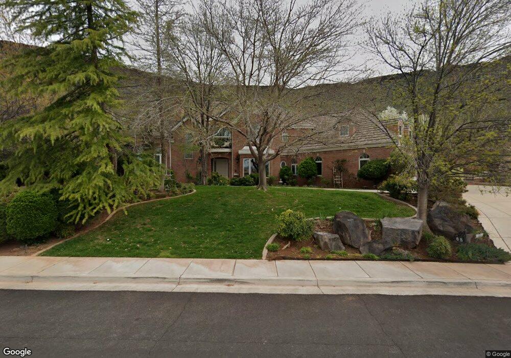
68 Shadow Point Dr St. George, UT 84770
Estimated Value: $1,039,000 - $1,780,000
5
Beds
6
Baths
6,470
Sq Ft
$227/Sq Ft
Est. Value
About This Home
This home is located at 68 Shadow Point Dr, St. George, UT 84770 and is currently estimated at $1,470,062, approximately $227 per square foot. 68 Shadow Point Dr is a home located in Washington County with nearby schools including Sunset School, Snow Canyon Middle School, and Lava Ridge Intermediate School.
Ownership History
Date
Name
Owned For
Owner Type
Purchase Details
Closed on
Jun 13, 2024
Sold by
Hensley Darren Webb and Kelly Jo
Bought by
Hensley Living Trust and Hensley
Current Estimated Value
Purchase Details
Closed on
Dec 22, 2015
Sold by
Hill Lacne
Bought by
Helso Darren and Helso Kely
Purchase Details
Closed on
Sep 19, 2013
Sold by
Brown Elise L and Brown Lloyd L
Bought by
Hensley Darren and Hensley Kelly
Create a Home Valuation Report for This Property
The Home Valuation Report is an in-depth analysis detailing your home's value as well as a comparison with similar homes in the area
Purchase History
| Date | Buyer | Sale Price | Title Company |
|---|---|---|---|
| Hensley Living Trust | -- | None Listed On Document | |
| Helso Darren | -- | None Available | |
| Hensley Darren | -- | Provo Land Title St George B |
Source: Public Records
Tax History
| Year | Tax Paid | Tax Assessment Tax Assessment Total Assessment is a certain percentage of the fair market value that is determined by local assessors to be the total taxable value of land and additions on the property. | Land | Improvement |
|---|---|---|---|---|
| 2025 | $5,727 | $857,450 | $127,215 | $730,235 |
| 2023 | $5,926 | $885,335 | $127,215 | $758,120 |
| 2022 | $6,260 | $879,615 | $127,215 | $752,400 |
| 2021 | $5,542 | $1,161,300 | $118,800 | $1,042,500 |
| 2020 | $5,196 | $1,025,400 | $106,300 | $919,100 |
| 2019 | $5,016 | $967,100 | $106,300 | $860,800 |
| 2018 | $4,963 | $493,295 | $0 | $0 |
| 2017 | $4,692 | $453,475 | $0 | $0 |
| 2016 | $4,733 | $423,060 | $0 | $0 |
| 2015 | $4,756 | $407,880 | $0 | $0 |
| 2014 | $8,552 | $738,000 | $0 | $0 |
Source: Public Records
Map
Nearby Homes
- 40 N Stone Mountain Dr
- 7 N Reflection Way
- 184 N 1240 W
- 10 N Valley View Dr Unit 109
- 250 S Donlee Dr Unit J
- 204 N 1280 W
- 663 W 65 S
- 301 N Donlee Dr
- 347 N Donlee Dr
- 438 N Stone Mountain Dr Unit 59
- 438 N Stone Mountain Dr Unit 17
- 1246 W 300 N
- 1150 W 360 N Unit 24
- 1150 W 360 N Unit 24
- 1210 W Indian Hills Dr Unit 29
- 1210 W Indian Hills Dr
- 1210 W Indian Hills Dr Unit 29
- 1210 W Indian Hills Dr Unit 27
- 346 N Donlee Dr
- 39 N Valley View Dr Unit 58
- 68 Shadow Point Dr
- 82 N Shadow Pointe Dr
- 82 Shadow Point Dr
- 56 Shadow Point Dr
- 56 Shadow Point Dr Unit 282
- Lot 44 W Lava Pointe Dr
- 75 Shadow Point Dr
- Lot 45 W Lava Pointe Dr
- LOT 3 Point Dr
- 63 Shadow Point Dr
- 0 Shadow Point Dr
- 94 Shadow Point Dr
- 87 N Shadow Pointe Dr
- 87 Shadow Point Dr
- 62 Eclipse Dr
- 76 Eclipse Dr
- 99 Shadow Point Dr
- 108 N Shadow Pointe Dr
- 987 Shadow Pointe Dr
- 987 Shadow Point Dr
Your Personal Tour Guide
Ask me questions while you tour the home.