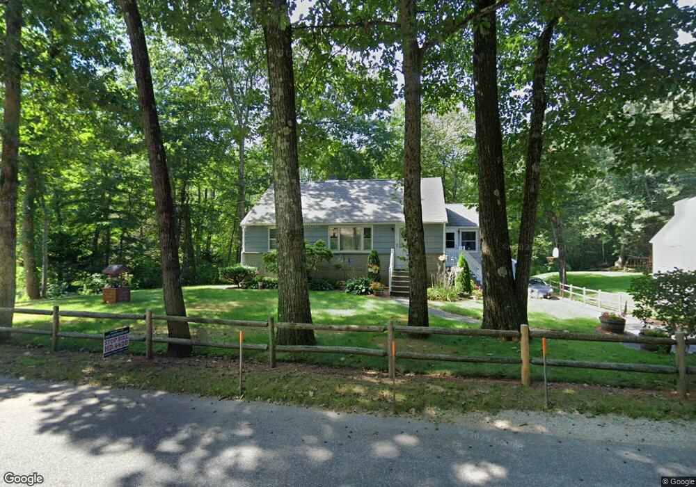
68 Shepard Rd Sturbridge, MA 01566
Estimated Value: $428,594 - $532,000
4
Beds
3
Baths
1,814
Sq Ft
$260/Sq Ft
Est. Value
About This Home
This home is located at 68 Shepard Rd, Sturbridge, MA 01566 and is currently estimated at $471,399, approximately $259 per square foot. 68 Shepard Rd is a home located in Worcester County with nearby schools including Burgess Elementary School, Tantasqua Regional Junior High School, and Tantasqua Regional High School.
Ownership History
Date
Name
Owned For
Owner Type
Purchase Details
Closed on
May 21, 1998
Sold by
Paquette Rt and Paquette Edward M
Bought by
Desy Mark O and Desy Kimberly A
Current Estimated Value
Home Financials for this Owner
Home Financials are based on the most recent Mortgage that was taken out on this home.
Original Mortgage
$96,000
Outstanding Balance
$17,578
Interest Rate
7.03%
Mortgage Type
Purchase Money Mortgage
Estimated Equity
$453,821
Create a Home Valuation Report for This Property
The Home Valuation Report is an in-depth analysis detailing your home's value as well as a comparison with similar homes in the area
Home Values in the Area
Average Home Value in this Area
Purchase History
| Date | Buyer | Sale Price | Title Company |
|---|---|---|---|
| Desy Mark O | $120,430 | -- |
Source: Public Records
Mortgage History
| Date | Status | Borrower | Loan Amount |
|---|---|---|---|
| Open | Desy Mark O | $60,000 | |
| Open | Desy Mark O | $96,000 | |
| Previous Owner | Desy Mark O | $20,000 |
Source: Public Records
Tax History
| Year | Tax Paid | Tax Assessment Tax Assessment Total Assessment is a certain percentage of the fair market value that is determined by local assessors to be the total taxable value of land and additions on the property. | Land | Improvement |
|---|---|---|---|---|
| 2025 | $5,698 | $357,700 | $82,300 | $275,400 |
| 2024 | $5,478 | $332,200 | $80,700 | $251,500 |
| 2023 | $5,170 | $286,100 | $70,500 | $215,600 |
| 2022 | $4,992 | $260,700 | $64,500 | $196,200 |
| 2021 | $4,557 | $239,600 | $61,400 | $178,200 |
| 2020 | $4,557 | $239,600 | $61,400 | $178,200 |
| 2019 | $4,274 | $223,200 | $63,300 | $159,900 |
| 2018 | $4,110 | $211,400 | $60,200 | $151,200 |
| 2017 | $3,915 | $201,800 | $57,900 | $143,900 |
| 2016 | $3,842 | $200,000 | $56,200 | $143,800 |
| 2015 | $3,790 | $197,000 | $56,200 | $140,800 |
Source: Public Records
Map
Nearby Homes
- 74 River Rd
- 74 Fairview Park Rd
- Lot 1 Berry Farms Road-2 Acre
- 170 Shepard Rd
- Lot B-6 River Rd
- 39 Park Ave
- 6 Berry Farms Rd Unit 3
- 6 Berry Farms Rd Unit 63
- 6 Berry Farms Rd Unit 64
- 6 Berry Farms Rd Unit 6
- 43 Park Ave
- 56 Park Ave
- 85 Idlewood St
- 3 Berry Farms Road - Jv
- 57 Old Sturbridge Rd
- 32 Crestwood Dr
- 402 Pleasant Pkwy
- 14 Beech St
- 757 South St
- 83 Plimpton St
Your Personal Tour Guide
Ask me questions while you tour the home.