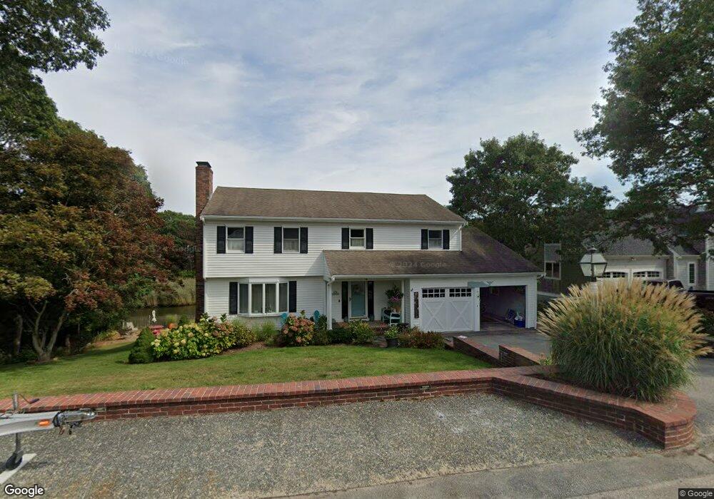
68 Squibnocket Dr East Falmouth, MA 02536
Estimated Value: $1,034,000 - $1,291,000
4
Beds
4
Baths
2,200
Sq Ft
$528/Sq Ft
Est. Value
About This Home
This home is located at 68 Squibnocket Dr, East Falmouth, MA 02536 and is currently estimated at $1,162,271, approximately $528 per square foot. 68 Squibnocket Dr is a home located in Barnstable County with nearby schools including East Falmouth Elementary School, Morse Pond School, and Lawrence School.
Ownership History
Date
Name
Owned For
Owner Type
Purchase Details
Closed on
May 10, 2011
Sold by
Weaver Samuel D
Bought by
Weaver Jacqueline A
Current Estimated Value
Purchase Details
Closed on
Jan 31, 1995
Sold by
Fleck Rt and Fleck
Bought by
Weaver Samuel Davis
Create a Home Valuation Report for This Property
The Home Valuation Report is an in-depth analysis detailing your home's value as well as a comparison with similar homes in the area
Home Values in the Area
Average Home Value in this Area
Purchase History
| Date | Buyer | Sale Price | Title Company |
|---|---|---|---|
| Weaver Jacqueline A | -- | -- | |
| Weaver Jacqueline A | -- | -- | |
| Weaver Samuel Davis | $265,000 | -- | |
| Weaver Samuel Davis | $265,000 | -- |
Source: Public Records
Mortgage History
| Date | Status | Borrower | Loan Amount |
|---|---|---|---|
| Closed | Weaver Samuel Davis | $100,000 | |
| Previous Owner | Weaver Samuel Davis | $170,000 | |
| Previous Owner | Weaver Samuel Davis | $180,000 |
Source: Public Records
Tax History Compared to Growth
Tax History
| Year | Tax Paid | Tax Assessment Tax Assessment Total Assessment is a certain percentage of the fair market value that is determined by local assessors to be the total taxable value of land and additions on the property. | Land | Improvement |
|---|---|---|---|---|
| 2025 | $6,981 | $1,189,200 | $698,100 | $491,100 |
| 2024 | $6,437 | $1,025,000 | $607,000 | $418,000 |
| 2023 | $6,413 | $926,800 | $576,700 | $350,100 |
| 2022 | $6,524 | $810,400 | $514,100 | $296,300 |
| 2021 | $6,554 | $771,000 | $514,100 | $256,900 |
| 2020 | $6,222 | $724,300 | $467,400 | $256,900 |
| 2019 | $6,183 | $722,300 | $467,400 | $254,900 |
| 2018 | $6,121 | $711,700 | $467,400 | $244,300 |
| 2017 | $5,996 | $702,900 | $467,400 | $235,500 |
| 2016 | $5,883 | $702,900 | $467,400 | $235,500 |
| 2015 | $5,757 | $702,900 | $467,400 | $235,500 |
| 2014 | $5,712 | $700,800 | $467,400 | $233,400 |
Source: Public Records
Map
Nearby Homes
- 64 Squibnocket Dr
- 74 Squibnocket Dr
- 67 Squibnocket Dr
- 78 Squibnocket Dr
- 58 Squibnocket Dr
- 59 Squibnocket Dr
- 79 Squibnocket Dr
- 11 Menemsha Way
- 12 Menemsha Way
- 8 Menemsha Way
- 15 Madeline Rd
- 23 Madeline Rd
- 84 Squibnocket Dr
- 19 Madeline Rd
- 17 Madeline Rd
- 11 Madeline Rd
- 14 Dylans Way
- 55 Squibnocket Dr
- 7 Menemsha Way
- 54 Squibnocket Dr