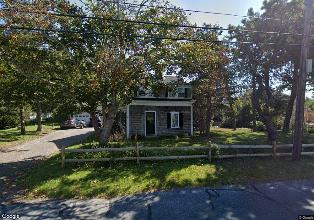
68 Uncle Barneys Rd West Dennis, MA 02670
West Dennis NeighborhoodEstimated Value: $894,000 - $1,081,000
3
Beds
2
Baths
1,550
Sq Ft
$630/Sq Ft
Est. Value
About This Home
This home is located at 68 Uncle Barneys Rd, West Dennis, MA 02670 and is currently estimated at $976,538, approximately $630 per square foot. 68 Uncle Barneys Rd is a home located in Barnstable County with nearby schools including Dennis-Yarmouth Regional High School and St. Pius X. School.
Ownership History
Date
Name
Owned For
Owner Type
Purchase Details
Closed on
Nov 12, 2024
Sold by
Marc C Amidon Ret and Amidon
Bought by
Amidon Philip S
Current Estimated Value
Purchase Details
Closed on
May 18, 2022
Sold by
Amidon Barbara S and Amidon Marc C
Bought by
Marc C Amidon Ret and Amidon
Purchase Details
Closed on
Dec 1, 1975
Bought by
Amidon Marc C and Amidon Barbara S
Create a Home Valuation Report for This Property
The Home Valuation Report is an in-depth analysis detailing your home's value as well as a comparison with similar homes in the area
Home Values in the Area
Average Home Value in this Area
Purchase History
| Date | Buyer | Sale Price | Title Company |
|---|---|---|---|
| Amidon Philip S | -- | None Available | |
| Amidon Philip S | -- | None Available | |
| Marc C Amidon Ret | -- | None Available | |
| Marc C Amidon Ret | -- | None Available | |
| Amidon Marc C | -- | -- |
Source: Public Records
Tax History Compared to Growth
Tax History
| Year | Tax Paid | Tax Assessment Tax Assessment Total Assessment is a certain percentage of the fair market value that is determined by local assessors to be the total taxable value of land and additions on the property. | Land | Improvement |
|---|---|---|---|---|
| 2025 | $3,723 | $859,800 | $571,000 | $288,800 |
| 2024 | $3,616 | $823,700 | $549,100 | $274,600 |
| 2023 | $3,919 | $839,200 | $582,400 | $256,800 |
| 2022 | $2,669 | $476,600 | $284,800 | $191,800 |
| 2021 | $0 | $451,800 | $279,200 | $172,600 |
| 2020 | $2,610 | $427,800 | $257,200 | $170,600 |
| 2019 | $0 | $429,500 | $252,100 | $177,400 |
| 2018 | $0 | $464,200 | $308,600 | $155,600 |
| 2017 | $0 | $469,300 | $308,600 | $160,700 |
| 2016 | $2,943 | $450,700 | $315,400 | $135,300 |
| 2015 | $2,884 | $450,700 | $315,400 | $135,300 |
| 2014 | $2,889 | $455,000 | $315,400 | $139,600 |
Source: Public Records
Map
Nearby Homes
- 308 Old Main St
- 2 Rita Mary Way
- 14 Schoolhouse Ln
- 45 Seth Ln
- 209 Main St Unit 3
- 209 Main St Unit 6
- 209 Main St Unit 1
- 209 Main St Unit 2
- 209 Main St Unit 4
- 209 Main St Unit 5
- 40 Kelley Rd
- 29 Bass River Rd
- 23 Doric Ave
- 181 Pleasant St
- 18 Turner Ln
- 22 Powhatan Rd
- 116 N Main St
- 15 Sharon Rd
- 178 School St
- 401 Main St Unit 201
- 62 Uncle Barneys Rd
- 74 Uncle Barneys Rd
- 60 Uncle Barneys Rd
- 17 Home Acres
- 63 Uncle Barney's Rd
- 62 Uncle Barney's
- 11 Debra Way
- 67 Uncle Barneys Rd
- 28 Uncle Johns Rd
- 82 Uncle Barneys Rd
- 56 Uncle Barneys Rd
- 73 Uncle Barneys Rd
- 63 Uncle Barneys Rd
- 20 Uncle Johns Rd
- 20 Home Acres
- 16 Uncle Johns Rd
- 81 Uncle Barneys Rd
- 15 Home Acres
- 52 Uncle Barneys Rd
- 10 Debra Way