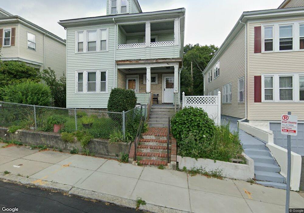
68 Westmore Rd Mattapan, MA 02126
Wellington Hill NeighborhoodEstimated Value: $745,873 - $837,000
4
Beds
2
Baths
2,652
Sq Ft
$297/Sq Ft
Est. Value
About This Home
This home is located at 68 Westmore Rd, Mattapan, MA 02126 and is currently estimated at $787,718, approximately $297 per square foot. 68 Westmore Rd is a home located in Suffolk County with nearby schools including KIPP Academy Boston Charter School and Berea Seventh-day Adventist Academy.
Ownership History
Date
Name
Owned For
Owner Type
Purchase Details
Closed on
May 15, 1996
Sold by
Westmore Road Rt 6 & 8
Bought by
Graves Carmensita and Graves Graves-Hackett J
Current Estimated Value
Home Financials for this Owner
Home Financials are based on the most recent Mortgage that was taken out on this home.
Original Mortgage
$97,500
Outstanding Balance
$5,439
Interest Rate
7.77%
Mortgage Type
Purchase Money Mortgage
Estimated Equity
$782,279
Purchase Details
Closed on
Dec 13, 1995
Sold by
Fhlmc
Bought by
Westmore Rd Rt 6 & 8
Create a Home Valuation Report for This Property
The Home Valuation Report is an in-depth analysis detailing your home's value as well as a comparison with similar homes in the area
Home Values in the Area
Average Home Value in this Area
Purchase History
| Date | Buyer | Sale Price | Title Company |
|---|---|---|---|
| Graves Carmensita | $130,000 | -- | |
| Westmore Rd Rt 6 & 8 | $48,000 | -- |
Source: Public Records
Mortgage History
| Date | Status | Borrower | Loan Amount |
|---|---|---|---|
| Open | Graves Carmensita | $97,500 | |
| Closed | Graves Carmensita | $26,000 |
Source: Public Records
Tax History Compared to Growth
Tax History
| Year | Tax Paid | Tax Assessment Tax Assessment Total Assessment is a certain percentage of the fair market value that is determined by local assessors to be the total taxable value of land and additions on the property. | Land | Improvement |
|---|---|---|---|---|
| 2025 | $7,587 | $655,200 | $250,800 | $404,400 |
| 2024 | $6,334 | $581,100 | $214,400 | $366,700 |
| 2023 | $5,833 | $543,100 | $200,400 | $342,700 |
| 2022 | $5,574 | $512,300 | $189,000 | $323,300 |
| 2021 | $5,061 | $474,300 | $175,000 | $299,300 |
| 2020 | $4,788 | $453,400 | $183,700 | $269,700 |
| 2019 | $4,230 | $401,300 | $132,000 | $269,300 |
| 2018 | $3,823 | $364,800 | $132,000 | $232,800 |
| 2017 | $3,863 | $364,800 | $132,000 | $232,800 |
| 2016 | $3,583 | $325,700 | $132,000 | $193,700 |
| 2015 | $3,167 | $261,500 | $91,400 | $170,100 |
| 2014 | $2,937 | $233,500 | $91,400 | $142,100 |
Source: Public Records
Map
Nearby Homes
- 4 Gilmer St
- 30-32 Westmore Rd
- 17 Greendale Rd Unit 2F
- 6 Deering Rd
- 84 W Main St Unit 84
- 12 Finch St Unit 12
- 1 Finch St Unit 1
- 14 Estella St Unit 2
- 10 Itasca St
- 10 Hosmer St
- 49 Fottler Rd
- 58 Mattapan St
- 29 Havelock St
- 27 Havelock St
- 45 1st Ave Unit 111
- 492 Harvard St
- 67 Wildwood St
- 23 Fessenden St
- 710 Walk Hill St
- 25 Fessenden St
- 68 Westmore Rd
- 68 Westmore Rd Unit 1
- 70 Westmore Rd Unit 72
- 72 Westmore Rd
- 66 Westmore Rd
- 20 Gilmer St
- 74 Westmore Rd Unit 76
- 74 Westmore Rd Unit 1
- 125 Hazelton St Unit 127
- 16 Gilmer St
- 62 Westmore Rd
- 78 Westmore Rd Unit 80
- 73 Westmore Rd Unit 75
- 77 Westmore Rd Unit 79
- 121 Hazelton St Unit 123
- 81 Westmore Rd Unit 83
- 10 Gilmer St
- 65 Westmore Rd
- 17 Gilmer St
- 60 Westmore Rd Unit 1