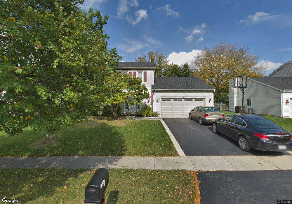
680 Auburn Ct Crystal Lake, IL 60014
Estimated Value: $332,302 - $392,000
4
Beds
3
Baths
1,852
Sq Ft
$200/Sq Ft
Est. Value
About This Home
This home is located at 680 Auburn Ct, Crystal Lake, IL 60014 and is currently estimated at $371,076, approximately $200 per square foot. 680 Auburn Ct is a home located in McHenry County with nearby schools including Indian Prairie Elementary School, Lundahl Middle School, and Crystal Lake South High School.
Ownership History
Date
Name
Owned For
Owner Type
Purchase Details
Closed on
Sep 5, 2000
Sold by
Kump William E and Kump Suzanne
Bought by
Garity Joseph A and Garity Sheri L
Current Estimated Value
Home Financials for this Owner
Home Financials are based on the most recent Mortgage that was taken out on this home.
Original Mortgage
$150,000
Outstanding Balance
$54,127
Interest Rate
7.96%
Estimated Equity
$316,949
Purchase Details
Closed on
Oct 29, 1993
Sold by
Klockenga Richard Kim and Klockenga Brenda R
Bought by
Kump William E and Kump Suzanne
Home Financials for this Owner
Home Financials are based on the most recent Mortgage that was taken out on this home.
Original Mortgage
$115,000
Interest Rate
7.02%
Create a Home Valuation Report for This Property
The Home Valuation Report is an in-depth analysis detailing your home's value as well as a comparison with similar homes in the area
Home Values in the Area
Average Home Value in this Area
Purchase History
| Date | Buyer | Sale Price | Title Company |
|---|---|---|---|
| Garity Joseph A | $187,500 | Lawyers Title Pick Up | |
| Kump William E | $150,000 | Universal Title Services Inc |
Source: Public Records
Mortgage History
| Date | Status | Borrower | Loan Amount |
|---|---|---|---|
| Open | Garity Joseph A | $150,000 | |
| Previous Owner | Kump William E | $115,000 | |
| Closed | Garity Joseph A | $4,500 |
Source: Public Records
Tax History Compared to Growth
Tax History
| Year | Tax Paid | Tax Assessment Tax Assessment Total Assessment is a certain percentage of the fair market value that is determined by local assessors to be the total taxable value of land and additions on the property. | Land | Improvement |
|---|---|---|---|---|
| 2024 | $8,030 | $102,849 | $19,431 | $83,418 |
| 2023 | $7,733 | $91,986 | $17,379 | $74,607 |
| 2022 | $8,415 | $94,838 | $24,609 | $70,229 |
| 2021 | $7,953 | $88,353 | $22,926 | $65,427 |
| 2020 | $7,751 | $85,225 | $22,114 | $63,111 |
| 2019 | $7,544 | $81,571 | $21,166 | $60,405 |
| 2018 | $7,063 | $75,354 | $19,553 | $55,801 |
| 2017 | $7,015 | $70,988 | $18,420 | $52,568 |
| 2016 | $6,832 | $66,580 | $17,276 | $49,304 |
| 2013 | -- | $57,787 | $16,116 | $41,671 |
Source: Public Records
Map
Nearby Homes
- 1420 Trailwood Dr
- 1391 Acadia Cir
- 1421 Acadia Cir
- 1451 Acadia Cir
- 1441 Acadia Cir
- 1461 Acadia Cir
- 1549 Hollytree Ln Unit 2
- 1549 Brompton Ln
- 1542 Candlewood Dr
- 796 Waterford Cut
- 1655 Kennsington Ln
- 1644 Stockton Ln
- 1668 Penn Ct Unit A
- 518 Silver Aspen Cir
- 1644 Brigham Ln
- 542 Silver Aspen Cir
- 645 Kendallwood Ct
- 1694 Penny Ln Unit A
- 761 Village Rd
- 1724 Hartford Ln
- 674 Auburn Ct
- 688 Auburn Ct
- 668 Auburn Ct
- 677 Auburn Ct
- 694 Auburn Ct
- 685 Auburn Ct
- 700 Regent Dr
- 658 Auburn Ct
- 700 Auburn Ct Unit 1
- 698 Regent Dr
- 693 Auburn Ct
- 657 Auburn Ct
- 697 Auburn Ct
- 1364 Bridgedale Rd
- 702 Regent Dr
- 650 Auburn Ct
- 696 Regent Dr
- 1302 Westport Ridge Ct
- 1304 Westport Ridge Ct
- 651 Auburn Ct