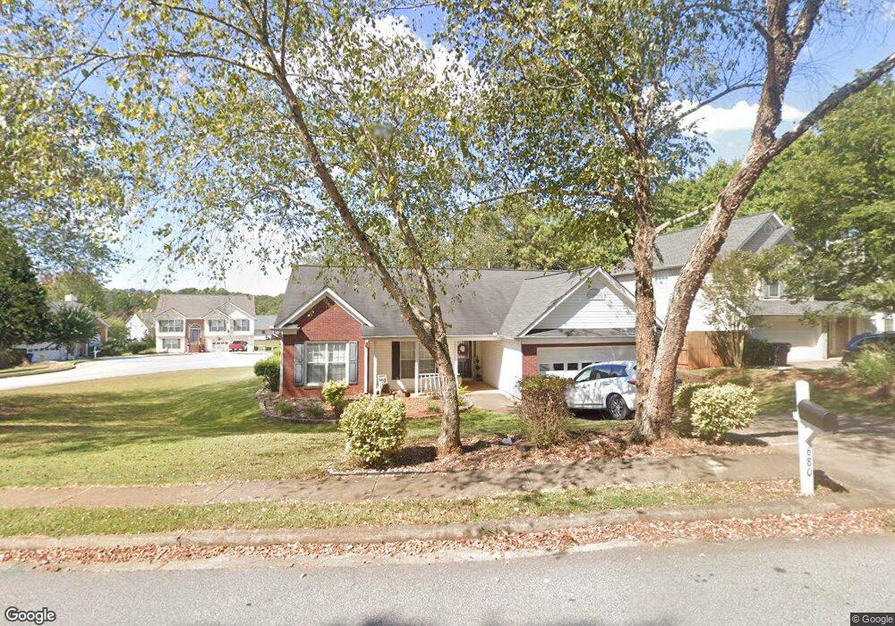
680 Burnham Ridge Unit 1 Lawrenceville, GA 30046
Estimated Value: $336,000 - $373,000
3
Beds
2
Baths
1,736
Sq Ft
$202/Sq Ft
Est. Value
About This Home
This home is located at 680 Burnham Ridge Unit 1, Lawrenceville, GA 30046 and is currently estimated at $350,740, approximately $202 per square foot. 680 Burnham Ridge Unit 1 is a home located in Gwinnett County with nearby schools including Benefield Elementary School, Richards Middle School, and Discovery High School.
Ownership History
Date
Name
Owned For
Owner Type
Purchase Details
Closed on
Mar 27, 1998
Sold by
Burnham Bldrs Lp
Bought by
Simpson Jacob Edward and Simpson Sonya A
Current Estimated Value
Home Financials for this Owner
Home Financials are based on the most recent Mortgage that was taken out on this home.
Original Mortgage
$127,399
Outstanding Balance
$23,867
Interest Rate
6.95%
Mortgage Type
VA
Estimated Equity
$326,873
Create a Home Valuation Report for This Property
The Home Valuation Report is an in-depth analysis detailing your home's value as well as a comparison with similar homes in the area
Home Values in the Area
Average Home Value in this Area
Purchase History
| Date | Buyer | Sale Price | Title Company |
|---|---|---|---|
| Simpson Jacob Edward | $124,000 | -- |
Source: Public Records
Mortgage History
| Date | Status | Borrower | Loan Amount |
|---|---|---|---|
| Open | Simpson Jacob Edward | $127,399 |
Source: Public Records
Tax History Compared to Growth
Tax History
| Year | Tax Paid | Tax Assessment Tax Assessment Total Assessment is a certain percentage of the fair market value that is determined by local assessors to be the total taxable value of land and additions on the property. | Land | Improvement |
|---|---|---|---|---|
| 2024 | $3,552 | $129,080 | $21,600 | $107,480 |
| 2023 | $3,552 | $128,120 | $24,000 | $104,120 |
| 2022 | $3,003 | $104,280 | $24,000 | $80,280 |
| 2021 | $2,645 | $85,400 | $16,000 | $69,400 |
| 2020 | $2,664 | $85,400 | $16,000 | $69,400 |
| 2019 | $2,413 | $76,520 | $13,600 | $62,920 |
| 2018 | $2,413 | $76,520 | $13,600 | $62,920 |
| 2016 | $2,084 | $60,280 | $13,600 | $46,680 |
| 2015 | $1,857 | $49,320 | $10,400 | $38,920 |
| 2014 | -- | $49,320 | $10,400 | $38,920 |
Source: Public Records
Map
Nearby Homes
- 652 Tower Hill Ct
- 555 Sydney Crest Ln
- 2099 Riverlanding Cir Unit II
- 1584 Park Grove Dr
- 1405 Chris Lake Dr
- 757 Riverlanding Dr
- 593 Mill Run Place
- 1564 Mill Run Ct Unit 1
- 537 Sydney Michelle Ln
- 1115 Chris Lake Dr
- 1759 Coleville Oak Ln
- 1789 Riverlanding Cir
- 1870 Garbrooke Cove
- 1880 Garbrooke Cove
- 1384 Sunrise Way
- 1684 Oak Ridge Way
- 398 Parc River Blvd
- 384 Parc River Blvd
- 690 Burnham Ridge
- 1469 Burnham Knoll
- 1452 Burnham Knoll
- 675 Burnham Ridge Unit 1
- 1462 Burnham Knoll Unit 1
- 655 Burnham Ridge
- 1479 Burnham Knoll Unit 1
- 1472 Burnham Knoll Unit 1
- 1388 Old Norcross Rd
- 1403 Alamein Dr
- 1423 Alamein Dr Unit 1
- 645 Burnham Ridge
- 642 Tower Hill Ct
- 1473 Alamein Dr Unit 1
- 1433 Alamein Dr
- 1443 Alamein Dr
- 1453 Alamein Dr Unit 1
- 1503 Alamein Dr Unit 1
- 651 Tower Hill Ct Unit 2
- 1463 Alamein Dr