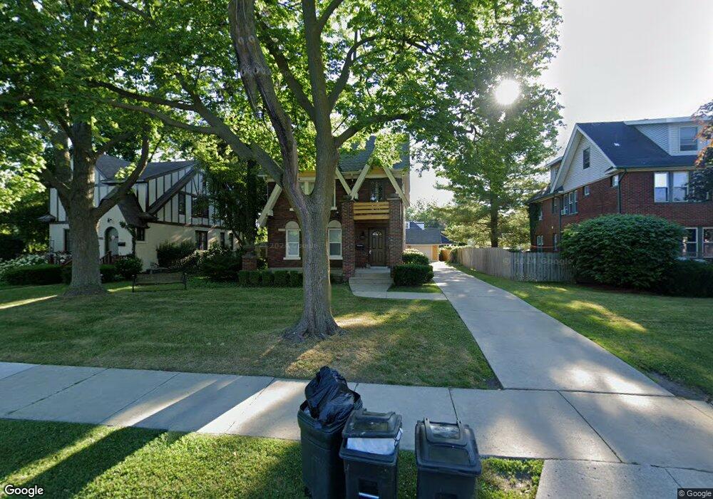
680 Neff Rd Unit Bldg-Unit Grosse Pointe, MI 48230
Estimated Value: $412,000 - $486,000
Studio
3
Baths
2,294
Sq Ft
$197/Sq Ft
Est. Value
About This Home
This home is located at 680 Neff Rd Unit Bldg-Unit, Grosse Pointe, MI 48230 and is currently estimated at $452,395, approximately $197 per square foot. 680 Neff Rd Unit Bldg-Unit is a home located in Wayne County with nearby schools including Lewis Maire Elementary School, Pierce Middle School, and Grosse Pointe South High School.
Ownership History
Date
Name
Owned For
Owner Type
Purchase Details
Closed on
Oct 8, 2021
Sold by
Coddens Robert R
Bought by
Ca Wanglin Llc and Ca Wanglin Llc
Current Estimated Value
Purchase Details
Closed on
Apr 1, 2019
Sold by
Coddens Robert R
Bought by
Ca Wanglin Llc
Home Financials for this Owner
Home Financials are based on the most recent Mortgage that was taken out on this home.
Original Mortgage
$460,000
Interest Rate
2.8%
Mortgage Type
Commercial
Create a Home Valuation Report for This Property
The Home Valuation Report is an in-depth analysis detailing your home's value as well as a comparison with similar homes in the area
Home Values in the Area
Average Home Value in this Area
Purchase History
| Date | Buyer | Sale Price | Title Company |
|---|---|---|---|
| Ca Wanglin Llc | -- | Transnation Ttl Agcy Of Mi M | |
| Ca Wanglin Llc | $275,000 | Leading Edge Title Agency | |
| Coddens Robert R | -- | Leading Edge Title Agency |
Source: Public Records
Mortgage History
| Date | Status | Borrower | Loan Amount |
|---|---|---|---|
| Previous Owner | Ca Wanglin Llc | $460,000 |
Source: Public Records
Tax History
| Year | Tax Paid | Tax Assessment Tax Assessment Total Assessment is a certain percentage of the fair market value that is determined by local assessors to be the total taxable value of land and additions on the property. | Land | Improvement |
|---|---|---|---|---|
| 2025 | $7,843 | $196,200 | $0 | $0 |
| 2024 | $7,474 | $186,300 | $0 | $0 |
| 2023 | $7,134 | $180,700 | $0 | $0 |
| 2022 | $10,143 | $164,600 | $0 | $0 |
| 2021 | $9,502 | $150,600 | $0 | $0 |
| 2019 | $5,899 | $130,300 | $0 | $0 |
| 2018 | $4,151 | $116,600 | $0 | $0 |
| 2017 | $5,064 | $115,200 | $0 | $0 |
| 2016 | $5,342 | $109,600 | $0 | $0 |
| 2015 | $8,319 | $100,100 | $0 | $0 |
| 2013 | $8,059 | $84,000 | $0 | $0 |
| 2012 | -- | $78,700 | $0 | $0 |
Source: Public Records
Map
Nearby Homes
- 614 Rivard Blvd
- 775 Notre Dame St
- 781 Loraine St
- 516 Neff Ln
- 612 Cadieux Rd
- 25 Village Ln
- 180 Fisher Rd
- 256 Fisher Rd
- 1264 Bishop Rd
- 47 Cranford Ln
- 201 Mcmillan Rd
- 379 Lakeland St
- 17540 Mack Ave Unit 10
- 42 Cranford Ln
- 355 Lincoln Rd
- 30 Cranford Ln
- 17590 Mack Ave Unit 8
- 213 Muir Rd
- 345 Roosevelt Place
- 1425 Bishop Rd
Your Personal Tour Guide
Ask me questions while you tour the home.