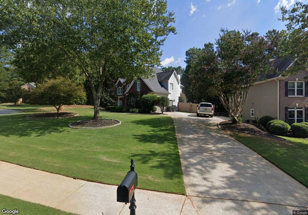
680 Silver Peak Ct Unit 1 Suwanee, GA 30024
Estimated Value: $562,820 - $620,000
4
Beds
3
Baths
2,832
Sq Ft
$208/Sq Ft
Est. Value
About This Home
This home is located at 680 Silver Peak Ct Unit 1, Suwanee, GA 30024 and is currently estimated at $589,955, approximately $208 per square foot. 680 Silver Peak Ct Unit 1 is a home located in Gwinnett County with nearby schools including Level Creek Elementary School, North Gwinnett Middle School, and North Gwinnett High School.
Ownership History
Date
Name
Owned For
Owner Type
Purchase Details
Closed on
May 29, 2000
Sold by
Monroe Robert and Monroe Lynnann
Bought by
Desilva Vincent C and Desilva Rachel E
Current Estimated Value
Home Financials for this Owner
Home Financials are based on the most recent Mortgage that was taken out on this home.
Original Mortgage
$189,300
Outstanding Balance
$65,040
Interest Rate
8.27%
Mortgage Type
New Conventional
Estimated Equity
$524,915
Purchase Details
Closed on
Sep 26, 1996
Sold by
Sharp Dev Inc
Bought by
Monroe Robert Lynnann
Create a Home Valuation Report for This Property
The Home Valuation Report is an in-depth analysis detailing your home's value as well as a comparison with similar homes in the area
Home Values in the Area
Average Home Value in this Area
Purchase History
| Date | Buyer | Sale Price | Title Company |
|---|---|---|---|
| Desilva Vincent C | $199,300 | -- | |
| Monroe Robert Lynnann | $167,000 | -- |
Source: Public Records
Mortgage History
| Date | Status | Borrower | Loan Amount |
|---|---|---|---|
| Open | Desilva Vincent C | $189,300 | |
| Closed | Monroe Robert Lynnann | $0 |
Source: Public Records
Tax History
| Year | Tax Paid | Tax Assessment Tax Assessment Total Assessment is a certain percentage of the fair market value that is determined by local assessors to be the total taxable value of land and additions on the property. | Land | Improvement |
|---|---|---|---|---|
| 2025 | $4,360 | $194,400 | $39,200 | $155,200 |
| 2024 | $4,511 | $194,400 | $39,200 | $155,200 |
| 2023 | $4,511 | $200,560 | $39,200 | $161,360 |
| 2022 | $5,201 | $179,680 | $39,200 | $140,480 |
| 2021 | $4,232 | $141,480 | $29,440 | $112,040 |
| 2020 | $3,913 | $128,120 | $29,440 | $98,680 |
| 2019 | $3,278 | $128,200 | $35,600 | $92,600 |
| 2018 | $3,297 | $128,200 | $35,600 | $92,600 |
| 2016 | $3,051 | $116,560 | $32,400 | $84,160 |
| 2015 | $2,798 | $103,800 | $27,000 | $76,800 |
| 2014 | -- | $103,800 | $27,000 | $76,800 |
Source: Public Records
Map
Nearby Homes
- 909 Biscayne Way
- 792 Village Field Ct
- 793 Village Field Ct
- 4434 Lassen Ct
- 4262 Goldfield Trace
- 1116 Bartlett Trace
- 4529 Silver Peak Pkwy Unit 2
- 4422 Grove Field Park
- 4718 Arbor Crest Place
- 4629 Arbor Crest Place Unit 3
- 755 Amberton Close Unit 2
- 754 Urban Grange Way
- 890 Lakefaire Landing
- 821 Scales Rd
- 1309 Bennett Creek Overlook
- 812 Cambron Commons Trace Unit 2
- 4460 Suwanee Dam Rd
- 1011 Crofton Landing Unit 1
- 0 Mary Lou St Unit 7445497
- 0 Mary Lou St Unit 10365827
- 690 Silver Peak Ct Unit 1
- 650 Silver Peak Ct
- 665 Silver Peak Ct
- 700 Silver Peak Ct
- 655 Silver Peak Ct
- 685 Silver Peak Ct
- 675 Silver Peak Ct Unit 1
- 695 Silver Peak Ct Unit 1
- 705 Silver Peak Ct
- 710 Silver Peak Ct
- 4309 Silver Peak Pkwy Unit 1
- 4279 Silver Peak Pkwy
- 4289 Silver Peak Pkwy
- 4319 Silver Peak Pkwy
- 725 Silver Peak Ct Unit 14
- 725 Silver Peak Ct Unit 1
- 1350 Peachtree Industrial Blvd
- 720 Silver Peak Ct
- 4329 Silver Peak Pkwy
- 4229 Silver Peak Pkwy
Your Personal Tour Guide
Ask me questions while you tour the home.