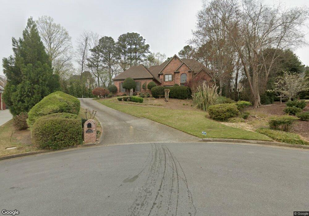
680 Turbridge Ct Unit 1 Alpharetta, GA 30022
Estimated Value: $1,156,532 - $1,237,000
6
Beds
5
Baths
4,354
Sq Ft
$275/Sq Ft
Est. Value
About This Home
This home is located at 680 Turbridge Ct Unit 1, Alpharetta, GA 30022 and is currently estimated at $1,195,883, approximately $274 per square foot. 680 Turbridge Ct Unit 1 is a home located in Fulton County with nearby schools including Dolvin Elementary School, Autrey Mill Middle School, and Johns Creek High School.
Ownership History
Date
Name
Owned For
Owner Type
Purchase Details
Closed on
Nov 28, 2005
Sold by
Kiser Thomas W
Bought by
Kiser Thomas W and Kiser Valerie E
Current Estimated Value
Home Financials for this Owner
Home Financials are based on the most recent Mortgage that was taken out on this home.
Original Mortgage
$407,000
Outstanding Balance
$223,002
Interest Rate
6.04%
Mortgage Type
New Conventional
Estimated Equity
$972,881
Purchase Details
Closed on
Nov 18, 2005
Sold by
Cendant Mobilty Financial Corp
Bought by
Wiser Thomas W
Home Financials for this Owner
Home Financials are based on the most recent Mortgage that was taken out on this home.
Original Mortgage
$407,000
Outstanding Balance
$223,002
Interest Rate
6.04%
Mortgage Type
New Conventional
Estimated Equity
$972,881
Purchase Details
Closed on
Jan 3, 1997
Sold by
Flach Kenneth E Sandra L
Bought by
Kelly Raymond T
Create a Home Valuation Report for This Property
The Home Valuation Report is an in-depth analysis detailing your home's value as well as a comparison with similar homes in the area
Home Values in the Area
Average Home Value in this Area
Purchase History
| Date | Buyer | Sale Price | Title Company |
|---|---|---|---|
| Kiser Thomas W | -- | -- | |
| Cendant Mobility Financial | $635,000 | -- | |
| Wiser Thomas W | $635,000 | -- | |
| Kelly Raymond T | $463,000 | -- |
Source: Public Records
Mortgage History
| Date | Status | Borrower | Loan Amount |
|---|---|---|---|
| Open | Wiser Thomas W | $407,000 | |
| Closed | Kelly Raymond T | $0 |
Source: Public Records
Tax History Compared to Growth
Tax History
| Year | Tax Paid | Tax Assessment Tax Assessment Total Assessment is a certain percentage of the fair market value that is determined by local assessors to be the total taxable value of land and additions on the property. | Land | Improvement |
|---|---|---|---|---|
| 2025 | $9,027 | $469,720 | $141,160 | $328,560 |
| 2023 | $11,996 | $425,000 | $91,040 | $333,960 |
| 2022 | $8,663 | $340,040 | $60,760 | $279,280 |
| 2021 | $8,605 | $302,720 | $68,080 | $234,640 |
| 2020 | $8,681 | $302,320 | $67,200 | $235,120 |
| 2019 | $1,035 | $296,920 | $66,000 | $230,920 |
| 2018 | $8,896 | $289,960 | $64,440 | $225,520 |
| 2017 | $8,528 | $262,720 | $58,040 | $204,680 |
| 2016 | $8,397 | $262,720 | $58,040 | $204,680 |
| 2015 | $7,152 | $262,720 | $58,040 | $204,680 |
| 2014 | $8,795 | $262,720 | $58,040 | $204,680 |
Source: Public Records
Map
Nearby Homes
- 10325 Oxford Mill Cir Unit 1
- 10405 Meadow Crest Ln
- 10415 Plantation Bridge Dr
- 10515 Colony Glen Dr Unit 2
- 115 Willow View Point
- 170 Autry Trail
- 350 Waters Bend Way
- 710 Country Manor Way
- 125 Thome Dr
- 120 Thome Dr
- 10090 Jones Bridge Rd Unit 8
- 100 Nature Mill Ct Unit 8
- 10050 Lauren Hall Ct
- 513 Camden Hall Dr
- 3815 Falls Landing Dr
- 750 Gates Ln
- 415 Wood Trace Ct
- 285 Rolling Mist Ct
- 10750 Avian Dr
- 235 Wood Shoals Ct
- 685 Turbridge Ct
- 10450 Oxford Mill Cir
- 670 Turbridge Ct Unit I
- 10400 Oxford Mill Cir
- 10440 Oxford Mill Cir Unit 3
- 10410 Oxford Mill Cir Unit 2
- 10460 Oxford Mill Cir
- 10390 Oxford Mill Cir Unit 2
- 675 Turbridge Ct
- 10430 Oxford Mill Cir
- 10420 Oxford Mill Cir
- 10470 Oxford Mill Cir Unit IV
- 660 Turbridge Ct
- 665 Turbridge Ct
- 10380 Oxford Mill Cir Unit 2
- 105 Keswick Way
- 100 Buttermere Ct
- 10395 Oxford Mill Cir Unit 2
- 530 Dunnally Ct
- 10455 Oxford Mill Cir Unit 3