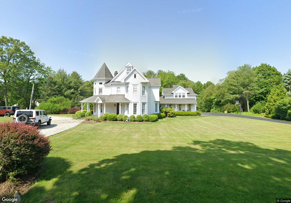
680 Warner Hill Rd Southport, CT 06890
Estimated Value: $2,080,627 - $2,427,000
4
Beds
5
Baths
4,070
Sq Ft
$554/Sq Ft
Est. Value
About This Home
This home is located at 680 Warner Hill Rd, Southport, CT 06890 and is currently estimated at $2,255,157, approximately $554 per square foot. 680 Warner Hill Rd is a home located in Fairfield County with nearby schools including Mill Hill School, Roger Ludlowe Middle School, and Fairfield Ludlowe High School.
Ownership History
Date
Name
Owned For
Owner Type
Purchase Details
Closed on
Jul 10, 1996
Sold by
Spector Mildred M Est
Bought by
Connelly J Christopher and Connelly Mary E
Current Estimated Value
Create a Home Valuation Report for This Property
The Home Valuation Report is an in-depth analysis detailing your home's value as well as a comparison with similar homes in the area
Home Values in the Area
Average Home Value in this Area
Purchase History
| Date | Buyer | Sale Price | Title Company |
|---|---|---|---|
| Connelly J Christopher | $155,000 | -- | |
| Connelly Christopher | $155,000 | -- | |
| Connelly Christopher | $155,000 | -- |
Source: Public Records
Mortgage History
| Date | Status | Borrower | Loan Amount |
|---|---|---|---|
| Open | Connelly Christopher | $275,000 | |
| Closed | Connelly Christopher | $155,000 | |
| Closed | Connelly Christopher | $100,000 |
Source: Public Records
Tax History Compared to Growth
Tax History
| Year | Tax Paid | Tax Assessment Tax Assessment Total Assessment is a certain percentage of the fair market value that is determined by local assessors to be the total taxable value of land and additions on the property. | Land | Improvement |
|---|---|---|---|---|
| 2025 | $24,092 | $848,610 | $410,900 | $437,710 |
| 2024 | $23,676 | $848,610 | $410,900 | $437,710 |
| 2023 | $23,345 | $848,610 | $410,900 | $437,710 |
| 2022 | $23,116 | $848,610 | $410,900 | $437,710 |
| 2021 | $22,895 | $848,610 | $410,900 | $437,710 |
| 2020 | $25,898 | $966,700 | $406,630 | $560,070 |
| 2019 | $25,898 | $966,700 | $406,630 | $560,070 |
| 2018 | $25,482 | $966,700 | $406,630 | $560,070 |
| 2017 | $24,960 | $966,700 | $406,630 | $560,070 |
| 2016 | $24,603 | $966,700 | $406,630 | $560,070 |
| 2015 | $25,233 | $1,017,870 | $430,290 | $587,580 |
| 2014 | $24,836 | $1,017,870 | $430,290 | $587,580 |
Source: Public Records
Map
Nearby Homes
- 476 Mill Hill Terrace
- 844 Mill Hill Terrace
- 647 Bronson Rd
- 232 Pell Meadow Dr
- 153 Pease Ave
- 28 Mill Hill Rd Unit 28
- 688 Hulls Farm Rd
- 254 Sherwood Farm Rd
- 1213 Cedar Rd
- 2 Elmwood Dr Unit 2
- 1001 Hulls Farm Rd
- 88 Overhill Rd
- 100 Overhill Rd
- 360 Duck Farm Rd
- 105 Charter Oak Rd
- 21 Beaumont St
- 2683 Bronson Rd
- 56 Drake Ln
- 44 Deer Run Rd
- 209 S Pine Creek Rd
- 630 Warner Hill Rd
- 907 Mill Hill Rd
- 1022 Mill Hill Rd
- 655 Warner Hill Rd
- 600 Warner Hill Rd
- 1060 Mill Hill Rd
- 975 Mill Hill Rd
- 1005 Mill Hill Rd
- 621 Warner Hill Rd
- 875 Mill Hill Rd
- 906 Mill Hill Rd
- 1116 Mill Hill Rd
- 1158 Mill Hill Rd
- 932 Mill Hill Rd
- 932 Mill Hill Rd
- 585 Warner Hill Rd
- 880 Mill Hill Rd
- 849 Mill Hill Rd
- 25 Waterville Rd
- 1101 Mill Hill Rd