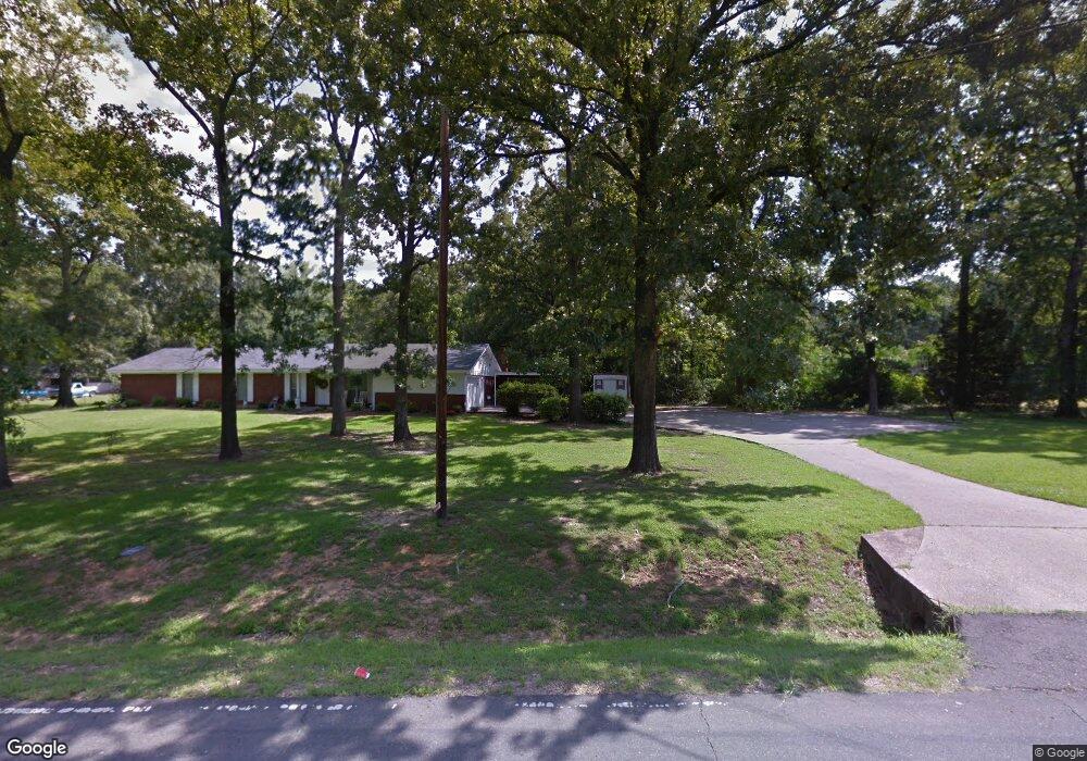
6800 Airport Rd Bastrop, LA 71220
Estimated Value: $148,000 - $204,000
3
Beds
3
Baths
2,535
Sq Ft
$71/Sq Ft
Est. Value
About This Home
This home is located at 6800 Airport Rd, Bastrop, LA 71220 and is currently estimated at $179,946, approximately $70 per square foot. 6800 Airport Rd is a home located in Morehouse Parish with nearby schools including Morehouse Junior High School, Oak Hill Elementary School, and Bastrop High School.
Ownership History
Date
Name
Owned For
Owner Type
Purchase Details
Closed on
Jul 11, 2011
Sold by
Sisson Betty Rodgers
Bought by
Mitchell Michael Jerome
Current Estimated Value
Home Financials for this Owner
Home Financials are based on the most recent Mortgage that was taken out on this home.
Original Mortgage
$140,600
Outstanding Balance
$96,774
Interest Rate
4.52%
Mortgage Type
Stand Alone First
Estimated Equity
$83,172
Purchase Details
Closed on
Apr 15, 2011
Sold by
Soper Jennifer Ann Sisson and Sisson Michelle Lynn
Bought by
Sisson Betty
Create a Home Valuation Report for This Property
The Home Valuation Report is an in-depth analysis detailing your home's value as well as a comparison with similar homes in the area
Home Values in the Area
Average Home Value in this Area
Purchase History
| Date | Buyer | Sale Price | Title Company |
|---|---|---|---|
| Mitchell Michael Jerome | $134,300 | -- | |
| Sisson Betty | -- | -- |
Source: Public Records
Mortgage History
| Date | Status | Borrower | Loan Amount |
|---|---|---|---|
| Open | Sisson Betty | $140,600 |
Source: Public Records
Tax History Compared to Growth
Tax History
| Year | Tax Paid | Tax Assessment Tax Assessment Total Assessment is a certain percentage of the fair market value that is determined by local assessors to be the total taxable value of land and additions on the property. | Land | Improvement |
|---|---|---|---|---|
| 2024 | $1,280 | $12,938 | $1,367 | $11,571 |
| 2023 | $1,284 | $12,932 | $500 | $12,432 |
| 2022 | $1,284 | $12,932 | $500 | $12,432 |
| 2021 | $1,284 | $12,932 | $500 | $12,432 |
| 2020 | $1,264 | $12,900 | $500 | $12,400 |
| 2019 | $1,235 | $12,850 | $500 | $12,350 |
| 2018 | $1,234 | $12,900 | $500 | $12,400 |
| 2017 | $1,234 | $12,850 | $500 | $12,350 |
| 2016 | $1,233 | $12,900 | $500 | $12,400 |
| 2015 | $1,172 | $12,900 | $500 | $12,400 |
| 2013 | $1,214 | $12,900 | $500 | $12,400 |
Source: Public Records
Map
Nearby Homes
- 606 Elmhurst Dr
- 9316 Pridgeon St
- 1400 E Pecan Ave
- 9290 Marlatt St
- 407 Tulane St
- 403 Cleveland St
- 6349 Estates Dr
- Lot 7 Us Highway 425 S Unit Robinson Acres Subd
- 413 Elm St
- TBD Us Highway 425 S
- 1403 Alabama Ave
- 204 S Cox St
- 8888 Blackwell Dr
- 110 Fairview Dr
- 120 Fairview Dr
- 124 Eastwood Dr
- 644 E Jefferson Ave
- 10112 Boswell St
- 211 N Odom St
- 1905 Cooper Lake Rd
- 6820 Airport Rd
- 6782 Airport Rd
- 6830 Airport Rd
- 706 Hollyhurst Extension
- 6809 Airport Rd
- 6821 Airport Rd
- 6770 Airport Rd
- 704 Hollyhurst Extension
- 6854 Airport Rd
- 6785 Airport Rd
- 1407 Jenny St
- 710 Oakhurst Dr
- 1101 Bryant St
- 708 Hollyhurst Extension
- 6750 Airport Rd
- 1412 Jenny St
- 1405 Jenny St
- 1408 Jenny St
- 1410 Jenny St
- 6753 Airport Rd