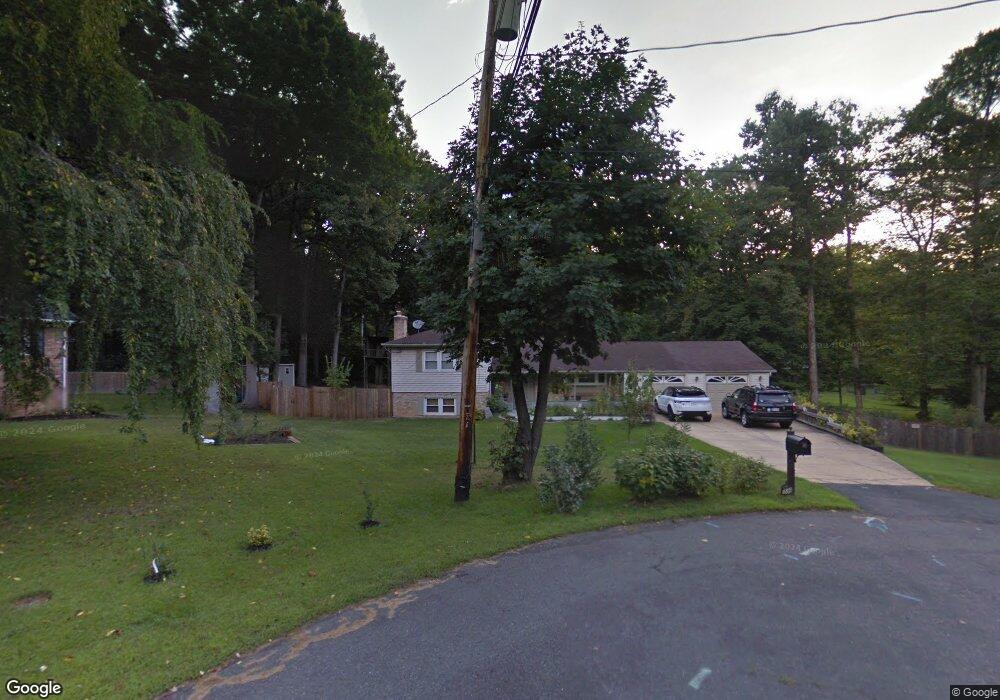
6800 Algonquin Ct Annandale, VA 22003
Estimated Value: $834,000 - $933,000
4
Beds
3
Baths
1,520
Sq Ft
$580/Sq Ft
Est. Value
About This Home
This home is located at 6800 Algonquin Ct, Annandale, VA 22003 and is currently estimated at $880,842, approximately $579 per square foot. 6800 Algonquin Ct is a home located in Fairfax County with nearby schools including Columbia Elementary School, Poe Middle School, and Annandale High School.
Ownership History
Date
Name
Owned For
Owner Type
Purchase Details
Closed on
Sep 13, 2017
Sold by
Cottrill Matthew and Zuniga Rosalie
Bought by
Cottrill Matthew and Zuniga Rosalie
Current Estimated Value
Purchase Details
Closed on
Jun 20, 2002
Sold by
Hart Irene
Bought by
Geerdes Gregg
Home Financials for this Owner
Home Financials are based on the most recent Mortgage that was taken out on this home.
Original Mortgage
$300,700
Interest Rate
6.81%
Mortgage Type
New Conventional
Create a Home Valuation Report for This Property
The Home Valuation Report is an in-depth analysis detailing your home's value as well as a comparison with similar homes in the area
Home Values in the Area
Average Home Value in this Area
Purchase History
| Date | Buyer | Sale Price | Title Company |
|---|---|---|---|
| Cottrill Matthew | -- | None Available | |
| Cottrill Matthew | -- | None Available | |
| Geerdes Gregg | $415,500 | -- |
Source: Public Records
Mortgage History
| Date | Status | Borrower | Loan Amount |
|---|---|---|---|
| Previous Owner | Geerdes Gregg | $300,700 |
Source: Public Records
Tax History Compared to Growth
Tax History
| Year | Tax Paid | Tax Assessment Tax Assessment Total Assessment is a certain percentage of the fair market value that is determined by local assessors to be the total taxable value of land and additions on the property. | Land | Improvement |
|---|---|---|---|---|
| 2025 | $10,015 | $863,280 | $330,000 | $533,280 |
| 2024 | $10,015 | $803,390 | $305,000 | $498,390 |
| 2023 | $9,710 | $808,420 | $305,000 | $503,420 |
| 2022 | $9,816 | $808,420 | $305,000 | $503,420 |
| 2021 | $8,939 | $720,300 | $275,000 | $445,300 |
| 2020 | $8,014 | $639,370 | $262,000 | $377,370 |
| 2019 | $7,897 | $628,380 | $262,000 | $366,380 |
| 2018 | $7,104 | $617,710 | $262,000 | $355,710 |
| 2017 | $7,339 | $595,710 | $240,000 | $355,710 |
| 2016 | $7,336 | $595,710 | $240,000 | $355,710 |
| 2015 | $6,965 | $585,350 | $240,000 | $345,350 |
| 2014 | $6,540 | $548,950 | $235,000 | $313,950 |
Source: Public Records
Map
Nearby Homes
- 5025 Kingston Dr
- 5024 Kingston Dr
- 5104 Birch Ln
- 4906 Van Walbeek Place
- 4903 Van Walbeek Place
- 4837 Randolph Dr
- 6640 Cardinal Ln
- 6623 Locust Way
- 5213 Montgomery St
- 4783 Kandel Ct
- 6615 Locust Way
- 4548 Conwell Dr
- 4536 Conwell Dr
- 4551 Logsdon Dr
- 5215 Gilpin Dr
- 4609 Willow Run Dr
- 5227 Cather Rd
- 7039 Leestone St
- 4530 Airlie Way
- 5112 Clinton Rd
- 6802 Algonquin Ct
- 4912 Montgomery St
- 4908 Montgomery St
- 6801 Algonquin Ct
- 6817 Silver Ln
- 6803 Algonquin Ct
- 4913 Dodson Dr
- 4916 Montgomery St
- 4909 Dodson Dr
- 4904 Montgomery St
- 5001 Dodson Dr
- 6821 Silver Ln
- 5005 Dodson Dr
- 5007 Dodson Dr
- 5000 Montgomery St
- 4905 Dodson Dr
- 4900 Montgomery St
- 6818 Silver Ln
- 4913 Montgomery St
- 5009 Dodson Dr