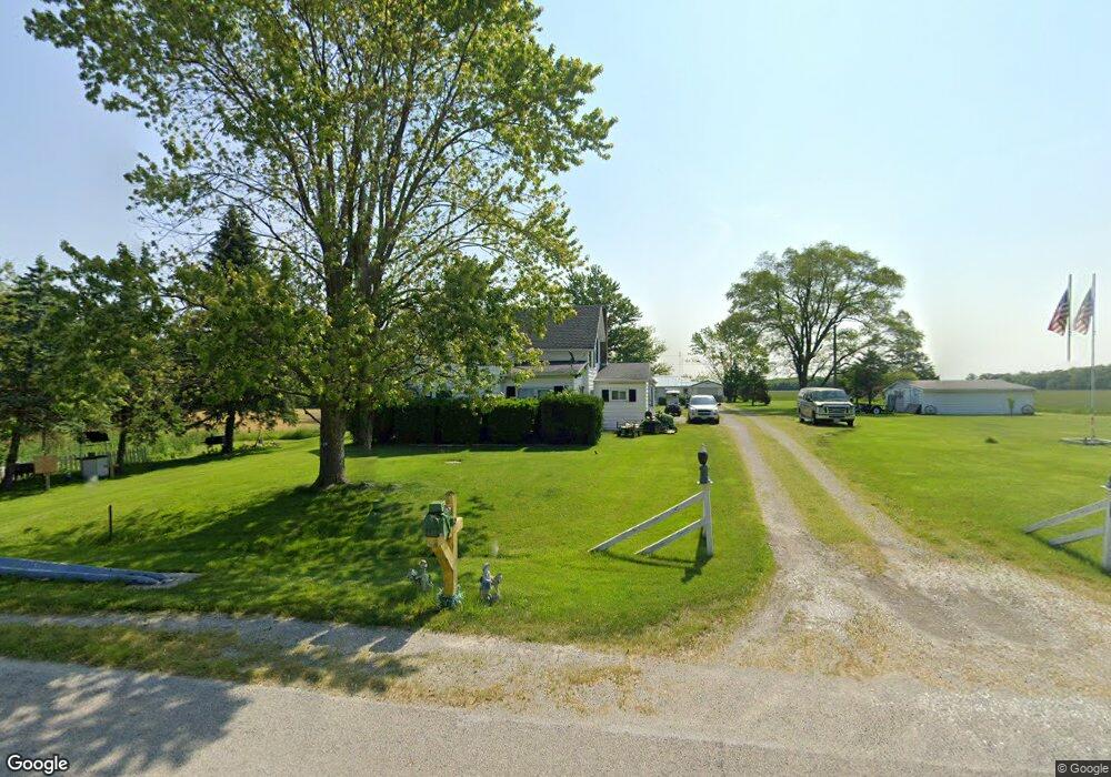
6800 Road 123 Paulding, OH 45879
Estimated Value: $114,000 - $146,000
4
Beds
1
Bath
1,244
Sq Ft
$104/Sq Ft
Est. Value
About This Home
This home is located at 6800 Road 123, Paulding, OH 45879 and is currently estimated at $129,786, approximately $104 per square foot. 6800 Road 123 is a home with nearby schools including Wayne Trace High School.
Ownership History
Date
Name
Owned For
Owner Type
Purchase Details
Closed on
May 18, 2016
Sold by
Pease Eddette Sue
Bought by
Thornell Larry H and Thornell Cathalene A
Current Estimated Value
Purchase Details
Closed on
May 27, 2015
Sold by
Rodman Dorothy K and Rodman Dorothy Kathleen
Bought by
Pease Eddette Sue and Rodman Dorothy K
Purchase Details
Closed on
Mar 11, 2010
Sold by
Rodman Dorothy K and Dorothy K Rodman Family Trust
Bought by
Rodman Dorothy K
Purchase Details
Closed on
Sep 21, 1998
Sold by
Rodman Dorothy K
Bought by
Pease Eddette Sue
Purchase Details
Closed on
Jul 8, 1998
Sold by
Rodman Dorothy K
Bought by
Pease Eddette Sue
Purchase Details
Closed on
Mar 2, 1998
Sold by
Rodman Edwin L
Bought by
Pease Eddette Sue
Create a Home Valuation Report for This Property
The Home Valuation Report is an in-depth analysis detailing your home's value as well as a comparison with similar homes in the area
Home Values in the Area
Average Home Value in this Area
Purchase History
| Date | Buyer | Sale Price | Title Company |
|---|---|---|---|
| Thornell Larry H | $50,000 | None Available | |
| Pease Eddette Sue | -- | None Available | |
| Rodman Dorothy K | -- | None Available | |
| Pease Eddette Sue | -- | -- | |
| Pease Eddette Sue | -- | -- | |
| Pease Eddette Sue | -- | -- |
Source: Public Records
Tax History Compared to Growth
Tax History
| Year | Tax Paid | Tax Assessment Tax Assessment Total Assessment is a certain percentage of the fair market value that is determined by local assessors to be the total taxable value of land and additions on the property. | Land | Improvement |
|---|---|---|---|---|
| 2024 | $983 | $30,560 | $7,910 | $22,650 |
| 2023 | $983 | $30,560 | $7,910 | $22,650 |
| 2022 | $1,012 | $30,560 | $7,910 | $22,650 |
| 2021 | $916 | $24,680 | $7,700 | $16,980 |
| 2020 | $947 | $24,680 | $7,700 | $16,980 |
| 2019 | $952 | $22,470 | $7,700 | $14,770 |
| 2018 | $467 | $22,470 | $7,700 | $14,770 |
| 2017 | $780 | $22,470 | $7,700 | $14,770 |
| 2016 | $552 | $22,190 | $7,420 | $14,770 |
| 2015 | $652 | $36,510 | $22,260 | $14,250 |
| 2014 | $661 | $36,510 | $22,260 | $14,250 |
| 2013 | -- | $34,660 | $20,410 | $14,250 |
Source: Public Records
Map
Nearby Homes
- 0 Road 72
- 225 2nd St
- 14255 Road 126
- 18251 Road 48
- 12919 State Route 114
- 201 N Main St
- 301 E Wayne St
- 300 S Williams St
- 100 N Maple St
- 301 N Main St
- 714 W Wayne St
- 720 W Wayne St
- 717 W Harrison St
- 720 W Perry St
- 120 S Grant St
- 516 N Williams St
- 215 N Dewitt St
- 741 Tom Tim Dr
- 726 N Main St
- Tract 2 - 0000 Ohio 111
- 6802 Road 123
- 6914 Road 123
- 6671 Road 123
- 15012 Road 82
- 6505 Road 123
- 15237 Road 82
- 6502 Road 123
- 7128 Co Rd 123
- 7128 Road 123
- 14547 Road 82
- 14374 Road 82
- 6098 Road 123
- 6098 R D 123
- 7509 Broughton Pike
- 7561 Broughton Pike
- 7506 Broughton Pike
- 6015 Road 123
- 7591 Broughton Pike
- 7591 Broughton Pike
- 0 Broughton Pike