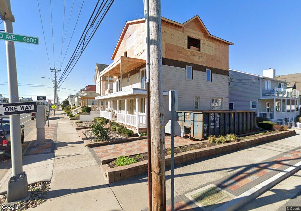
6801 Atlantic Ave Ventnor City, NJ 08406
Estimated Value: $900,000 - $2,010,000
--
Bed
--
Bath
2,220
Sq Ft
$629/Sq Ft
Est. Value
About This Home
This home is located at 6801 Atlantic Ave, Ventnor City, NJ 08406 and is currently estimated at $1,397,382, approximately $629 per square foot. 6801 Atlantic Ave is a home located in Atlantic County with nearby schools including Ventnor Elementary School, Ventnor Middle School, and St. James Elementary School.
Ownership History
Date
Name
Owned For
Owner Type
Purchase Details
Closed on
Mar 12, 2020
Sold by
Port Tamar J and Estate Of Ilda V Ficher
Bought by
Port Joel Alan and Port Tamar J
Current Estimated Value
Purchase Details
Closed on
Sep 30, 1999
Sold by
Ficher Miguel
Bought by
Ficher Miguel and Ficher Ilda
Purchase Details
Closed on
Jun 21, 1996
Sold by
Ficher Miguel and Ficher Ilda
Bought by
Ficher Miguel
Create a Home Valuation Report for This Property
The Home Valuation Report is an in-depth analysis detailing your home's value as well as a comparison with similar homes in the area
Home Values in the Area
Average Home Value in this Area
Purchase History
| Date | Buyer | Sale Price | Title Company |
|---|---|---|---|
| Port Joel Alan | $320,000 | First Platinum Abstract Llc | |
| Ficher Miguel | -- | -- | |
| Ficher Miguel | -- | The Title Company |
Source: Public Records
Tax History Compared to Growth
Tax History
| Year | Tax Paid | Tax Assessment Tax Assessment Total Assessment is a certain percentage of the fair market value that is determined by local assessors to be the total taxable value of land and additions on the property. | Land | Improvement |
|---|---|---|---|---|
| 2025 | $17,551 | $642,200 | $272,300 | $369,900 |
| 2024 | $17,551 | $642,200 | $272,300 | $369,900 |
| 2023 | $12,142 | $472,100 | $272,300 | $199,800 |
| 2022 | $12,142 | $472,100 | $272,300 | $199,800 |
| 2021 | $12,218 | $472,100 | $272,300 | $199,800 |
| 2020 | $12,232 | $472,100 | $272,300 | $199,800 |
| 2019 | $12,204 | $472,100 | $272,300 | $199,800 |
| 2018 | $12,435 | $472,100 | $272,300 | $199,800 |
| 2017 | $12,501 | $472,100 | $272,300 | $199,800 |
| 2016 | $12,900 | $590,100 | $434,300 | $155,800 |
| 2015 | $12,782 | $590,100 | $434,300 | $155,800 |
| 2014 | $12,150 | $590,100 | $434,300 | $155,800 |
Source: Public Records
Map
Nearby Homes
- 1 S Wissahickon Ave
- 4 S Newark Ave
- 2 S Newark Ave
- 6709 Atlantic Ave
- 101 S Buffalo Ave
- 2 B N Buffalo Ave
- 2 A N Buffalo Ave
- 3 N Wissahickon Ave
- 2 N Newark Ave
- 18 N Buffalo Ave
- 18 N Buffalo #B Ave
- 26 N Richards Ave
- 102 N Richards Ave
- 5 N New Haven Unit Ave Unit C3A
- 113 N Richards Ave
- 118 N Rosborough Ave Unit 2
- 110 S Swarthmore Ave
- 6703 Monmouth Ave
- 126 N New Haven Ave
- 132 N Lafayette Ave
- 30 S Buffalo Ave
- 6803 Atlantic Ave
- 6721 Atlantic Ave
- 28 S Buffalo Ave
- 6719 Atlantic Ave
- 6717 Atlantic Ave
- 6717 Atlantic Ave
- 25 S Buffalo Ave
- 6717 Atlantic Ave
- 6723 Atlantic Ave
- 6800 Atlantic Ave
- 26 S Buffalo Ave
- 6715 Atlantic Ave
- 6809 Atlantic Ave
- 6802 Atlantic Ave
- 6713 Atlantic Ave
- 23 S Buffalo Ave
- 32 S Richards Ave Unit 1
- 32 S Richards Ave Unit B