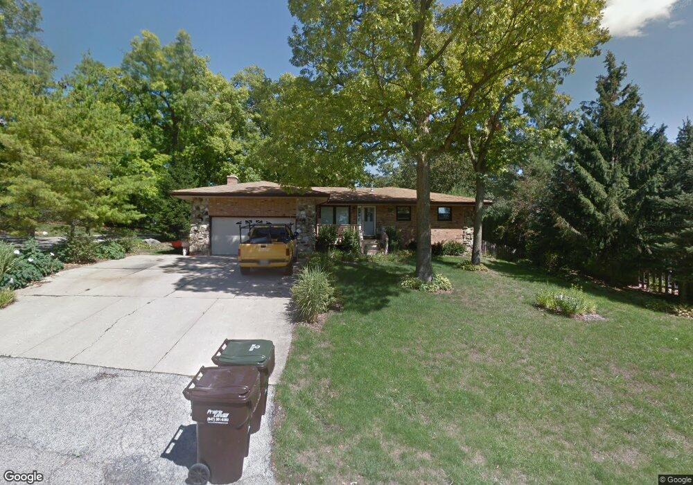
6802 Normandy Dr Spring Grove, IL 60081
Northwest Fox Lake NeighborhoodEstimated Value: $243,755 - $335,000
--
Bed
--
Bath
1,432
Sq Ft
$201/Sq Ft
Est. Value
About This Home
This home is located at 6802 Normandy Dr, Spring Grove, IL 60081 and is currently estimated at $287,939, approximately $201 per square foot. 6802 Normandy Dr is a home located in McHenry County with nearby schools including Spring Grove Elementary School, Nippersink Middle School, and Richmond-Burton High School.
Ownership History
Date
Name
Owned For
Owner Type
Purchase Details
Closed on
May 12, 2000
Sold by
Lingle Glenn and Lingle Debora
Bought by
First Midwest Trust Company Natl Assn and Trust #6559
Current Estimated Value
Purchase Details
Closed on
Jan 6, 1998
Sold by
Cooper Richard L
Bought by
Lingle Glenn and Lingle Debora
Home Financials for this Owner
Home Financials are based on the most recent Mortgage that was taken out on this home.
Original Mortgage
$115,000
Interest Rate
7.26%
Mortgage Type
Purchase Money Mortgage
Create a Home Valuation Report for This Property
The Home Valuation Report is an in-depth analysis detailing your home's value as well as a comparison with similar homes in the area
Home Values in the Area
Average Home Value in this Area
Purchase History
| Date | Buyer | Sale Price | Title Company |
|---|---|---|---|
| First Midwest Trust Company Natl Assn | -- | -- | |
| Lingle Glenn | $150,000 | Blackhawk Title Services |
Source: Public Records
Mortgage History
| Date | Status | Borrower | Loan Amount |
|---|---|---|---|
| Previous Owner | Lingle Glenn | $115,000 |
Source: Public Records
Tax History
| Year | Tax Paid | Tax Assessment Tax Assessment Total Assessment is a certain percentage of the fair market value that is determined by local assessors to be the total taxable value of land and additions on the property. | Land | Improvement |
|---|---|---|---|---|
| 2024 | $2,870 | $79,307 | $10,534 | $68,773 |
| 2023 | $3,074 | $73,967 | $9,825 | $64,142 |
| 2022 | $3,668 | $65,066 | $8,643 | $56,423 |
| 2021 | $3,710 | $61,337 | $8,148 | $53,189 |
| 2020 | $3,806 | $58,634 | $7,789 | $50,845 |
| 2019 | $3,899 | $57,722 | $7,668 | $50,054 |
| 2018 | $4,578 | $55,938 | $7,431 | $48,507 |
| 2017 | $4,503 | $52,529 | $6,978 | $45,551 |
| 2016 | $4,513 | $50,166 | $6,664 | $43,502 |
| 2013 | -- | $57,549 | $8,240 | $49,309 |
Source: Public Records
Map
Nearby Homes
- 47 Nassau Colony Unit 1
- 55 Vail Colony Unit 6
- 49 Oak Hill Colony Unit 12
- 11 Saint Thomas Colony Unit 7
- 35 Montego Colony Unit 7
- 63 Aspen Colony Unit 8
- 40 Bermuda Colony Unit 7
- 16 Saint Thomas Colony Unit 6
- 23 Jamaica Colony Unit 5
- 6415 N Shore Ave
- 38265 N State Park Rd
- 7503 Windsor Ave
- 6421 Cherrywood Ct Unit 232
- 530 Main Street Rd
- 535 Deer Run
- 28624 W Kendall Ave
- 7202 Oxford Cir Unit 237
- 7411 Leisure Village Ave Unit 198
- 7105 Saint Tropez Ct Unit 297
- 7302 Chevy Chase Ct Unit 51
- 6808 Normandy Dr
- 211 Timber Ln
- 218 Coventry Ave
- 220 Timber Ln
- 212 Coventry Ave
- 209 Timber Ln
- 6817 Normandy Dr
- 212 Timber Ln
- 208 Coventry Ave
- 6735 Normandy Dr
- 215 Baron Dr
- 6904 Normandy Dr
- 211 Baron Dr
- 219 Coventry Ave
- 206 Coventry Ave
- 217 Coventry Ave
- 6719 Normandy Dr
- 7835 Normandy Dr
- 6813 Chillems Dr
- 207 Baron Dr
Your Personal Tour Guide
Ask me questions while you tour the home.