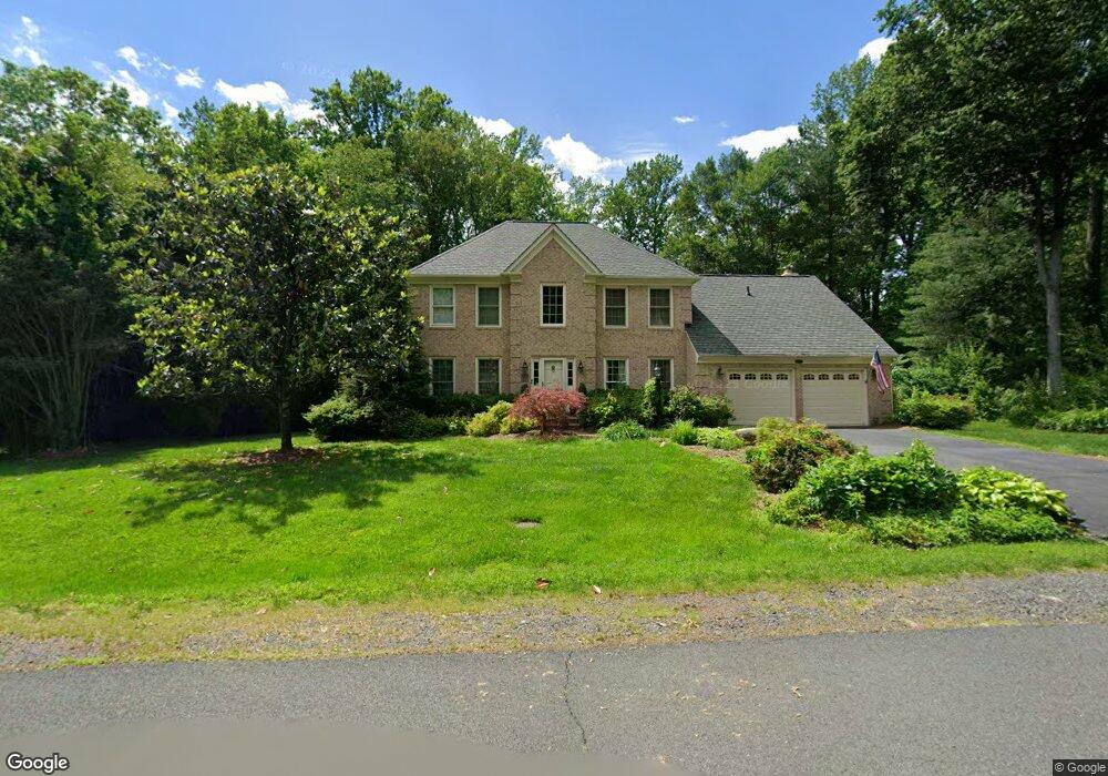
6802 Spout Ln Fairfax Station, VA 22039
Estimated Value: $1,251,000 - $1,359,000
4
Beds
4
Baths
3,688
Sq Ft
$349/Sq Ft
Est. Value
About This Home
This home is located at 6802 Spout Ln, Fairfax Station, VA 22039 and is currently estimated at $1,285,874, approximately $348 per square foot. 6802 Spout Ln is a home located in Fairfax County with nearby schools including Fairview Elementary School, James W Robinson, Jr. Secondary School, and Fairfax Baptist Temple Academy.
Ownership History
Date
Name
Owned For
Owner Type
Purchase Details
Closed on
Apr 30, 1997
Sold by
Shyne John W and Mcshyne Connie Mc
Bought by
Toenshoff Donald A and Toenshoff Victori M
Current Estimated Value
Home Financials for this Owner
Home Financials are based on the most recent Mortgage that was taken out on this home.
Original Mortgage
$290,400
Outstanding Balance
$39,259
Interest Rate
7.85%
Mortgage Type
New Conventional
Estimated Equity
$1,246,615
Create a Home Valuation Report for This Property
The Home Valuation Report is an in-depth analysis detailing your home's value as well as a comparison with similar homes in the area
Home Values in the Area
Average Home Value in this Area
Purchase History
| Date | Buyer | Sale Price | Title Company |
|---|---|---|---|
| Toenshoff Donald A | $363,000 | -- |
Source: Public Records
Mortgage History
| Date | Status | Borrower | Loan Amount |
|---|---|---|---|
| Open | Toenshoff Donald A | $290,400 |
Source: Public Records
Tax History Compared to Growth
Tax History
| Year | Tax Paid | Tax Assessment Tax Assessment Total Assessment is a certain percentage of the fair market value that is determined by local assessors to be the total taxable value of land and additions on the property. | Land | Improvement |
|---|---|---|---|---|
| 2025 | $12,343 | $1,179,770 | $356,000 | $823,770 |
| 2024 | $12,343 | $1,065,440 | $356,000 | $709,440 |
| 2023 | $11,678 | $1,034,810 | $356,000 | $678,810 |
| 2022 | $10,944 | $957,090 | $326,000 | $631,090 |
| 2021 | $9,956 | $848,420 | $306,000 | $542,420 |
| 2020 | $9,557 | $807,540 | $306,000 | $501,540 |
| 2019 | $9,267 | $783,000 | $296,000 | $487,000 |
| 2018 | $8,724 | $758,650 | $286,000 | $472,650 |
| 2017 | $9,295 | $800,560 | $286,000 | $514,560 |
| 2016 | $8,983 | $775,380 | $281,000 | $494,380 |
| 2015 | $8,246 | $738,930 | $276,000 | $462,930 |
| 2014 | $7,973 | $716,040 | $261,000 | $455,040 |
Source: Public Records
Map
Nearby Homes
- 6805 Old Stone Fence Rd
- 11017 Highridge St
- 6606 Okeefe Knoll Ct
- 6536 Little ox Rd
- 10621 Beechnut Ct
- 6408 Jumet Ct
- 11203 Silverleaf Dr
- 11322 Long Manor Dr
- 10510 Henderson Rd
- 7211 Twelve Oaks Dr
- 10625 Battalion Landing Ct
- 10304 Mockingbird Pond Ct
- 7808 Hill House Ct
- 11498 Quailwood Manor Dr
- 6115 Martins Landing Ct
- 10256 Quiet Pond Terrace
- 10205 Quiet Pond Terrace
- 10411 Todman Landing Ct
- 6108 Pond Lily Ct
- 10731 Bear Oak Ct
- 6800 Spout Ln
- 6803 Spout Ln
- 6807 Spout Ln
- 6842 Brimstone Ln
- 6810 Spout Ln
- 6839 Brimstone Ln
- 6809 Spout Ln
- 6841 Brimstone Ln
- 6906 Brimstone Ln
- 6830 Brimstone Ln
- 6837 Brimstone Ln
- 6908 Brimstone Ln
- 10802 Cogswell Place
- 6901 Brimstone Ln
- 6828 Brimstone Ln
- 6903 Brimstone Ln
- 6910 Brimstone Ln
- 10803 Cogswell Place
- 6905 Brimstone Ln