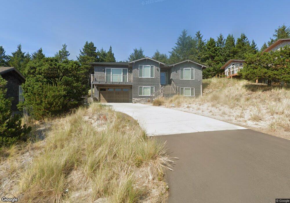
6805 Nestucca Ridge Rd Pacific City, OR 97135
Estimated Value: $1,061,000 - $1,438,000
4
Beds
3
Baths
1,926
Sq Ft
$625/Sq Ft
Est. Value
About This Home
This home is located at 6805 Nestucca Ridge Rd, Pacific City, OR 97135 and is currently estimated at $1,204,210, approximately $625 per square foot. 6805 Nestucca Ridge Rd is a home with nearby schools including Nestucca K-8 School and Nestucca High School.
Ownership History
Date
Name
Owned For
Owner Type
Purchase Details
Closed on
Dec 28, 2023
Sold by
Stratis Antonios Panagiotis and Stratis Anna Maria
Bought by
Stratis Family Trust and Stratis
Current Estimated Value
Purchase Details
Closed on
Dec 15, 2017
Sold by
Sayler Michelle L and Peterson Ronald S
Bought by
Stratis Antonios P and Stratis Anna M
Create a Home Valuation Report for This Property
The Home Valuation Report is an in-depth analysis detailing your home's value as well as a comparison with similar homes in the area
Home Values in the Area
Average Home Value in this Area
Purchase History
| Date | Buyer | Sale Price | Title Company |
|---|---|---|---|
| Stratis Family Trust | -- | None Listed On Document | |
| Stratis Antonios P | $125,000 | First American Title |
Source: Public Records
Tax History Compared to Growth
Tax History
| Year | Tax Paid | Tax Assessment Tax Assessment Total Assessment is a certain percentage of the fair market value that is determined by local assessors to be the total taxable value of land and additions on the property. | Land | Improvement |
|---|---|---|---|---|
| 2024 | $7,477 | $620,020 | $118,410 | $501,610 |
| 2023 | $7,426 | $601,970 | $114,960 | $487,010 |
| 2022 | $7,163 | $584,440 | $111,610 | $472,830 |
| 2021 | $6,993 | $567,420 | $108,360 | $459,060 |
| 2020 | $6,824 | $550,900 | $105,210 | $445,690 |
| 2019 | $910 | $81,920 | $81,920 | $0 |
| 2018 | $882 | $79,540 | $79,540 | $0 |
| 2017 | $803 | $77,230 | $77,230 | $0 |
| 2016 | $791 | $74,990 | $74,990 | $0 |
| 2015 | $773 | $72,810 | $72,810 | $0 |
| 2014 | $759 | $70,690 | $70,690 | $0 |
| 2013 | -- | $68,640 | $68,640 | $0 |
Source: Public Records
Map
Nearby Homes
- 5950 Neptune Dr
- 34320 Cape Kiwanda Dr
- 5904 Barefoot Ln
- 34475 Brooten Rd
- 5930 Summerhouse Ln
- 34270 Sea Swallow Dr
- 0 Dory Pointe Loop Unit TL8100 229390931
- 5685 Barefoot Ln
- 33520 Cape Kiwanda Dr
- 5706 Four Sisters Ln
- 6415 Dory Pointe Loop
- 33495 Cape Kiwanda Dr
- 33515 Madrona Dr
- TL8100 Dory Pointe Loop
- 6925 Parker St
- 6930 Parker St
- 34700 Hill St
- TL 2714 Tent St
- 34905 Cape Kiwanda Dr
- 6755 Nestucca Ridge Rd
- 6855 Nestucca Ridge Rd
- Lot 69 High Tide Dr
- 6800 Nestucca Ridge Rd
- 6750 Nestucca Ridge Rd
- 6935 Nestucca Ridge Rd
- 33750 High Tide Dr
- 33750 High Tide Dr
- 33705 High Tide Dr
- 6700 Nestucca Ridge Rd
- 6900 Nestucca Ridge Rd
- 6900 Nestucca Ridge Rd Unit 73
- 6900 Nestucca Ridge Rd
- 33690 High Tide Dr
- 6705 Nestucca Ridge Rd
- 0 High Tide Rd Unit 8016576
- 0 High Tide Rd Unit 65 11573781
- 0 High Tide Rd Unit 69
- 33830 Venture Blvd
- 33700 High Tide Dr