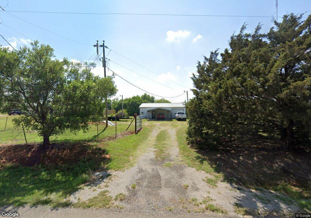
6805 S Tucker Rd Duncan, OK 73533
Estimated Value: $77,090 - $142,000
1
Bed
1
Bath
1,080
Sq Ft
$101/Sq Ft
Est. Value
About This Home
This home is located at 6805 S Tucker Rd, Duncan, OK 73533 and is currently estimated at $109,273, approximately $101 per square foot. 6805 S Tucker Rd is a home with nearby schools including Comanche Elementary School, Comanche Middle School, and Comanche High School.
Ownership History
Date
Name
Owned For
Owner Type
Purchase Details
Closed on
Feb 8, 2012
Sold by
Osaile Sammy and Osaile Samuel
Bought by
Lolar Krista Lynn
Current Estimated Value
Home Financials for this Owner
Home Financials are based on the most recent Mortgage that was taken out on this home.
Original Mortgage
$20,000
Interest Rate
3.95%
Mortgage Type
Unknown
Purchase Details
Closed on
Sep 16, 2008
Sold by
Mayes Ricky D and Mays Ricky D
Bought by
Osaile Sammy and Osaile Myra
Home Financials for this Owner
Home Financials are based on the most recent Mortgage that was taken out on this home.
Original Mortgage
$21,748
Interest Rate
6.52%
Mortgage Type
Purchase Money Mortgage
Purchase Details
Closed on
Jun 19, 1996
Sold by
Ellis Harry L
Create a Home Valuation Report for This Property
The Home Valuation Report is an in-depth analysis detailing your home's value as well as a comparison with similar homes in the area
Purchase History
| Date | Buyer | Sale Price | Title Company |
|---|---|---|---|
| Lolar Krista Lynn | $25,000 | None Available | |
| Osaile Sammy | $25,000 | None Available | |
| -- | $20,000 | -- |
Source: Public Records
Mortgage History
| Date | Status | Borrower | Loan Amount |
|---|---|---|---|
| Closed | Lolar Krista Lynn | $20,000 | |
| Previous Owner | Osaile Sammy | $21,748 |
Source: Public Records
Tax History
| Year | Tax Paid | Tax Assessment Tax Assessment Total Assessment is a certain percentage of the fair market value that is determined by local assessors to be the total taxable value of land and additions on the property. | Land | Improvement |
|---|---|---|---|---|
| 2025 | $393 | $4,507 | $246 | $4,261 |
| 2024 | $370 | $4,088 | $223 | $3,865 |
| 2023 | $370 | $4,088 | $225 | $3,863 |
| 2022 | $335 | $3,893 | $215 | $3,678 |
| 2021 | $342 | $3,708 | $198 | $3,510 |
| 2020 | $308 | $3,363 | $198 | $3,165 |
| 2019 | $308 | $3,203 | $338 | $2,865 |
| 2018 | $292 | $3,203 | $338 | $2,865 |
| 2017 | $243 | $3,050 | $338 | $2,712 |
| 2016 | $232 | $2,767 | $338 | $2,429 |
| 2015 | $151 | $2,767 | $338 | $2,429 |
| 2014 | $151 | $2,767 | $338 | $2,429 |
Source: Public Records
Map
Nearby Homes
- 0 E 1770 Rd
- 325 W Terry Rd
- 286348 Comanche Lake Ln
- ???? S 2nd St
- 177914 N 2770 Rd
- 0 S 2nd St
- 174629 N 2920 Rd
- 180163 Larue Dr
- 282096 Andrews Dr
- Tract A Millrun Addition
- NO ADDRESS N North Hwy 81 - East On Osage
- 276961 276961 E 1740 Rd
- 284769 E Osage Road (1690 Road)
- ???? ???? Ne Curtis Dr
- BLK 2 LOT 5 Trail Unit Dr
- Tract B Millrun Addition
- 276375 N 2813 Rd
- Blk 1 Lot 4a Trail Unit Dr
- 273164 273164 Kaye Dr
- NO ADDRESS N Highway 81 - South of Osage
