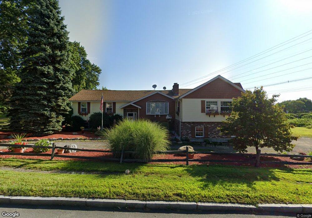
681 Lincoln St Waltham, MA 02451
Lakeview NeighborhoodEstimated Value: $971,000 - $1,295,000
3
Beds
4
Baths
2,737
Sq Ft
$405/Sq Ft
Est. Value
About This Home
This home is located at 681 Lincoln St, Waltham, MA 02451 and is currently estimated at $1,108,925, approximately $405 per square foot. 681 Lincoln St is a home located in Middlesex County with nearby schools including Douglas Macarthur Elementary School, John F Kennedy Middle School, and Waltham Sr High School.
Ownership History
Date
Name
Owned For
Owner Type
Purchase Details
Closed on
Oct 24, 2024
Sold by
Collette Frederick A and Collette Eva A
Bought by
Fred A & E A Collette Lt and Collette
Current Estimated Value
Purchase Details
Closed on
Jun 12, 1975
Bought by
Collette Frederick A and Collette Eva A
Create a Home Valuation Report for This Property
The Home Valuation Report is an in-depth analysis detailing your home's value as well as a comparison with similar homes in the area
Home Values in the Area
Average Home Value in this Area
Purchase History
| Date | Buyer | Sale Price | Title Company |
|---|---|---|---|
| Fred A & E A Collette Lt | -- | None Available | |
| Fred A & E A Collette Lt | -- | None Available | |
| Collette Frederick A | $11,000 | -- |
Source: Public Records
Mortgage History
| Date | Status | Borrower | Loan Amount |
|---|---|---|---|
| Previous Owner | Collette Frederick A | $400,000 | |
| Previous Owner | Collette Frederick A | $100,000 | |
| Previous Owner | Collette Frederick A | $60,000 |
Source: Public Records
Tax History Compared to Growth
Tax History
| Year | Tax Paid | Tax Assessment Tax Assessment Total Assessment is a certain percentage of the fair market value that is determined by local assessors to be the total taxable value of land and additions on the property. | Land | Improvement |
|---|---|---|---|---|
| 2025 | $8,926 | $909,000 | $490,700 | $418,300 |
| 2024 | $8,484 | $880,100 | $467,700 | $412,400 |
| 2023 | $8,452 | $819,000 | $427,700 | $391,300 |
| 2022 | $8,508 | $763,700 | $387,700 | $376,000 |
| 2021 | $8,415 | $743,400 | $387,700 | $355,700 |
| 2020 | $8,219 | $687,800 | $367,700 | $320,100 |
| 2019 | $8,299 | $655,500 | $346,900 | $308,600 |
| 2018 | $7,169 | $568,500 | $321,700 | $246,800 |
| 2017 | $6,776 | $539,500 | $292,700 | $246,800 |
| 2016 | $6,371 | $520,500 | $273,700 | $246,800 |
| 2015 | $6,694 | $509,800 | $257,700 | $252,100 |
Source: Public Records
Map
Nearby Homes
- 15 Kings Way Unit 25
- 98 Seminole Ave
- 463 Lincoln St
- 102 Milner St
- 249 Lake St
- 92 Milner St
- 11 Autumn Ln
- 234 Lake St
- 28 Hillcrest St
- 30 Wampum Ave
- 129 Lake St
- 28 Goldencrest Ave
- 65 Montclair Ave
- 15 Cedarcroft Ln
- 14 Benjamin Rd
- 14 Piedmont Ave
- 30 Jacqueline Rd Unit C
- 44 Sachem St
- 1105 Lexington St Unit 102
- 28 College Farm Rd Unit 2
- 697 Lincoln St
- 40 Silver Hill Ln
- 17 Smith St
- 32 Silver Hill Ln
- 48 Silver Hill Ln
- 19 Smith St
- Lot 3 Rock Ln
- 11 Smith St
- 4 High Rock Cir
- 56 Silver Hill Ln
- 701 Lincoln St
- 696 Lincoln St
- 698 Lincoln St
- 25 Smith St
- 11 Loretta Rd
- 39 Silver Hill Ln
- 29 Silver Hill Ln
- 64 Silver Hill Ln
- 5 High Rock Cir
- 655 Lincoln St