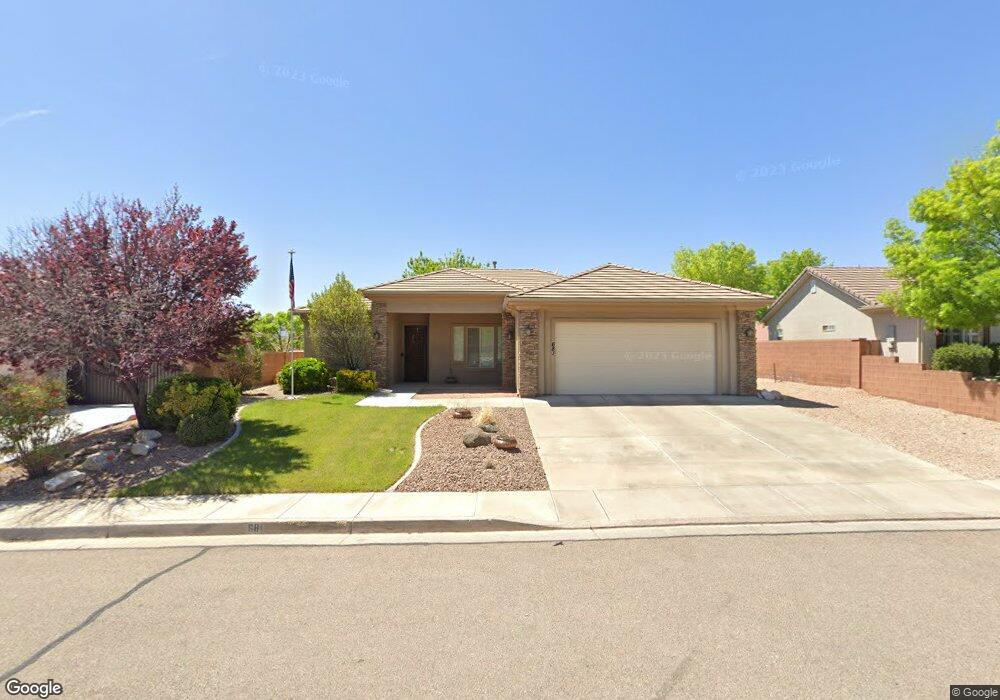
681 N 1620 West Cir Saint George, UT 84770
Estimated Value: $475,000 - $490,000
4
Beds
2
Baths
1,851
Sq Ft
$262/Sq Ft
Est. Value
About This Home
This home is located at 681 N 1620 West Cir, Saint George, UT 84770 and is currently estimated at $484,662, approximately $261 per square foot. 681 N 1620 West Cir is a home located in Washington County with nearby schools including Sunset School, Snow Canyon Middle School, and Lava Ridge Intermediate School.
Ownership History
Date
Name
Owned For
Owner Type
Purchase Details
Closed on
Dec 4, 2024
Sold by
Stockman Gary Dean and Stockman Carol Marie
Bought by
Garry D And Carol M Stockman Trust and Stockman
Current Estimated Value
Purchase Details
Closed on
Dec 19, 2017
Sold by
Cahoon Owen W and Cahoon Charlotte T
Bought by
Stockman Gary Dean and Stockman Carol Marie
Create a Home Valuation Report for This Property
The Home Valuation Report is an in-depth analysis detailing your home's value as well as a comparison with similar homes in the area
Home Values in the Area
Average Home Value in this Area
Purchase History
| Date | Buyer | Sale Price | Title Company |
|---|---|---|---|
| Garry D And Carol M Stockman Trust | -- | None Listed On Document | |
| Garry D And Carol M Stockman Trust | -- | None Listed On Document | |
| Stockman Gary Dean | -- | Mountain View Title |
Source: Public Records
Tax History Compared to Growth
Tax History
| Year | Tax Paid | Tax Assessment Tax Assessment Total Assessment is a certain percentage of the fair market value that is determined by local assessors to be the total taxable value of land and additions on the property. | Land | Improvement |
|---|---|---|---|---|
| 2025 | $1,736 | $264,825 | $46,750 | $218,075 |
| 2023 | $1,842 | $275,165 | $35,750 | $239,415 |
| 2022 | $1,930 | $271,205 | $35,750 | $235,455 |
| 2021 | $1,745 | $365,700 | $45,000 | $320,700 |
| 2020 | $1,555 | $306,800 | $45,000 | $261,800 |
| 2019 | $1,535 | $296,000 | $50,000 | $246,000 |
| 2018 | $1,475 | $146,850 | $0 | $0 |
| 2017 | $1,374 | $132,770 | $0 | $0 |
| 2016 | $1,429 | $127,765 | $0 | $0 |
| 2015 | $1,358 | $116,435 | $0 | $0 |
| 2014 | $1,445 | $124,685 | $0 | $0 |
Source: Public Records
Map
Nearby Homes
- 1732 N 540 W Unit 120
- 1732 W 540 N Unit 120
- 1732 W 540 N Unit 13
- 1732 W 540 N Unit 17
- 1732 W 540 N Unit 92
- 1732 W 540 N Unit 68
- 1735 W 540 N Unit 1006
- 1735 W 540 N Unit 2302
- 1735 W 540 N Unit 2302
- 1735 W 540 N Unit 1202
- 1735 W 540 N Unit 1001
- 1385 W 625 N
- 1385 W 625 North St
- 954 N 1725 W Unit 32
- 1793 W 950 N Unit 3
- 695 N Daybreak Dr
- 1708 W 1020 N Unit 146
- 727 N 1275 W
- 1742 W 1020 N Unit 123
- 1782 W 1020 N Unit 133
- 681 N 1620 W
- 667 N 1620 West Cir
- 667 N 1620 W
- 695 N 1620 West Cir
- 695 N 1620 Cir W
- 709 N 1620 Cir W
- 653 N 1620 West Cir
- 709 N 1620 West Cir
- 682 N 1620 West Cir
- 682 N 1620 W
- 696 N 1620 W
- 696 N 1620 West Cir
- 668 N 1620 West Cir
- 668 N 1620 Cir W
- 0 1620 St W
- 0 1620 St W
- 0 1620 St W
- 710 N 1620 West Cir
- 641 N 1620 W
- 723 N 1620 West Cir