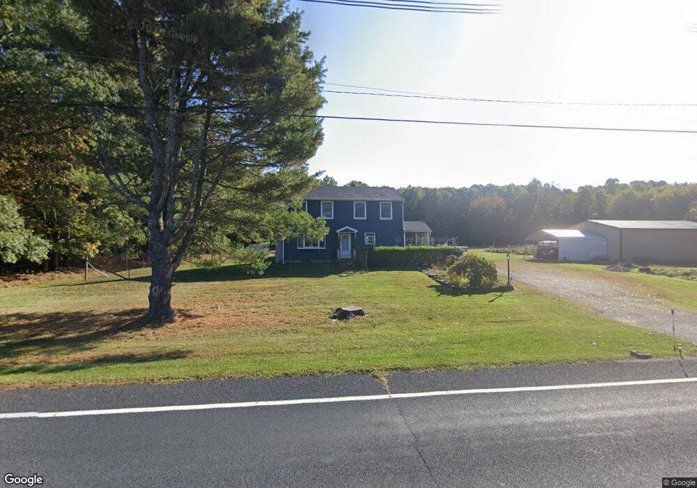
681 Pittstown Rd Frenchtown, NJ 08825
Franklin NeighborhoodEstimated Value: $486,000 - $557,000
--
Bed
--
Bath
1,824
Sq Ft
$280/Sq Ft
Est. Value
About This Home
This home is located at 681 Pittstown Rd, Frenchtown, NJ 08825 and is currently estimated at $509,927, approximately $279 per square foot. 681 Pittstown Rd is a home located in Hunterdon County with nearby schools including Franklin Township School and North Hunterdon High School.
Ownership History
Date
Name
Owned For
Owner Type
Purchase Details
Closed on
Oct 30, 2023
Sold by
Strouse Gary J and Strouse Barbara Ann
Bought by
Stanton Geoffrey M and Stanton Gina S
Current Estimated Value
Home Financials for this Owner
Home Financials are based on the most recent Mortgage that was taken out on this home.
Original Mortgage
$270,000
Outstanding Balance
$261,840
Interest Rate
7.18%
Mortgage Type
Seller Take Back
Estimated Equity
$248,087
Create a Home Valuation Report for This Property
The Home Valuation Report is an in-depth analysis detailing your home's value as well as a comparison with similar homes in the area
Home Values in the Area
Average Home Value in this Area
Purchase History
| Date | Buyer | Sale Price | Title Company |
|---|---|---|---|
| Stanton Geoffrey M | $420,000 | None Listed On Document |
Source: Public Records
Mortgage History
| Date | Status | Borrower | Loan Amount |
|---|---|---|---|
| Open | Stanton Geoffrey M | $270,000 |
Source: Public Records
Tax History Compared to Growth
Tax History
| Year | Tax Paid | Tax Assessment Tax Assessment Total Assessment is a certain percentage of the fair market value that is determined by local assessors to be the total taxable value of land and additions on the property. | Land | Improvement |
|---|---|---|---|---|
| 2025 | $9,776 | $325,200 | $185,400 | $139,800 |
| 2024 | $9,242 | $325,200 | $185,400 | $139,800 |
| 2023 | $9,242 | $325,200 | $185,400 | $139,800 |
| 2022 | $9,184 | $325,200 | $185,400 | $139,800 |
| 2021 | $8,657 | $325,200 | $185,400 | $139,800 |
| 2020 | $8,897 | $325,200 | $185,400 | $139,800 |
| 2019 | $8,985 | $325,200 | $185,400 | $139,800 |
| 2018 | $8,484 | $325,200 | $185,400 | $139,800 |
| 2017 | $8,322 | $325,200 | $185,400 | $139,800 |
| 2016 | $8,084 | $325,200 | $185,400 | $139,800 |
| 2015 | $8,062 | $325,200 | $185,400 | $139,800 |
| 2014 | $8,228 | $325,200 | $185,400 | $139,800 |
Source: Public Records
Map
Nearby Homes
- 719 Pittstown Rd
- 115 Lower Oak Grove Rd
- 144 Lower Oak Grove Rd
- 175 Lower Oak Grove Rd
- 678 State Route 12
- 550 Barbertown Point Breeze Rd
- 584 Oak Grove Rd
- 364 Oak Grove Rd
- 56 Old Route12
- 617 County Road 579
- 554-560 Oak Grove Rd
- 150 Oak Grove Rd
- 72 Hampton Rd
- 37 Barbertown Point Breeze Rd
- 2 Shrope Ln
- 990 County Road 519
- 1491&1493 County Road 519
- 92 Oak Grove Rd
- 1068 County Road519
- 153 Hammar Rd
- 689 Pittstown Rd
- 663 Pittstown Rd
- 663 Pittstown Rd Unit 1
- 702 Pittstown Rd
- 662 Pittstown Rd
- 656 Pittstown Rd
- 655 Pittstown Rd
- 139 Slacktown Rd
- 967 Croton Rd
- 652 Pittstown Rd
- 725 State Route 12
- 715 Pittstown Rd
- 184 Lower Oak Grove Rd
- 120 Slacktown Rd
- 182 Lower Oak Grove Rd
- 637 Pittstown Rd
- 164 Lower Oak Grove Rd
- 160 Lower Oak Grove Rd
- 828 New Jersey 12
- 731 State Route 12