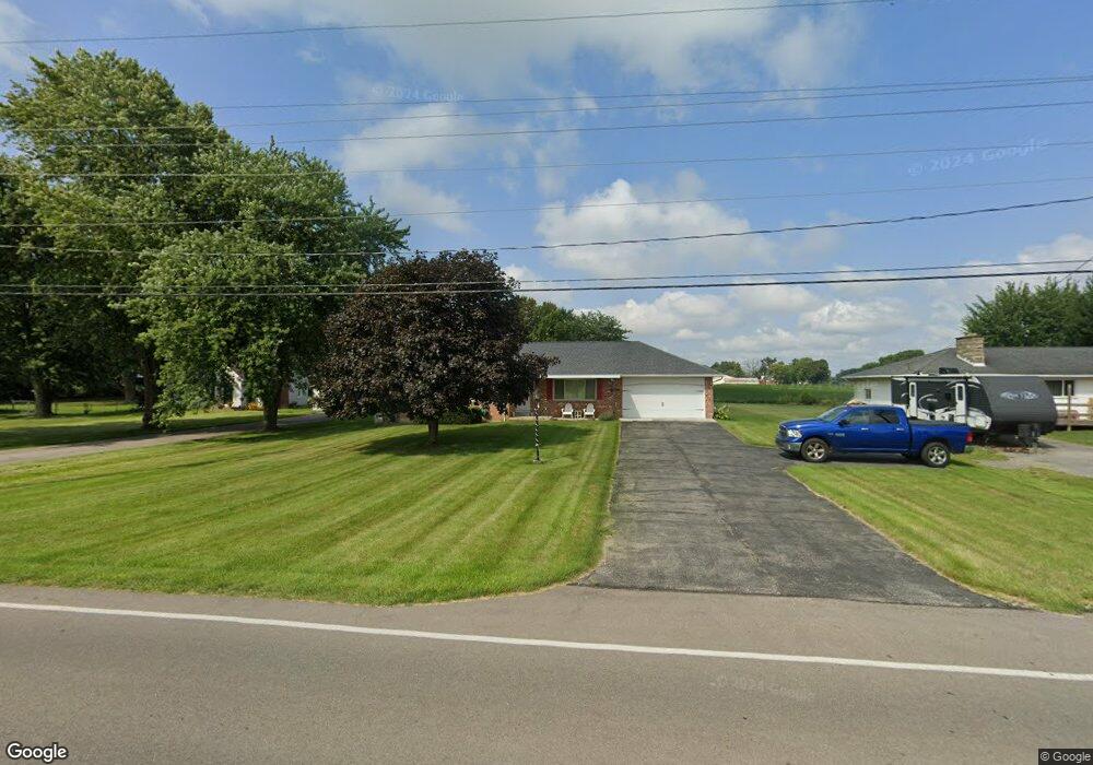
681 Pole Lane Rd Marion, OH 43302
Estimated Value: $233,000 - $269,000
3
Beds
2
Baths
1,376
Sq Ft
$177/Sq Ft
Est. Value
About This Home
This home is located at 681 Pole Lane Rd, Marion, OH 43302 and is currently estimated at $243,400, approximately $176 per square foot. 681 Pole Lane Rd is a home located in Marion County with nearby schools including River Valley High School, Marion Preparatory Academy, and TRECA Digital Academy.
Ownership History
Date
Name
Owned For
Owner Type
Purchase Details
Closed on
Apr 16, 2018
Sold by
Hartman Pamela L and Emans Ii Charles W
Bought by
Emans Danielle J
Current Estimated Value
Home Financials for this Owner
Home Financials are based on the most recent Mortgage that was taken out on this home.
Original Mortgage
$81,600
Outstanding Balance
$59,336
Interest Rate
4.44%
Mortgage Type
New Conventional
Estimated Equity
$184,064
Purchase Details
Closed on
Oct 13, 1999
Bought by
Emans Charles W & Maxine J Trustees
Create a Home Valuation Report for This Property
The Home Valuation Report is an in-depth analysis detailing your home's value as well as a comparison with similar homes in the area
Home Values in the Area
Average Home Value in this Area
Purchase History
| Date | Buyer | Sale Price | Title Company |
|---|---|---|---|
| Emans Danielle J | $102,000 | None Available | |
| Emans Charles W & Maxine J Trustees | -- | -- |
Source: Public Records
Mortgage History
| Date | Status | Borrower | Loan Amount |
|---|---|---|---|
| Open | Emans Danielle J | $81,600 |
Source: Public Records
Tax History Compared to Growth
Tax History
| Year | Tax Paid | Tax Assessment Tax Assessment Total Assessment is a certain percentage of the fair market value that is determined by local assessors to be the total taxable value of land and additions on the property. | Land | Improvement |
|---|---|---|---|---|
| 2024 | $2,204 | $53,120 | $10,750 | $42,370 |
| 2023 | $2,204 | $53,120 | $10,750 | $42,370 |
| 2022 | $2,262 | $53,120 | $10,750 | $42,370 |
| 2021 | $2,089 | $44,130 | $9,350 | $34,780 |
| 2020 | $2,027 | $44,130 | $9,350 | $34,780 |
| 2019 | $1,975 | $44,130 | $9,350 | $34,780 |
| 2018 | $1,149 | $37,590 | $8,090 | $29,500 |
| 2017 | $1,161 | $37,590 | $8,090 | $29,500 |
| 2016 | $1,160 | $37,590 | $8,090 | $29,500 |
| 2015 | $1,143 | $36,670 | $7,700 | $28,970 |
| 2014 | $1,143 | $36,670 | $7,700 | $28,970 |
| 2012 | $1,186 | $36,780 | $6,180 | $30,600 |
Source: Public Records
Map
Nearby Homes
- 645 Augusta Dr
- 627 Augusta Dr
- 386 Pole Lane Rd
- 485 New Park Dr
- 499 Carolyn Dr
- 402 Carolyn Dr
- 0 Denning Ave
- 145 Sara Ave
- 1225 Ackerman Ave
- 357 Franconia Ave
- 197 Franconia Ave
- 144 Spencer St
- 1966 Linda St
- 1185 E Center St
- 164 Clover Ave
- 534 Meadow Ln
- 1195 Indiana Ave
- 565 Mayfield Dr
- 1090 E Church St
- 214 Merchant Ave
- 691 Pole Lane Rd
- 669 Pole Lane Rd
- 703 Pole Lane Rd
- 657 Pole Lane Rd
- 686 Bayhill Ct
- 645 Pole Lane Rd
- 684 Bayhill Ct
- 692 Bay Hill Ct Unit 24
- 682 Bay Hill Ct
- 2137 Bay Hill Dr
- 733 Pole Lane Rd
- 2140 Bay Hill Dr
- 633 Pole Lane Rd
- 0 Bay Hill Dr Unit LOT 8 2710361
- 0 Bay Hill Dr Unit LOT 4
- 745 Pole Lane Rd
- 697 Bay Hill Ct
- 0 Bay Hill Ct
- 738 Bayhill Ct
- 611 Pole Lane Rd