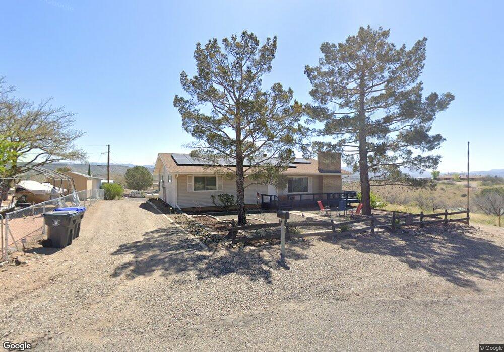
681 S Park Cir Camp Verde, AZ 86322
Estimated Value: $245,000 - $282,507
--
Bed
--
Bath
1,664
Sq Ft
$161/Sq Ft
Est. Value
About This Home
This home is located at 681 S Park Cir, Camp Verde, AZ 86322 and is currently estimated at $267,627, approximately $160 per square foot. 681 S Park Cir is a home located in Yavapai County with nearby schools including Camp Verde Elementary School, Camp Verde Middle School, and Camp Verde High School.
Ownership History
Date
Name
Owned For
Owner Type
Purchase Details
Closed on
Jan 3, 2022
Sold by
Santo Living Trust
Bought by
Austin Ricky and Austin Tonya
Current Estimated Value
Home Financials for this Owner
Home Financials are based on the most recent Mortgage that was taken out on this home.
Original Mortgage
$245,471
Outstanding Balance
$226,262
Interest Rate
3.12%
Mortgage Type
FHA
Estimated Equity
$41,365
Purchase Details
Closed on
Aug 2, 2018
Sold by
Wade Scott Lawrence
Bought by
Wade Stephanie Lee Ann
Purchase Details
Closed on
Feb 7, 1997
Sold by
Santo Beverly A
Bought by
Santo Beverly A
Create a Home Valuation Report for This Property
The Home Valuation Report is an in-depth analysis detailing your home's value as well as a comparison with similar homes in the area
Home Values in the Area
Average Home Value in this Area
Purchase History
| Date | Buyer | Sale Price | Title Company |
|---|---|---|---|
| Austin Ricky | $250,000 | Yavapai Title Agency | |
| Wade Stephanie Lee Ann | -- | None Available | |
| Santo Beverly A | -- | -- |
Source: Public Records
Mortgage History
| Date | Status | Borrower | Loan Amount |
|---|---|---|---|
| Open | Austin Ricky | $245,471 |
Source: Public Records
Tax History Compared to Growth
Tax History
| Year | Tax Paid | Tax Assessment Tax Assessment Total Assessment is a certain percentage of the fair market value that is determined by local assessors to be the total taxable value of land and additions on the property. | Land | Improvement |
|---|---|---|---|---|
| 2026 | $1,580 | $27,315 | -- | -- |
| 2024 | $1,561 | $26,644 | -- | -- |
| 2023 | $1,561 | $22,365 | $0 | $0 |
| 2022 | $1,500 | $18,388 | $1,760 | $16,628 |
| 2021 | $1,548 | $16,842 | $1,686 | $15,156 |
| 2020 | $1,510 | $0 | $0 | $0 |
| 2019 | $1,495 | $0 | $0 | $0 |
| 2018 | $1,424 | $0 | $0 | $0 |
| 2017 | $1,402 | $0 | $0 | $0 |
| 2016 | $1,363 | $0 | $0 | $0 |
| 2015 | -- | $0 | $0 | $0 |
| 2014 | -- | $0 | $0 | $0 |
Source: Public Records
Map
Nearby Homes
- 615 S 3rd St
- 595 S Park Cir
- 421 S Dakota Dr
- 3 E State Route 260 --
- 660 S Dakota Dr
- 0000 W General Crook Trail
- 477 Arizona 260
- 639 S Azure Dr
- 1010 S Clarence Ln
- 556 S Azure Dr
- 000 W Salt Mine Rd
- 385 S 4th St
- 451 W Salt Mine Rd
- 539 W Saddle Creek Dr
- 100 E Wee Hollow Dr
- 667 E Cliffs Pkwy
- 105 E Wee Hollow Dr
- 126 E Wee Hollow Dr
- 107 E Wee Hollow Dr
- 2375 S San Dominique Rd