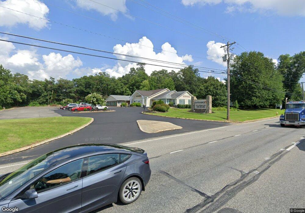
6810 Crain Hwy La Plata, MD 20646
Estimated Value: $1,566,437
--
Bed
--
Bath
5,774
Sq Ft
$271/Sq Ft
Est. Value
About This Home
This home is located at 6810 Crain Hwy, La Plata, MD 20646 and is currently estimated at $1,566,437, approximately $271 per square foot. 6810 Crain Hwy is a home located in Charles County with nearby schools including Walter J. Mitchell Elementary School, Milton M. Somers Middle School, and La Plata High School.
Ownership History
Date
Name
Owned For
Owner Type
Purchase Details
Closed on
Aug 27, 2009
Sold by
R I C Properties Ltd
Bought by
Osit Investments Llc
Current Estimated Value
Purchase Details
Closed on
Dec 3, 1985
Sold by
Golden Corral Corporation
Bought by
R I C Properties Ltd
Purchase Details
Closed on
Mar 13, 1985
Sold by
Pickeral Adrian F
Bought by
Golden Corral Corporation
Home Financials for this Owner
Home Financials are based on the most recent Mortgage that was taken out on this home.
Original Mortgage
$450,000
Interest Rate
13.1%
Create a Home Valuation Report for This Property
The Home Valuation Report is an in-depth analysis detailing your home's value as well as a comparison with similar homes in the area
Home Values in the Area
Average Home Value in this Area
Purchase History
| Date | Buyer | Sale Price | Title Company |
|---|---|---|---|
| Osit Investments Llc | $875,000 | -- | |
| R I C Properties Ltd | $600,700 | -- | |
| Golden Corral Corporation | $156,800 | -- |
Source: Public Records
Mortgage History
| Date | Status | Borrower | Loan Amount |
|---|---|---|---|
| Previous Owner | Golden Corral Corporation | $450,000 |
Source: Public Records
Tax History Compared to Growth
Tax History
| Year | Tax Paid | Tax Assessment Tax Assessment Total Assessment is a certain percentage of the fair market value that is determined by local assessors to be the total taxable value of land and additions on the property. | Land | Improvement |
|---|---|---|---|---|
| 2025 | $33,390 | $1,079,367 | -- | -- |
| 2024 | $16,457 | $1,077,233 | $0 | $0 |
| 2023 | $18,804 | $1,075,100 | $397,100 | $678,000 |
| 2022 | $15,582 | $1,040,700 | $0 | $0 |
| 2021 | $14,611 | $1,006,300 | $0 | $0 |
| 2020 | $14,611 | $971,900 | $397,100 | $574,800 |
| 2019 | $14,665 | $971,900 | $397,100 | $574,800 |
| 2018 | $14,603 | $971,900 | $397,100 | $574,800 |
| 2017 | $14,959 | $990,200 | $0 | $0 |
| 2016 | -- | $936,333 | $0 | $0 |
| 2015 | $12,395 | $882,467 | $0 | $0 |
| 2014 | $12,395 | $828,600 | $0 | $0 |
Source: Public Records
Map
Nearby Homes
- 45 Hibiscus Ct
- 107 Howard St
- 105 Palmetto Ct
- 302 Edelen Station Place
- 0 Glen Albin Rd Unit 1002259446
- 600 Edelen Station Place Unit 7402
- The Adelina Plan at Fischer's Grant
- The Willow Plan at Fischer's Grant
- The Westminster Plan at Fischer's Grant
- The Somerset Plan at Fischer's Grant
- The Lancaster Plan at Fischer's Grant
- The Belmont Plan at Fischer's Grant
- The Glenwood Plan at Fischer's Grant
- The Oxford Plan at Fischer's Grant
- The Brentwood Plan at Fischer's Grant
- The Hampton Plan at Fischer's Grant
- The Fairfax Plan at Fischer's Grant
- The Ashland Plan at Fischer's Grant
- The Winchester Plan at Fischer's Grant
- 203 Port Tobacco Rd
- 6790 Crain Hwy
- 6830 Crain Hwy
- 6780 Crain Hwy
- 6770 Crain Hwy
- 101 Carol's Place Unit 31
- 101 Carol's Place Unit 22
- 101 Carol's Place Unit 33
- 101 Carol's Place Unit 23
- 101 Carol's Place Unit 16
- 101 Carol's Place Unit 26
- 101 Carol's Place Unit 17
- 101 Carol's Place Unit 24
- 101 Carol's Place Unit 14
- 101 Carol's Place Unit 13
- 101 Carol's Place Unit 12
- 101 Carol's Place Unit 34
- 101 Carol's Place Unit 27
- 101 Carol's Place Unit 11
- 101 Carol's Place Unit 21
- 101 Carol's Place Unit 15