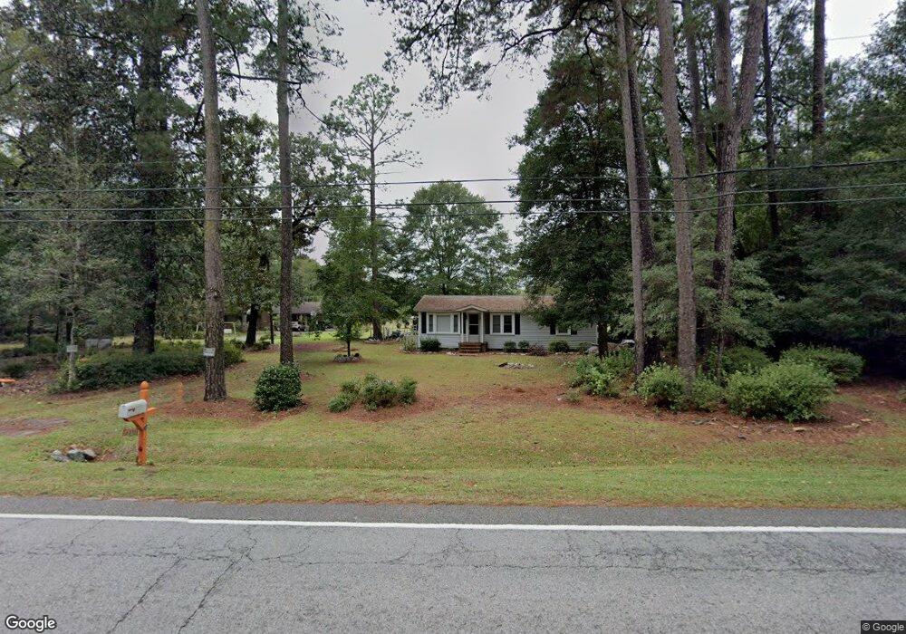
6810 Freedom Rd Branchville, SC 29432
Estimated Value: $96,501 - $221,000
3
Beds
1
Bath
880
Sq Ft
$162/Sq Ft
Est. Value
About This Home
This home is located at 6810 Freedom Rd, Branchville, SC 29432 and is currently estimated at $142,375, approximately $161 per square foot. 6810 Freedom Rd is a home located in Orangeburg County with nearby schools including Lockett Elementary, Lockett Elementary School, and Branchville High School.
Ownership History
Date
Name
Owned For
Owner Type
Purchase Details
Closed on
Jun 30, 2014
Sold by
Byrd Mickey G and Byrd Diane W
Bought by
Byrd Diane W and Diane W Byrd Trust
Current Estimated Value
Purchase Details
Closed on
Jan 24, 2012
Sold by
Johnson Lesley Sinkler
Bought by
Byrd Mickey G and Byrd Diane W
Purchase Details
Closed on
Dec 12, 2011
Sold by
Byrd Mickey G and Byrd Diane W
Bought by
Johnson Lesley Sinkler
Purchase Details
Closed on
Jul 2, 2004
Sold by
Byrd Lanny A and Byrd John W
Bought by
Byrd Mickey G
Create a Home Valuation Report for This Property
The Home Valuation Report is an in-depth analysis detailing your home's value as well as a comparison with similar homes in the area
Home Values in the Area
Average Home Value in this Area
Purchase History
| Date | Buyer | Sale Price | Title Company |
|---|---|---|---|
| Byrd Diane W | -- | -- | |
| Byrd Mickey G | -- | -- | |
| Byrd Mickey G | -- | -- | |
| Johnson Lesley Sinkler | -- | -- | |
| Byrd Mickey G | $14,000 | -- |
Source: Public Records
Tax History Compared to Growth
Tax History
| Year | Tax Paid | Tax Assessment Tax Assessment Total Assessment is a certain percentage of the fair market value that is determined by local assessors to be the total taxable value of land and additions on the property. | Land | Improvement |
|---|---|---|---|---|
| 2024 | $1,444 | $4,023 | $873 | $3,150 |
| 2023 | $1,250 | $3,066 | $762 | $2,304 |
| 2022 | $1,250 | $3,066 | $762 | $2,304 |
| 2021 | $1,241 | $3,066 | $762 | $2,304 |
| 2020 | $1,143 | $3,066 | $0 | $0 |
| 2019 | $1,107 | $3,066 | $0 | $0 |
| 2018 | $1,113 | $2,934 | $0 | $0 |
| 2017 | $1,097 | $2,934 | $0 | $0 |
| 2016 | $1,092 | $2,934 | $0 | $0 |
| 2015 | $1,034 | $2,934 | $0 | $0 |
| 2014 | $1,034 | $1,956 | $508 | $1,448 |
| 2013 | -- | $2,008 | $508 | $1,500 |
Source: Public Records
Map
Nearby Homes
- 0 Calhoun St Unit 25018526
- 0 Calhoun St Unit 170350
- 00 Freedom Rd
- 323 Railroad Ave
- TBD Ellis St
- 1 Freedom Rd
- 281 Bridge St
- 360 Bridge St
- 1373 Bridge St
- 5837 Freedom Rd
- 0 Highway 210 Unit 24752850
- 496 O C 4148
- 4756 Edisto River Rd
- Rd
- 4534 Cattle Creek Rd
- 2958 Heritage Hwy
- 646 Briar Creek Rd
- 668 Briar Creek Rd
- 1 Parnel Rd
- 269 Out Water Ln
- 6830 Freedom Rd
- 6816 Freedom Rd
- 6816 Freedom Rd
- 6847 Freedom Rd
- 6841 Freedom Rd
- 165 Sardis Church Rd
- 6743 Freedom Rd
- 6872 Freedom Rd
- 183 Clarence Rd
- 219 Sardis Church Rd
- 132 Clarence Rd
- 330 Sardis Church Rd
- 371 Sardis Church Rd
- 124 Tara Ln
- 6650 Freedom Rd
- 6914 Freedom Rd
- 331 Camp Edisto Rd
- 385 Sardis Church Rd
- 315 Camp Edisto Rd
- 105 Steedly St