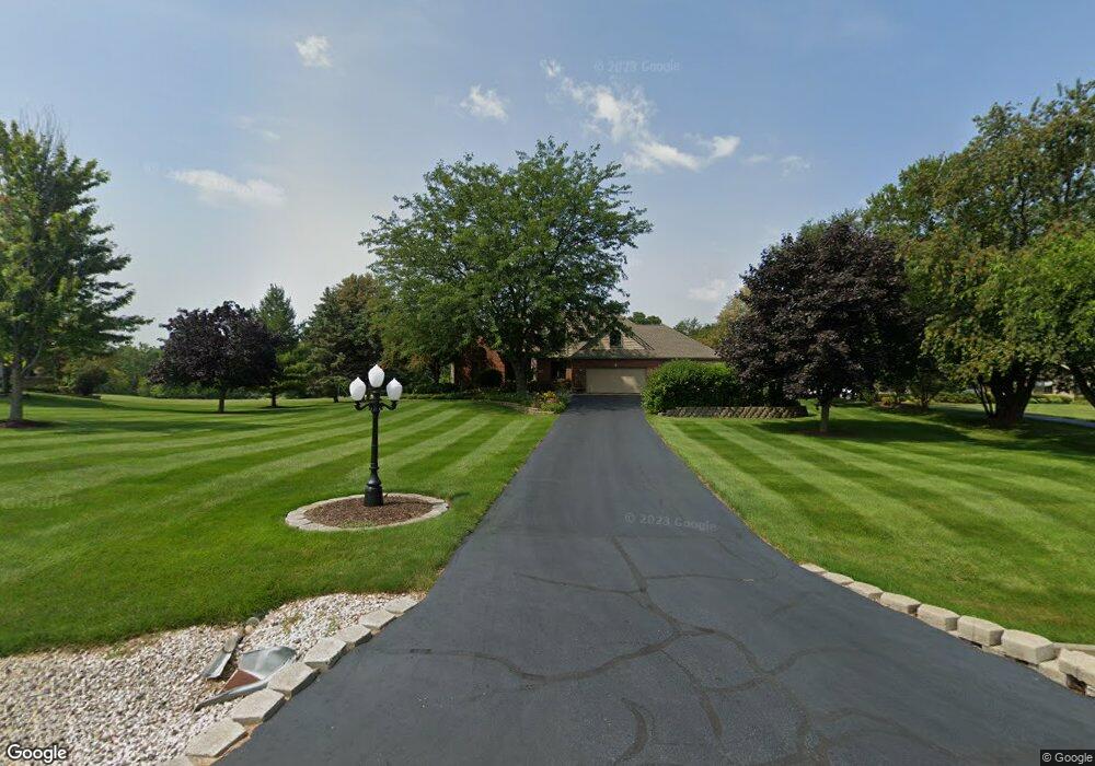
6811 Paulson Dr Marengo, IL 60152
Estimated Value: $452,707 - $661,000
4
Beds
--
Bath
2,945
Sq Ft
$190/Sq Ft
Est. Value
About This Home
This home is located at 6811 Paulson Dr, Marengo, IL 60152 and is currently estimated at $559,427, approximately $189 per square foot. 6811 Paulson Dr is a home located in McHenry County with nearby schools including Riley Community Consolidated School District 18, Marengo Community High School, and Zion Lutheran School.
Ownership History
Date
Name
Owned For
Owner Type
Purchase Details
Closed on
Oct 4, 2012
Sold by
Simonini Joseph and Simonini Catherine
Bought by
Simonini Joseph and Simonini Catherine
Current Estimated Value
Purchase Details
Closed on
May 10, 1996
Sold by
Simonini Joseph
Bought by
Simonini Joseph and Simonini Catherine
Purchase Details
Closed on
Aug 1, 1995
Sold by
Carmichael Construction Inc
Bought by
Simonini Joseph
Purchase Details
Closed on
Feb 1, 1995
Sold by
Harmony R E Co Ownership Iv
Bought by
Carmichael Construction
Home Financials for this Owner
Home Financials are based on the most recent Mortgage that was taken out on this home.
Original Mortgage
$46,500
Interest Rate
9.24%
Mortgage Type
Seller Take Back
Create a Home Valuation Report for This Property
The Home Valuation Report is an in-depth analysis detailing your home's value as well as a comparison with similar homes in the area
Home Values in the Area
Average Home Value in this Area
Purchase History
| Date | Buyer | Sale Price | Title Company |
|---|---|---|---|
| Simonini Joseph | -- | None Available | |
| Simonini Joseph | -- | -- | |
| Simonini Joseph | $48,500 | Chicago Title | |
| Carmichael Construction | $47,500 | Chicago Title |
Source: Public Records
Mortgage History
| Date | Status | Borrower | Loan Amount |
|---|---|---|---|
| Previous Owner | Carmichael Construction | $46,500 |
Source: Public Records
Tax History
| Year | Tax Paid | Tax Assessment Tax Assessment Total Assessment is a certain percentage of the fair market value that is determined by local assessors to be the total taxable value of land and additions on the property. | Land | Improvement |
|---|---|---|---|---|
| 2024 | $7,923 | $156,667 | $11,020 | $145,647 |
| 2023 | $9,698 | $139,607 | $9,820 | $129,787 |
| 2022 | $9,744 | $128,009 | $9,004 | $119,005 |
| 2021 | $6,936 | $118,603 | $8,342 | $110,261 |
| 2020 | $9,136 | $112,122 | $7,886 | $104,236 |
| 2019 | $9,738 | $107,314 | $7,548 | $99,766 |
| 2018 | $9,332 | $104,001 | $5,806 | $98,195 |
| 2017 | $9,168 | $100,532 | $5,612 | $94,920 |
| 2016 | $8,375 | $96,702 | $5,398 | $91,304 |
| 2013 | -- | $92,515 | $18,308 | $74,207 |
Source: Public Records
Map
Nearby Homes
- 0 Ratfield Rd
- 1006 Ruth Ct
- 915 Courtney Ln
- 836 Oak Manor Dr
- 870 Mildred Dr
- 955 Riverdale Ct
- 0 Maple St
- 579 Johnson St
- 737 E Grant Hwy
- 459 Kennedy St
- 704 Cherokee Trail
- 704 Echo (Lot 21) Trail
- 806 Echo (Lot 22) Trail
- 802 Echo (Lot 23) Trail
- 313 E Grant Hwy
- 10 ac U S 20
- 214 S Prospect St
- 436 W Washington St
- 8106 Maple St
- 19923 E Grant Hwy
- 6807 Paulson Dr
- 21302 Babs Trail
- 6814 Hennig Dr
- 6808 Paulson Dr
- 6819 Paulson Dr
- 21219 Babs Trail
- 6818 Paulson Dr
- 21305 Babs Trail
- 6714 Paulson Dr
- 6810 Hennig Dr
- 6817 Hennig Dr
- 6909 Paulson Dr
- 6811 Hennig Dr
- 6918 Hennig Dr
- 7001 Paulson Dr
- 21201 Ratfield Rd
- 6902 Paulson Dr
- 6802 Hennig Dr
- 6906 Paulson Dr
- 21206 Ratfield Rd
Your Personal Tour Guide
Ask me questions while you tour the home.