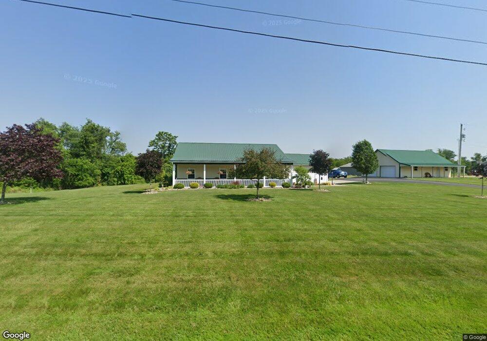
68126 Old Twenty One Rd Cambridge, OH 43725
Estimated Value: $246,000 - $326,000
--
Bed
--
Bath
1,584
Sq Ft
$182/Sq Ft
Est. Value
About This Home
This home is located at 68126 Old Twenty One Rd, Cambridge, OH 43725 and is currently estimated at $289,069, approximately $182 per square foot. 68126 Old Twenty One Rd is a home with nearby schools including Cambridge High School.
Ownership History
Date
Name
Owned For
Owner Type
Purchase Details
Closed on
Apr 25, 2014
Sold by
Bouvier Louis S
Bought by
Lanzer Michael and Lanzer J
Current Estimated Value
Purchase Details
Closed on
Aug 27, 2005
Sold by
Crooks Robert D and Crooks Karen L
Bought by
Bouvier Louis S and Bouvier Denise J
Home Financials for this Owner
Home Financials are based on the most recent Mortgage that was taken out on this home.
Original Mortgage
$77,000
Interest Rate
7.77%
Mortgage Type
Adjustable Rate Mortgage/ARM
Create a Home Valuation Report for This Property
The Home Valuation Report is an in-depth analysis detailing your home's value as well as a comparison with similar homes in the area
Home Values in the Area
Average Home Value in this Area
Purchase History
| Date | Buyer | Sale Price | Title Company |
|---|---|---|---|
| Lanzer Michael | $41,000 | None Available | |
| Bouvier Louis S | $77,000 | -- |
Source: Public Records
Mortgage History
| Date | Status | Borrower | Loan Amount |
|---|---|---|---|
| Previous Owner | Bouvier Louis S | $77,000 |
Source: Public Records
Tax History Compared to Growth
Tax History
| Year | Tax Paid | Tax Assessment Tax Assessment Total Assessment is a certain percentage of the fair market value that is determined by local assessors to be the total taxable value of land and additions on the property. | Land | Improvement |
|---|---|---|---|---|
| 2024 | $3,131 | $75,509 | $11,624 | $63,885 |
| 2023 | $3,131 | $61,386 | $9,450 | $51,936 |
| 2022 | $2,722 | $61,390 | $9,440 | $51,950 |
| 2021 | $2,692 | $61,390 | $9,440 | $51,950 |
| 2020 | $2,423 | $55,090 | $7,990 | $47,100 |
| 2019 | $476 | $10,610 | $7,990 | $2,620 |
| 2018 | $425 | $10,610 | $7,990 | $2,620 |
| 2017 | $406 | $9,240 | $6,950 | $2,290 |
| 2016 | $406 | $9,240 | $6,950 | $2,290 |
| 2015 | $406 | $9,240 | $6,950 | $2,290 |
| 2014 | -- | $20,820 | $6,410 | $14,410 |
| 2013 | $645 | $20,820 | $6,410 | $14,410 |
Source: Public Records
Map
Nearby Homes
- 67706 Oldham Rd
- 67295 Old Twenty One Rd
- 10909 Barrett Hill Rd
- 10909 Ruby Rd
- 0 Angus Rd
- 10084 Cadiz Rd
- 1616 Quail Hollow Dr
- 0 Pigeon Gap Rd
- 1355 Highland Ave
- 66421 Wolfs Den Rd
- 1121 Clark St
- 818 Highland Ave
- 808 N 12th St
- 812 N 12th St
- 807 Harrison Ave
- 10373 Plainfield Rd
- 632 N 9th St
- 614 N 11th St
- 614 N North 11th St
- 620 N 9th St
- 68088 Old Twenty One Rd
- 68188 Old Twenty One Rd
- 68183 Old Twenty One Rd
- 68185 Old Twenty One Rd
- 68062 Old Twenty One Rd
- 68074 Old Twenty One Rd
- 68048 Old Twenty One Rd
- 9106 Liberty Rd
- 9263 Liberty Rd
- 68272 Old Twenty One Rd
- 683 Old Twentyone Rd
- 67979 Old Twenty One Rd
- 68195 Old Twenty One Rd
- 9293 Liberty Rd
- 68271 Old Twenty One Rd
- 6373&6371 Harvest Dr
- 9254 Liberty Rd
- 9311 Liberty Rd
- 9270 Liberty Rd
- 9220 Liberty Rd