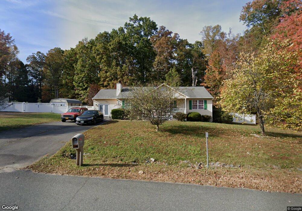
6813 Silverbrook Dr Spotsylvania, VA 22553
Chancellor NeighborhoodEstimated Value: $390,000 - $457,000
3
Beds
2
Baths
1,504
Sq Ft
$280/Sq Ft
Est. Value
About This Home
This home is located at 6813 Silverbrook Dr, Spotsylvania, VA 22553 and is currently estimated at $421,589, approximately $280 per square foot. 6813 Silverbrook Dr is a home located in Spotsylvania County with nearby schools including Courthouse Road Elementary School, Freedom Middle School, and Courtland High School.
Ownership History
Date
Name
Owned For
Owner Type
Purchase Details
Closed on
Aug 14, 2018
Sold by
Lingerfelt Maureen Ann
Bought by
Lingerfelt Jerry Christopher and Lingerfelt Maureen Ann
Current Estimated Value
Purchase Details
Closed on
Dec 28, 2000
Sold by
Tricord Inc
Bought by
Collins Maureen A
Home Financials for this Owner
Home Financials are based on the most recent Mortgage that was taken out on this home.
Original Mortgage
$142,704
Outstanding Balance
$53,263
Interest Rate
7.7%
Mortgage Type
Purchase Money Mortgage
Estimated Equity
$368,326
Create a Home Valuation Report for This Property
The Home Valuation Report is an in-depth analysis detailing your home's value as well as a comparison with similar homes in the area
Home Values in the Area
Average Home Value in this Area
Purchase History
| Date | Buyer | Sale Price | Title Company |
|---|---|---|---|
| Lingerfelt Jerry Christopher | -- | None Available | |
| Collins Maureen A | $144,250 | -- |
Source: Public Records
Mortgage History
| Date | Status | Borrower | Loan Amount |
|---|---|---|---|
| Open | Collins Maureen A | $142,704 |
Source: Public Records
Tax History Compared to Growth
Tax History
| Year | Tax Paid | Tax Assessment Tax Assessment Total Assessment is a certain percentage of the fair market value that is determined by local assessors to be the total taxable value of land and additions on the property. | Land | Improvement |
|---|---|---|---|---|
| 2025 | $2,411 | $328,400 | $125,000 | $203,400 |
| 2024 | $2,411 | $328,400 | $125,000 | $203,400 |
| 2023 | $1,970 | $255,300 | $100,000 | $155,300 |
| 2022 | $1,883 | $255,300 | $100,000 | $155,300 |
| 2021 | $1,962 | $242,400 | $90,000 | $152,400 |
| 2020 | $1,962 | $242,400 | $90,000 | $152,400 |
| 2019 | $1,967 | $232,100 | $85,000 | $147,100 |
| 2018 | $1,933 | $232,100 | $85,000 | $147,100 |
| 2017 | $2,647 | $207,600 | $65,000 | $142,600 |
| 2016 | $1,765 | $207,600 | $65,000 | $142,600 |
| 2015 | $722 | $190,500 | $50,000 | $140,500 |
| 2014 | $722 | $190,500 | $50,000 | $140,500 |
Source: Public Records
Map
Nearby Homes
- 6700 Reindeer Ct
- 10611 Cobblestone Dr
- 10611 Maple Ridge Dr
- 10504 Big Horn Dr
- 10041 Gander Ct
- 10028 Gander Ct
- 10911 Antelope Trail
- 10008 Gander Ct
- 11139 Gander Ct
- 9910 Agnes Ln
- 9770 Courthouse Rd
- 6815 Bloomsbury Ln
- 11002 Jaguar Ct
- 11004 Jaguar Ct
- 11100 Saturn Ct
- 10724 Tealwing Cove
- 11302 Patrick Henry Ln
- 11100 Ascot Cir
- 7002 Zenith Ct
- 10315 Winter Park Ln
- 6815 Silverbrook Dr
- 6812 Silverbrook Dr
- 6814 Silverbrook Dr
- 6817 Silverbrook Dr
- 6809 Silverbrook Dr
- 6816 Silverbrook Dr
- 10522 Crestfield Ln
- 6818 Silverbrook Dr
- 10419 Rolling Ridge Dr
- 6820 Silverbrook Dr
- 10521 Crestfield Ln
- 6807 Silverbrook Dr
- 10409 Rolling Ridge Dr
- 10520 Crestfield Ln
- 10423 Rolling Ridge Dr
- 6822 Silverbrook Dr
- 6805 Silverbrook Dr
- 10420 Rolling Ridge Dr
- 6803 Silverbrook Dr
- 10519 Crestfield Ln