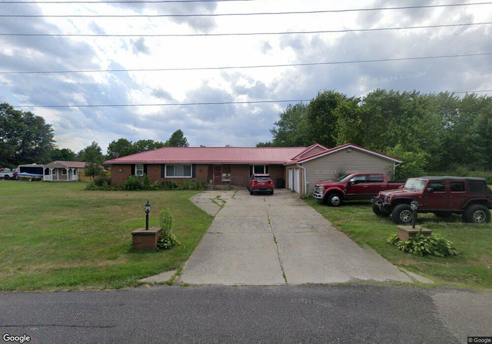
6815 California Ave Louisville, OH 44641
Estimated Value: $278,000 - $433,000
5
Beds
2
Baths
3,082
Sq Ft
$106/Sq Ft
Est. Value
About This Home
This home is located at 6815 California Ave, Louisville, OH 44641 and is currently estimated at $327,651, approximately $106 per square foot. 6815 California Ave is a home located in Stark County with nearby schools including Louisville High School and St. Thomas Aquinas High School & Middle School.
Ownership History
Date
Name
Owned For
Owner Type
Purchase Details
Closed on
Oct 2, 2015
Sold by
Breinig Robert J and Breinig Darlene
Bought by
Breinig Heather B and Breinig Craig
Current Estimated Value
Home Financials for this Owner
Home Financials are based on the most recent Mortgage that was taken out on this home.
Original Mortgage
$197,802
Outstanding Balance
$154,939
Interest Rate
3.75%
Mortgage Type
FHA
Estimated Equity
$172,712
Purchase Details
Closed on
Oct 15, 1991
Create a Home Valuation Report for This Property
The Home Valuation Report is an in-depth analysis detailing your home's value as well as a comparison with similar homes in the area
Home Values in the Area
Average Home Value in this Area
Purchase History
| Date | Buyer | Sale Price | Title Company |
|---|---|---|---|
| Breinig Heather B | -- | Attorney | |
| -- | -- | -- |
Source: Public Records
Mortgage History
| Date | Status | Borrower | Loan Amount |
|---|---|---|---|
| Open | Breinig Heather B | $197,802 |
Source: Public Records
Tax History Compared to Growth
Tax History
| Year | Tax Paid | Tax Assessment Tax Assessment Total Assessment is a certain percentage of the fair market value that is determined by local assessors to be the total taxable value of land and additions on the property. | Land | Improvement |
|---|---|---|---|---|
| 2025 | -- | $73,470 | $21,420 | $52,050 |
| 2024 | -- | $69,900 | $21,420 | $48,480 |
| 2023 | $3,107 | $63,670 | $17,190 | $46,480 |
| 2022 | $2,900 | $59,260 | $17,190 | $42,070 |
| 2021 | $2,908 | $59,260 | $17,190 | $42,070 |
| 2020 | $2,448 | $52,710 | $15,470 | $37,240 |
| 2019 | $2,459 | $52,720 | $15,470 | $37,250 |
| 2018 | $2,451 | $52,720 | $15,470 | $37,250 |
| 2017 | $2,363 | $48,490 | $14,700 | $33,790 |
| 2016 | $2,270 | $47,650 | $14,700 | $32,950 |
| 2015 | $2,276 | $47,650 | $14,700 | $32,950 |
| 2014 | $310 | $44,750 | $13,800 | $30,950 |
| 2013 | $1,159 | $44,750 | $13,800 | $30,950 |
Source: Public Records
Map
Nearby Homes
- 6079 Eastlawn St NE
- 6285 California Ave
- 6150 Pilot View Cir
- 5700 Glena St
- 0 Pilot Knob Ave NE
- 1561 Noel St
- 3580 Brookridge Ave Lot 15
- 6030 Holderman Ave
- 0 Brookridge Ave
- 0 Glenbar St
- 524 Glenbar St
- 5623 Shallow Creek Ave
- 614 Reno Dr
- 5474 Ravenna Ave
- 3788 Psolla St NE
- 7844 Morningstar Dr
- 5109 Columbus Rd NE
- 1175 Sturbridge Dr
- 1149 Sturbridge Dr
- 316 E Reno Dr
- 6480 Easton St
- 6556 Easton St
- 6800 California Ave
- 6454 Easton St
- 6742 California Ave
- 6424 Easton St
- 6725 California Ave
- 6461 Easton St
- 6751 California Ave
- 6575 Easton St
- 6380 Easton St
- 6395 Easton St
- 6352 Easton St
- 6351 Easton St NE
- 6616 California Ave
- 6616 California Ave
- 6324 Easton St
- 6324 Easton St
- 6331 Easton St
- 6371 Easton St