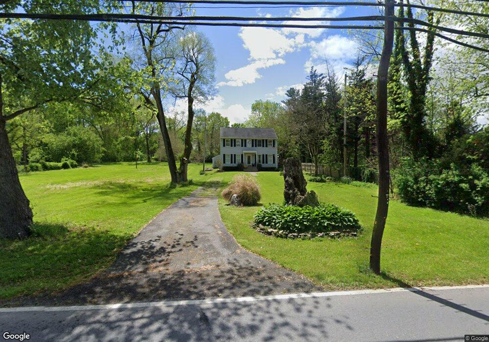
6815 Michaels Mill Rd Adamstown, MD 21710
Estimated Value: $312,682 - $493,000
--
Bed
--
Bath
1,496
Sq Ft
$255/Sq Ft
Est. Value
About This Home
This home is located at 6815 Michaels Mill Rd, Adamstown, MD 21710 and is currently estimated at $381,671, approximately $255 per square foot. 6815 Michaels Mill Rd is a home located in Frederick County with nearby schools including Carroll Manor Elementary School, Ballenger Creek Middle School, and Tuscarora High School.
Ownership History
Date
Name
Owned For
Owner Type
Purchase Details
Closed on
Nov 14, 1997
Sold by
Habitat For Humanity Of
Bought by
Mulcahy Elizabeth N
Current Estimated Value
Purchase Details
Closed on
Apr 30, 1997
Sold by
Sappington Michael F
Bought by
Habitat For Humanity Of and Frederick County
Purchase Details
Closed on
Aug 16, 1994
Sold by
Johnson E C
Bought by
Sappington Michael F
Home Financials for this Owner
Home Financials are based on the most recent Mortgage that was taken out on this home.
Original Mortgage
$60,000
Interest Rate
8.52%
Create a Home Valuation Report for This Property
The Home Valuation Report is an in-depth analysis detailing your home's value as well as a comparison with similar homes in the area
Home Values in the Area
Average Home Value in this Area
Purchase History
| Date | Buyer | Sale Price | Title Company |
|---|---|---|---|
| Mulcahy Elizabeth N | $123,993 | -- | |
| Habitat For Humanity Of | $30,000 | -- | |
| Sappington Michael F | $35,000 | -- |
Source: Public Records
Mortgage History
| Date | Status | Borrower | Loan Amount |
|---|---|---|---|
| Previous Owner | Sappington Michael F | $60,000 | |
| Closed | Mulcahy Elizabeth N | -- |
Source: Public Records
Tax History Compared to Growth
Tax History
| Year | Tax Paid | Tax Assessment Tax Assessment Total Assessment is a certain percentage of the fair market value that is determined by local assessors to be the total taxable value of land and additions on the property. | Land | Improvement |
|---|---|---|---|---|
| 2025 | $2,897 | $247,700 | -- | -- |
| 2024 | $2,897 | $227,000 | $76,900 | $150,100 |
| 2023 | $2,669 | $217,033 | $0 | $0 |
| 2022 | $2,552 | $207,067 | $0 | $0 |
| 2021 | $2,424 | $197,100 | $59,800 | $137,300 |
| 2020 | $2,424 | $195,933 | $0 | $0 |
| 2019 | $2,410 | $194,767 | $0 | $0 |
| 2018 | $2,417 | $193,600 | $59,800 | $133,800 |
| 2017 | $2,396 | $193,600 | $0 | $0 |
| 2016 | $2,486 | $193,600 | $0 | $0 |
| 2015 | $2,486 | $196,000 | $0 | $0 |
| 2014 | $2,486 | $196,000 | $0 | $0 |
Source: Public Records
Map
Nearby Homes
- 0 Michaels Mill Rd
- 6816 Buckingham Ln
- 7106 Downing St
- 7119 Michaels Mill Rd
- 6216 Manor Woods Rd
- 3913 Baker Valley Rd
- 3520 Starlight St Unit 302
- 5798 Morland Dr N
- 2684 Lydia Ct
- 5880 Union Ridge Dr
- 5820 Woodwinds Cir
- 4718 Cambria Rd
- 4861 Finnical Way Unit 401
- 6501 Walcott Ln Unit 202
- 5078 Croydon Terrace
- 4916 Small Gains Way
- 2305 Mount Ephraim Rd
- 5086 Stapleton Terrace
- 6739 Killdeer Ct
- 6380 Betty Linton Ln
- 3529 Buckeystown Pike
- 3525 Buckeystown Pike
- 3601 Buckeystown Pike
- 3528 & 3532 Buckeystown Pike
- 3604 Buckeystown Pike
- 3521 Buckeystown Pike
- 3521 Buckeystown Pike
- 3612 Buckeystown Pike
- 6925 Michaels Mill Rd
- 6803 Michaels Mill Rd
- 6821 Michaels Mill Rd
- 3513 Buckeystown Pike
- 3513 Buckeystown Pike
- 3407 Buckeystown Pike
- 3607 Buckeystown Pike
- 6929 Michaels Mill Rd
- 3620 Buckeystown Pike
- 6929 Michaels Mill Rd
- 3509 Buckeystown Pike
- 6720 Manor Woods Rd