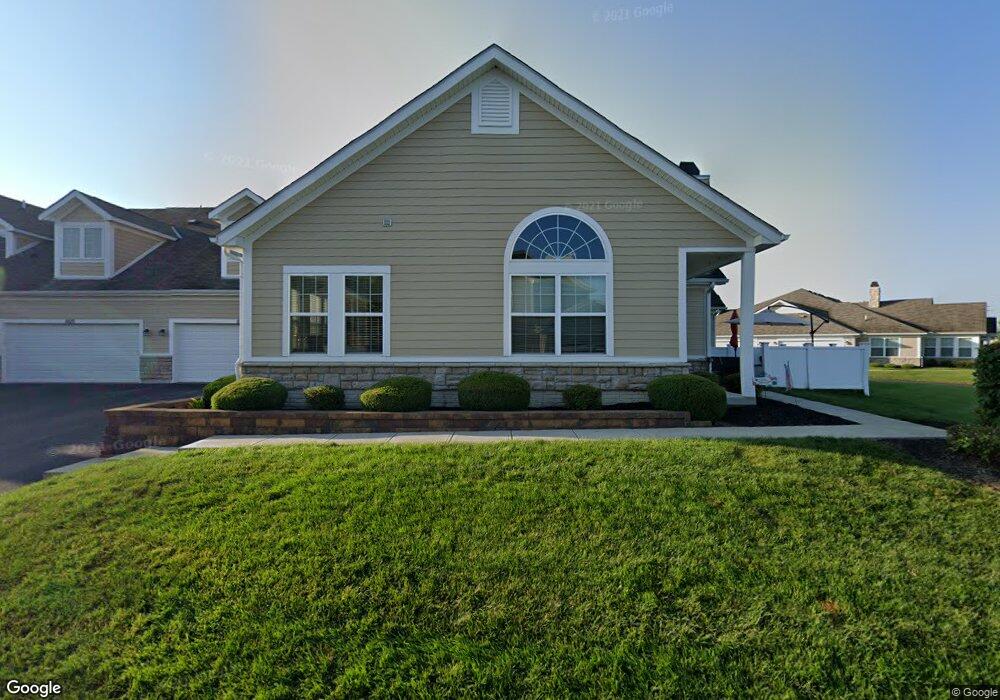
6816 Kinsale Ln Powell, OH 43065
Liberty Township NeighborhoodEstimated Value: $360,397 - $407,000
3
Beds
3
Baths
2,121
Sq Ft
$184/Sq Ft
Est. Value
About This Home
This home is located at 6816 Kinsale Ln, Powell, OH 43065 and is currently estimated at $389,599, approximately $183 per square foot. 6816 Kinsale Ln is a home located in Delaware County with nearby schools including Liberty Tree Elementary School, Hyatts Middle School, and Olentangy Liberty High School.
Ownership History
Date
Name
Owned For
Owner Type
Purchase Details
Closed on
Dec 29, 2016
Sold by
Mayle Forrest A and Mayle Laurie B
Bought by
Mayle Forrest A and Mayle Laurie B
Current Estimated Value
Home Financials for this Owner
Home Financials are based on the most recent Mortgage that was taken out on this home.
Original Mortgage
$241,645
Outstanding Balance
$196,346
Interest Rate
4.08%
Mortgage Type
New Conventional
Estimated Equity
$193,253
Purchase Details
Closed on
Apr 13, 2016
Sold by
Shier Peter A and Shier Meredith
Bought by
Mayle Forrest A and Mayle Laurie B
Purchase Details
Closed on
Mar 25, 2014
Sold by
Kinsale Village Llc
Bought by
Shier Meredith and Shier Peter A
Home Financials for this Owner
Home Financials are based on the most recent Mortgage that was taken out on this home.
Original Mortgage
$220,182
Interest Rate
4.12%
Mortgage Type
FHA
Create a Home Valuation Report for This Property
The Home Valuation Report is an in-depth analysis detailing your home's value as well as a comparison with similar homes in the area
Home Values in the Area
Average Home Value in this Area
Purchase History
| Date | Buyer | Sale Price | Title Company |
|---|---|---|---|
| Mayle Forrest A | -- | Lender Title | |
| Mayle Forrest A | $245,000 | Attorney | |
| Shier Meredith | $224,300 | Talon Title Agency |
Source: Public Records
Mortgage History
| Date | Status | Borrower | Loan Amount |
|---|---|---|---|
| Open | Mayle Forrest A | $241,645 | |
| Previous Owner | Shier Meredith | $220,182 |
Source: Public Records
Tax History Compared to Growth
Tax History
| Year | Tax Paid | Tax Assessment Tax Assessment Total Assessment is a certain percentage of the fair market value that is determined by local assessors to be the total taxable value of land and additions on the property. | Land | Improvement |
|---|---|---|---|---|
| 2024 | $6,052 | $105,180 | $21,000 | $84,180 |
| 2023 | $6,082 | $105,180 | $21,000 | $84,180 |
| 2022 | $7,185 | $99,890 | $16,800 | $83,090 |
| 2021 | $7,201 | $99,890 | $16,800 | $83,090 |
| 2020 | $7,239 | $99,890 | $16,800 | $83,090 |
| 2019 | $5,874 | $83,230 | $14,000 | $69,230 |
| 2018 | $5,905 | $83,230 | $14,000 | $69,230 |
| 2017 | $5,857 | $73,500 | $12,250 | $61,250 |
| 2016 | $5,711 | $73,500 | $12,250 | $61,250 |
| 2015 | $5,197 | $73,500 | $12,250 | $61,250 |
| 2014 | $1,633 | $15,650 | $12,250 | $3,400 |
| 2013 | $135 | $2,030 | $2,030 | $0 |
Source: Public Records
Map
Nearby Homes
- 7030 Kinsale Ln
- 3143 Rossmore Cir
- 0 Home Rd Unit 225042181
- 3296 Home Rd
- 7042 Celebration Dr
- 7086 Celebration Dr
- 7203 Celebration Dr
- 3769 Shoal Way
- 2932 Beechwood Dr
- 6523 White Star Dr
- 3809 Shoal Way
- 3803 Shoal Way
- 6781 Dulles Dr
- 3682 Eagles Landing Dr
- 7088 Unitas Loop
- 7080 Unitas Loop
- 6445 White Star Dr
- 7094 Unitas Loop
- 6425 White Star Dr
- 6507 White Star Dr
- 6820 Kinsale Ln
- 6782 Kinsale Ln
- 6784 Kinsale Ln
- 6809 Kinsale Ln
- 6805 Kinsale Ln
- 6805 Kinsale Ln Unit 6805
- 6825 Kinsale Ln
- 6819 Kinsale Ln
- 6815 Kinsale Ln
- 6827 Kinsale Ln
- 6906 Kinsale Ln
- 6841 Kinsale Ln
- 6810 Kinsale Ln
- 3308 Kenmare Ln
- 3310 Kenmare Ln
- 6812 Kinsale Ln
- 3278 Kenmare Ln
- 3262 Kenmare Ln
- 3264 Kenmare Ln