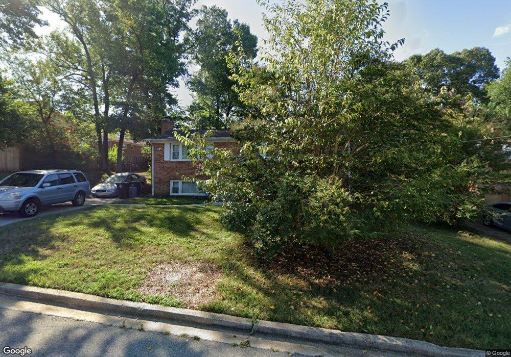
6817 Briarcliff Dr Clinton, MD 20735
Estimated Value: $394,000 - $427,000
4
Beds
3
Baths
1,100
Sq Ft
$373/Sq Ft
Est. Value
About This Home
This home is located at 6817 Briarcliff Dr, Clinton, MD 20735 and is currently estimated at $410,442, approximately $373 per square foot. 6817 Briarcliff Dr is a home located in Prince George's County with nearby schools including Waldon Woods Elementary School, Stephen Decatur Middle School, and Surrattsville High School.
Ownership History
Date
Name
Owned For
Owner Type
Purchase Details
Closed on
Mar 27, 2003
Sold by
Powell Wiley
Bought by
Marriott Ian
Current Estimated Value
Purchase Details
Closed on
Sep 24, 2001
Sold by
Secretary Of Veterans Affairs
Bought by
Powelll Wiley and Powelll Charlesetta
Purchase Details
Closed on
Dec 11, 2000
Sold by
Williams Betty J
Bought by
Secretary Of Veterans Affairs
Purchase Details
Closed on
Jun 17, 1996
Sold by
Albritton Donna L
Bought by
Williams Betty J
Create a Home Valuation Report for This Property
The Home Valuation Report is an in-depth analysis detailing your home's value as well as a comparison with similar homes in the area
Home Values in the Area
Average Home Value in this Area
Purchase History
| Date | Buyer | Sale Price | Title Company |
|---|---|---|---|
| Marriott Ian | $182,900 | -- | |
| Powelll Wiley | $140,000 | -- | |
| Secretary Of Veterans Affairs | $118,095 | -- | |
| Williams Betty J | $137,000 | -- |
Source: Public Records
Tax History Compared to Growth
Tax History
| Year | Tax Paid | Tax Assessment Tax Assessment Total Assessment is a certain percentage of the fair market value that is determined by local assessors to be the total taxable value of land and additions on the property. | Land | Improvement |
|---|---|---|---|---|
| 2025 | $4,571 | $336,600 | $101,200 | $235,400 |
| 2024 | $4,571 | $319,433 | $0 | $0 |
| 2023 | $4,410 | $302,267 | $0 | $0 |
| 2022 | $4,205 | $285,100 | $101,200 | $183,900 |
| 2021 | $4,012 | $269,000 | $0 | $0 |
| 2020 | $3,911 | $252,900 | $0 | $0 |
| 2019 | $3,788 | $236,800 | $100,600 | $136,200 |
| 2018 | $3,684 | $228,967 | $0 | $0 |
| 2017 | $3,604 | $221,133 | $0 | $0 |
| 2016 | -- | $213,300 | $0 | $0 |
| 2015 | $3,301 | $211,000 | $0 | $0 |
| 2014 | $3,301 | $208,700 | $0 | $0 |
Source: Public Records
Map
Nearby Homes
- 11218 Keystone Ave
- 6704 Crafton Ln
- 7012 Groveton Dr
- 6812 Fulford St
- 6710 Eilerson St
- 10802 Slippery Elm Ct
- 11313 Marlee Ave
- 6911 Groveton Dr
- 11501 Hermitt St
- 6311 Teaberry Way
- 7014 Sand Cherry Way
- 11403 Hershey Red Place
- 7211 Cimmaron Ash Ct
- 6205 Brooke Jane Dr
- 11106 Teaberry Way Ct
- 7001 Killarney St
- 10203 Deep Creek Ct
- 7006 Chain Fern Ct
- 10309 Brandywine Rd
- Cedar Pointe
- 6813 Briarcliff Dr
- 6821 Briarcliff Dr
- 11209 Colorado St
- 6808 Northgate Pkwy
- 6809 Briarcliff Dr
- 6816 Northgate Pkwy
- 6812 Briarcliff Dr
- 6816 Briarcliff Dr
- 6804 Northgate Pkwy
- 6808 Briarcliff Dr
- 11201 Colorado St
- 6805 Briarcliff Dr
- 6800 Northgate Pkwy
- 11208 Colorado St
- 6804 Briarcliff Dr
- 6901 Briarcliff Dr
- 6900 Northgate Pkwy
- 11200 Colorado St
- 6817 Northgate Pkwy
- 6705 Sweet Shrub Ct