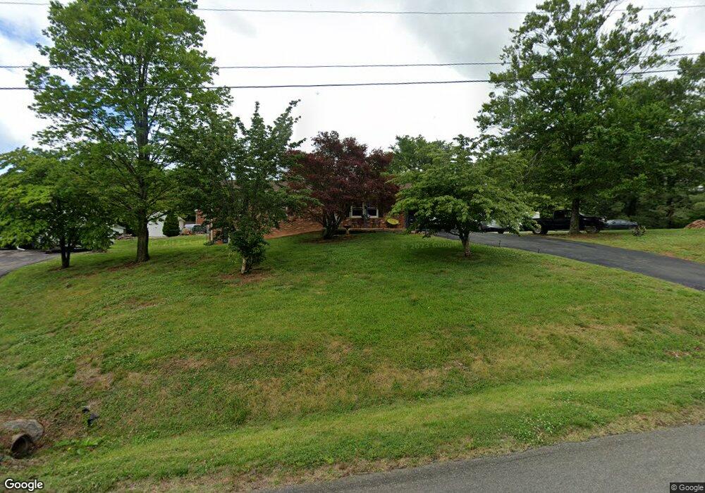
6817 Byers Rd Roanoke, VA 24019
Estimated Value: $278,204 - $316,000
3
Beds
2
Baths
1,188
Sq Ft
$250/Sq Ft
Est. Value
About This Home
This home is located at 6817 Byers Rd, Roanoke, VA 24019 and is currently estimated at $297,551, approximately $250 per square foot. 6817 Byers Rd is a home located in Roanoke County with nearby schools including Mountain View Elementary School, Northside Middle School, and Northside High School.
Ownership History
Date
Name
Owned For
Owner Type
Purchase Details
Closed on
Apr 25, 2019
Sold by
The Mabel Wright Tuck Revocable Trust
Bought by
Tuck Lawrence Wayne
Current Estimated Value
Purchase Details
Closed on
Dec 15, 2016
Sold by
Harris Timothy E
Bought by
Harris Timothy E and The Mabel Wright Tuck Revocable Trust
Purchase Details
Closed on
Apr 16, 2010
Sold by
Tuck Mabel W
Bought by
Tuck Mabel W
Purchase Details
Closed on
Apr 13, 2010
Sold by
Tuck Mabel W
Bought by
Tuck Mabel W
Create a Home Valuation Report for This Property
The Home Valuation Report is an in-depth analysis detailing your home's value as well as a comparison with similar homes in the area
Home Values in the Area
Average Home Value in this Area
Purchase History
| Date | Buyer | Sale Price | Title Company |
|---|---|---|---|
| Tuck Lawrence Wayne | -- | None Available | |
| Harris Timothy E | -- | None Available | |
| Tuck Mabel W | -- | None Available | |
| Harris Timothy Eugene | -- | None Available | |
| Tuck Mabel W | -- | None Available |
Source: Public Records
Tax History Compared to Growth
Tax History
| Year | Tax Paid | Tax Assessment Tax Assessment Total Assessment is a certain percentage of the fair market value that is determined by local assessors to be the total taxable value of land and additions on the property. | Land | Improvement |
|---|---|---|---|---|
| 2025 | $2,402 | $233,200 | $60,500 | $172,700 |
| 2024 | $2,274 | $218,700 | $57,200 | $161,500 |
| 2023 | $2,127 | $200,700 | $52,800 | $147,900 |
| 2022 | $1,939 | $177,900 | $47,300 | $130,600 |
| 2021 | $1,754 | $160,900 | $41,800 | $119,100 |
| 2020 | $1,725 | $158,300 | $40,700 | $117,600 |
| 2019 | $1,682 | $154,300 | $40,700 | $113,600 |
| 2018 | $1,599 | $147,700 | $40,700 | $107,000 |
| 2017 | $1,599 | $146,700 | $40,700 | $106,000 |
| 2016 | $1,601 | $146,900 | $40,700 | $106,200 |
| 2015 | $1,573 | $144,300 | $40,700 | $103,600 |
| 2014 | $1,560 | $143,100 | $40,700 | $102,400 |
Source: Public Records
Map
Nearby Homes
- 735 Goodland Ave
- 839 Clearwater Ave
- 7002 Brookview Rd
- 1290 Trafalgar Dr
- 849 Walhalla Ct
- 819 Walhalla Ct
- 867 Walhalla Ct
- 1010 Big Ben Dr
- 1336 Crutchfield St
- 1195 Cardiff Ct
- 1429 Crutchfield St
- 831 Sumpter Place
- 1112 Gaston Dr
- 5932 Dairy Rd
- 7116 Peyton St
- 8531 Muirfield Cir
- 8525 Muirfield Cir
- 573 Crestland Dr
- 5904 Plantation Rd
- 0 Sanderson Dr
- 0 3800 & Utah Rd Unit 1728304
- 0 3800 & Utah Rd Unit 53344
- 0 3800 & Utah Rd Unit 53343
- 0 3800 & Utah Rd Unit 220186
- 6827 Byers Rd
- 6832 Quail Place
- 6830 Byers Rd
- 6752 Quail Place
- 6836 Quail Place
- 6836 Byers Rd
- 6746 Quail Place
- 6435 Pinetree Ln
- 6846 Byers Rd
- 6835 Quail Place
- 6749 Stonington Rd
- 6745 Quail Place
- 6858 Byers Rd
- 6743 Stonington Rd
- 6738 Quail Place
- 6884 Byers Rd