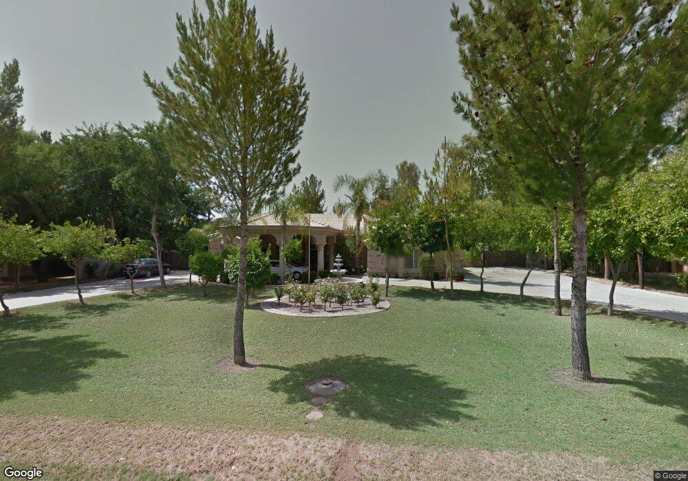
6817 W Corrine Dr Peoria, AZ 85381
Estimated Value: $694,000 - $1,036,688
4
Beds
3
Baths
3,741
Sq Ft
$236/Sq Ft
Est. Value
About This Home
This home is located at 6817 W Corrine Dr, Peoria, AZ 85381 and is currently estimated at $883,922, approximately $236 per square foot. 6817 W Corrine Dr is a home located in Maricopa County with nearby schools including Oakwood Elementary School, Cactus High School, and Legacy Traditional School - Glendale.
Ownership History
Date
Name
Owned For
Owner Type
Purchase Details
Closed on
Jan 29, 1998
Sold by
Urlea Rubin and Urlea Sorica
Bought by
Hreniuc John J and Hreniuc Sorina
Current Estimated Value
Home Financials for this Owner
Home Financials are based on the most recent Mortgage that was taken out on this home.
Original Mortgage
$120,000
Interest Rate
7.06%
Mortgage Type
Seller Take Back
Purchase Details
Closed on
Jan 9, 1996
Sold by
Gipson Jesse L
Bought by
Urlea Rubin and Urlea Sorica
Create a Home Valuation Report for This Property
The Home Valuation Report is an in-depth analysis detailing your home's value as well as a comparison with similar homes in the area
Home Values in the Area
Average Home Value in this Area
Purchase History
| Date | Buyer | Sale Price | Title Company |
|---|---|---|---|
| Hreniuc John J | $150,000 | -- | |
| Urlea Rubin | $71,500 | Nations Title Insurance |
Source: Public Records
Mortgage History
| Date | Status | Borrower | Loan Amount |
|---|---|---|---|
| Previous Owner | Hreniuc John J | $120,000 |
Source: Public Records
Tax History Compared to Growth
Tax History
| Year | Tax Paid | Tax Assessment Tax Assessment Total Assessment is a certain percentage of the fair market value that is determined by local assessors to be the total taxable value of land and additions on the property. | Land | Improvement |
|---|---|---|---|---|
| 2025 | $5,070 | $62,395 | -- | -- |
| 2024 | $5,120 | $59,424 | -- | -- |
| 2023 | $5,120 | $65,910 | $13,180 | $52,730 |
| 2022 | $5,008 | $54,780 | $10,950 | $43,830 |
| 2021 | $5,272 | $52,270 | $10,450 | $41,820 |
| 2020 | $5,310 | $51,980 | $10,390 | $41,590 |
| 2019 | $5,131 | $46,560 | $9,310 | $37,250 |
| 2018 | $5,573 | $49,230 | $9,840 | $39,390 |
| 2017 | $6,136 | $51,380 | $10,270 | $41,110 |
| 2016 | $6,058 | $50,250 | $10,050 | $40,200 |
| 2015 | $5,596 | $47,770 | $9,550 | $38,220 |
Source: Public Records
Map
Nearby Homes
- 6845 W Charter Oak Rd
- 6749 W Charter Oak Rd
- 6746 W Wethersfield Rd
- 6849 W Wethersfield Rd
- 6763 W Wethersfield Rd
- 6739 W Cactus Rd
- 6614 W Sweetwater Ave
- 7126 W Columbine Dr
- 6602 W Surrey Ave
- 6821 W Cherry Hills Dr
- 12709 N 72nd Ave
- 7214 W Columbine Dr
- 7220 W Larkspur Dr
- 6914 W Sunnyside Dr Unit 3
- 7233 W Corrine Dr
- 6415 W Surrey Ave
- 7191 W Surrey Ave
- 6938 W Jenan Dr
- 7301 W Sweetwater Ave
- 7113 W Sunnyside Dr
- 6803 W Corrine Dr
- 6829 W Corrine Dr
- 6828 W Columbine Dr
- 6820 W Columbine Dr
- 6836 W Columbine Dr
- 6745 W Corrine Dr
- 6812 W Columbine Dr
- 6839 W Corrine Dr
- 6818 W Corrine Dr
- 6804 W Corrine Dr
- 6844 W Columbine Dr
- 6746 W Columbine Dr
- 6832 W Corrine Dr
- 6829 W Columbine Dr
- 6823 W Columbine Dr
- 6835 W Columbine Dr
- 6735 W Corrine Dr
- 6735 W Corrine Dr Unit 42
- 6740 W Corrine Dr
- 6817 W Columbine Dr