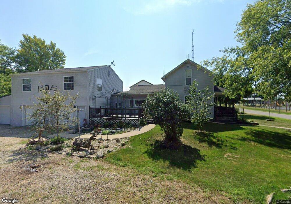
6817 West St Linn Grove, IN 46711
Estimated Value: $132,000 - $181,000
3
Beds
1
Bath
1,406
Sq Ft
$108/Sq Ft
Est. Value
About This Home
This home is located at 6817 West St, Linn Grove, IN 46711 and is currently estimated at $151,168, approximately $107 per square foot. 6817 West St is a home located in Adams County with nearby schools including South Adams Elementary School, South Adams Middle School, and South Adams High School.
Ownership History
Date
Name
Owned For
Owner Type
Purchase Details
Closed on
Nov 1, 2019
Sold by
Koons Ammette
Bought by
Pennington Erin L
Current Estimated Value
Purchase Details
Closed on
May 21, 2015
Sold by
Sigler
Bought by
Ford Erin L
Purchase Details
Closed on
Oct 23, 1999
Sold by
Herman Daniel F and Herman Marilyn C
Bought by
Sigler Anthony C and Sigler Pamela K
Home Financials for this Owner
Home Financials are based on the most recent Mortgage that was taken out on this home.
Original Mortgage
$60,000
Interest Rate
6.68%
Mortgage Type
Credit Line Revolving
Create a Home Valuation Report for This Property
The Home Valuation Report is an in-depth analysis detailing your home's value as well as a comparison with similar homes in the area
Home Values in the Area
Average Home Value in this Area
Purchase History
| Date | Buyer | Sale Price | Title Company |
|---|---|---|---|
| Pennington Erin L | -- | -- | |
| Ford Erin L | $69,000 | -- | |
| Sigler Anthony C | -- | -- |
Source: Public Records
Mortgage History
| Date | Status | Borrower | Loan Amount |
|---|---|---|---|
| Previous Owner | Sigler Anthony C | $60,000 |
Source: Public Records
Tax History Compared to Growth
Tax History
| Year | Tax Paid | Tax Assessment Tax Assessment Total Assessment is a certain percentage of the fair market value that is determined by local assessors to be the total taxable value of land and additions on the property. | Land | Improvement |
|---|---|---|---|---|
| 2024 | $1,315 | $108,900 | $9,200 | $99,700 |
| 2023 | $494 | $99,900 | $9,200 | $90,700 |
| 2022 | $367 | $87,300 | $9,200 | $78,100 |
| 2021 | $345 | $80,600 | $9,200 | $71,400 |
| 2020 | $354 | $80,600 | $9,200 | $71,400 |
| 2019 | $256 | $76,200 | $9,200 | $67,000 |
| 2018 | $245 | $73,500 | $9,200 | $64,300 |
| 2017 | $257 | $76,000 | $9,600 | $66,400 |
| 2016 | $216 | $72,700 | $9,600 | $63,100 |
| 2014 | $214 | $73,300 | $9,600 | $63,700 |
| 2013 | $258 | $74,000 | $9,600 | $64,400 |
Source: Public Records
Map
Nearby Homes
- 5636 SW State Road 116-1
- 2422 W 700 S
- 1750 Oakwood Ln
- 1075 Black Bear Path
- 1346 Stuckistrasse
- 120 Hahnemann Ct
- 1224 W Clark
- 1106 Clark St
- 1105 Clark St
- 1018 W Water St
- 766 W Van Buren St
- 10821 S 600 W
- 156 Bryan St
- 260 S Jefferson St
- 609 Welty St
- TBD E Shore Dr
- 155 Oregon St
- 570 Winchester Rd
- 0 S Indiana 116
- 205 Holly Ln