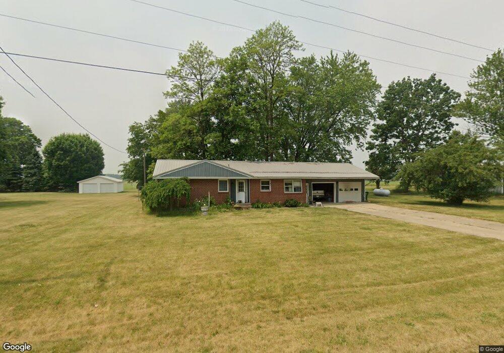
68178 White School Rd Sturgis, MI 49091
Estimated Value: $213,000 - $236,000
3
Beds
2
Baths
1,220
Sq Ft
$185/Sq Ft
Est. Value
About This Home
This home is located at 68178 White School Rd, Sturgis, MI 49091 and is currently estimated at $225,550, approximately $184 per square foot. 68178 White School Rd is a home located in St. Joseph County with nearby schools including Sturgis High School and Trinity Lutheran School.
Ownership History
Date
Name
Owned For
Owner Type
Purchase Details
Closed on
Jul 22, 2015
Sold by
Jacobs Brett and Jacobs Leslie Ann
Bought by
Yoder Stan and Yoder Vicki
Current Estimated Value
Purchase Details
Closed on
Jan 3, 2008
Sold by
Schram Joel Edward
Bought by
Gordon Leslie Ann and Jacobs Brett
Home Financials for this Owner
Home Financials are based on the most recent Mortgage that was taken out on this home.
Original Mortgage
$76,000
Interest Rate
6.27%
Mortgage Type
Purchase Money Mortgage
Purchase Details
Closed on
Apr 16, 2001
Sold by
Schram Joel E and Schram Judith A
Bought by
Schram Joel E
Create a Home Valuation Report for This Property
The Home Valuation Report is an in-depth analysis detailing your home's value as well as a comparison with similar homes in the area
Home Values in the Area
Average Home Value in this Area
Purchase History
| Date | Buyer | Sale Price | Title Company |
|---|---|---|---|
| Yoder Stan | $90,000 | Patrick Abstract & Title Off | |
| Gordon Leslie Ann | $80,000 | Patrick Abstract | |
| Schram Joel E | -- | -- |
Source: Public Records
Mortgage History
| Date | Status | Borrower | Loan Amount |
|---|---|---|---|
| Previous Owner | Gordon Leslie Ann | $76,000 |
Source: Public Records
Tax History Compared to Growth
Tax History
| Year | Tax Paid | Tax Assessment Tax Assessment Total Assessment is a certain percentage of the fair market value that is determined by local assessors to be the total taxable value of land and additions on the property. | Land | Improvement |
|---|---|---|---|---|
| 2025 | $1,702 | $92,700 | $8,100 | $84,600 |
| 2024 | $591 | $85,400 | $6,800 | $78,600 |
| 2023 | $563 | $74,700 | $7,300 | $67,400 |
| 2022 | $0 | $68,800 | $7,800 | $61,000 |
| 2021 | $1,500 | $65,200 | $7,200 | $58,000 |
| 2020 | $1,482 | $59,800 | $6,700 | $53,100 |
| 2019 | $1,454 | $49,200 | $5,800 | $43,400 |
| 2018 | $1,280 | $47,700 | $5,800 | $41,900 |
| 2017 | $1,287 | $46,600 | $46,600 | $0 |
| 2016 | -- | $45,300 | $45,300 | $0 |
| 2015 | -- | $46,900 | $0 | $0 |
| 2014 | -- | $39,400 | $39,400 | $0 |
| 2012 | -- | $41,300 | $41,300 | $0 |
Source: Public Records
Map
Nearby Homes
- 0 Vl Seneca Ct
- VL1 Ottokee Dr
- VL2 Ottokee Dr
- 67696 Thunderbird Dr
- 200 Broadus St
- 206 1st St
- 26865 Us Highway 12
- 202 N Centerville Rd
- 69375 Vicky Dr
- 600 Saint Joseph St
- 501 W Ohio Ct
- 708 N Centerville Rd
- 203 Grove St
- 202 N Clay St
- 210 Grove St
- 805 N Nottawa St
- 607 N Nottawa St
- 303 Williams St
- 501 Norwood St
- 416 Sturgis St
- 68238 White School Rd
- 68208 White School Rd
- 68020 White School Rd
- 67104 Minnewaukan Lake Rd
- 67110 Minnewaukan Lake Rd
- 67116 Minnewaukan Lake Rd
- 67124 Minnewaukan Lake Rd
- 25872 Airline Rd
- 25984 Airline Rd
- 26070 Airline Rd
- 25984 Airline Rd
- 25952 Airline Rd
- 67138 Minnewaukan Lake Rd
- 25877 Hiawatha Dr
- 25912 Airline Rd
- 67959 Ottawa Dr
- 67152 Minnewaukan Lake Rd
- 25861 Hiawatha Dr
- 25844 Airline Rd
- 25780 Airline Rd